Surveying, Mapping and GIS

Exploring all aspects of mapping and geography, from field data collection, to mapping and analysis, to integration, applications development and enterprise architecture...

  • Geospatial Technology, End to End...

    Exploring all aspects of mapping and geography, from field data collection, to mapping and analysis, to integration, applications development, enterprise architecture and policy

EPA Environmental Information Symposium

Posted by Dave Smith On 12/29/2008 04:33:00 PM 0 comments

Earlier in the month, I attended the EPA's Environmental Information Symposium - While I didn't post any updates here during the conference, I will now take the opportunity to carry over some of the more fun posts that I made to the Ning site that was set up for the Symposium:
Wordle: Web 2.0 Themes for the EPA Environmental Information Symposium
"Liberate The Data"

A Web 2.0 Success Story: Apps for Democracy

I touched on this during my presentation:


  • “Smarter, Better, Faster, Cheaper: Pick 4” – Vivek Kundra, District of Columbia CTO


  • The District of Columbia published an Open Data Catalog: GeoRSS, XML, KML and other data types


  • They then posted a contest and allowed the public to build applications, built on their Open Data Catalog


  • RESULT: In 30 days: 47 new applications for the web, facebook and mobile clients, over $2,000,000 in development at a cost of $50,000 = over 4000% ROI


  • http://www.appsfordemocracy.org/

The Web is the Platform

As a potential future paradigm, web-enabled connectivity binds together disparate resources, across EPA program offices, regions, labs, both horizontally and vertically, by transparently supporting access to data, analysis and resources:


For external stakeholders, those EPA resources then similarly become transparent, as part of the "EPA cloud" on the web, whereby the public, whether academia, industry, state or other government alike can access available resources toward supporting their own business requirements, whether watershed stewardship groups, regulated reporting industry, ecology research in academia or others:

Merry Christmas

Posted by Dave Smith On 12/25/2008 10:12:00 AM 0 comments

An Apropos Christmas for Surveying and Mapping...

A great picture, posted by Mike Berry to the rpls.com message board...

Conjunction of December 2008

Posted by Dave Smith On 12/02/2008 10:20:00 PM 1 comments

We had overcast skies and not much of a good view last night, but tonight, I was greeted with a much better view of the conjunction of the Moon, Jupiter and Venus:


A lovely sight...

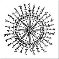
Magnetic Declination

Posted by Dave Smith On 12/01/2008 05:14:00 PM 1 comments


For folks working with historic deeds and bearing references, there are a number of tools available -


Additionally, there is a freeware tool available from Resurgent Software, which will compute historic declinations to 1600: http://www.resurgentsoftware.com/geomag.html

Further online tools and resources for geomagnetism and computation:

EDIT: And an additonal one suggested by Chuck Conley from Canada's Geological Survey

Environmental Information Symposium 2008

Posted by Dave Smith On 12/01/2008 03:58:00 PM 2 comments


I will be flying out to Phoenix, Arizona December 9th-12th, to attend the US Environmental Protection Agency's annual Environmental Information Symposium... This year, I will be participating on a panel, to discuss collaborative geospatial tools, web services and data publishing, integration and visualization frameworks for environmental science, such as Microsoft Virtual Earth and Google Earth. I am definitely looking forward to sparking some discussion and engaging more people who collect, manage, consume or make decisions based on environmental data... My particular interest at this point is not just in publishing data via open, standards-based (not just OGC, but REST, JSON and others), accessible, dynamic data resources, but also in modeling and analysis, and beginning to look at workflows toward solving a wide variety of environmental problems.

Last year, I got to have a lot of fun developing a turbo Virtual Earth integration in 36 hours, for the Puget Sound Information Challenge. To blow my own horn, my application was recognized by EPA's CIO as one of the most interesting contributions made to the effort. Needless to say, I am really looking forward to attending again this year.

The event will be held at the JW Marriott Desert Ridge Resort in Phoenix,

Can't attend in person? Live streaming will be available as well.

(and thanks to Sean Gillies...)

Search