Once again, I greatly enjoyed this year's ESRI Federal User Conference - I was able to make it to several sessions Thursday and Friday... Perhaps will post more on this, as time permits.
This will be as close as I get to live blogging from the ESRI Federal User Conference, Day 1.
- Buzzword: VGI. Volunteered Geographic Information. a/k/a crowdsourcing. All pointing to the OpenStreetMap paradigm- Given the phenomenal success of OpenStreetMap in supporting base mapping for humanitarian efforts in Haiti, along with the fluid and adaptable nature of its key/value pair model, which was utilized for tagging crisis-related features, such as landslides, collapsed buildings, road obstacles, refugee camps and so on - how can one NOT talk about OpenStreetMap? Great to hear about OpenStreetMap being used in ArcGIS. But... the pundit in me asks, how transparent is this? Is it "importing OSM data"? That's great for many applications. But what of emergency response applications? Given the dynamic nature of OpenStreetMap, "import" might not cut it. How about direct, native OSM support? That I need to investigate further. But then, comes the other, far more important piece of VGI - the participatory piece? Can/will ArcGIS 10 support direct editing of OSM? And outside of OSM, how much robust ArcGIS 10 capability for participatory GIS exists right out of the box?
- Offshoot: Citizen-centric science. I understand Audubon demonstrated eBird - interesting - a year ago, I contributed a proof-of-concept to the eBio conference in London, demonstrating harnessing social media such as Twitter to allow citizen science participation to allow folks to record observations of various species in the wild, toward such ends as assessing biodiversity, invasive species, and so on. I tied this in with web services such as GBIF's lookup services to, for example, translate between common names and scientific name, and so on. This, in turn, tied in to other sources such as Flickr, and combined, wherever possible, with available geographic information, for providing feeds and display in, for example Bing Maps or other platforms. Great to see this coming along... I'd be interested in looking at the Audubon effort more closely, along with further exploring the model for vetting and validating inputs.
- The Cloud... Evidently a big focus on cloud hosting, the new partnership between ESRI and Amazon, and "rent ArcGIS Server by the hour". I think this is an interesting model and have been harping on this for years. Geodata services hosting at this point is nothing esoteric, and could/should essentially be commoditized *cough* GeoServer *cough*. But... where the less-well-charted and more-interesting territory still lies is not in just serving up data. ArcGIS Server is frankly often too much tool to waste on just serving up map layers and tiles. Where I see the opportunity for ArcGIS server is in true ANALYSIS, MODELING and so on. Web-based geoanalytical services and geoprocessing services. We need a good model, and some good strategic thinking in the community of how the long-range picture of all of that will look.
- ArcGIS for iPhone... That was another feature of ArcGIS 10 noted by some who attended the Plenary... Sounds great, but... I want to know more about how it operates, and more importantly, how customizable, configurable, how many features and functionalities it supports. Hopefully someone can shed some light there...
I am looking forward to spending this week in Washington DC, despite any further threats of snow (1"-3" expected tonight)... Living in Northeastern Pennsylvania, 1 to 3 inches of snow is no big thing. But the 30+ that hit the Washington area last week are astounding. Hopefully, much of the prior accumulation is now under control.
ESRI Federal User Conference Highlights
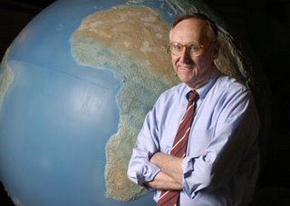
My recently-retired EPA friend and colleague Dave Wolf was the recipient of the "Making a Difference" award. Dave was involved in pioneering efforts in web mapping at EPA, with EnviroMapper and other efforts.
I unfortunately arrived a bit late, and missed the discussion of ArcGIS Explorer Build 900 - fortunately Jithen Singh has a good overview of it here: http://mandown.co.nz/esri/arcgis-explorer-build-900-showcased-at-the-esri-federal-user-conference-2009/
As I arrived, I noted that there was a big focus being put on integration between ArcGIS and remote sensing imagery capability, specifically with ENVI and IDL: http://www.ittvis.com/ProductServices/ENVI.aspx. Dan Zimble led into presentations showing some of this capability, particularly integration of IDL scripts with ModelBuilder
Other highlights and demos:
- Time Layer Animation
- Keyless License Manager capability
- Microsoft Virtual Earth data as a subscription service
- APIs: Demonstration of ArcGIS Server Flex API via Solar Boston map: http://gis.cityofboston.gov/solarboston/
Relating to water issues, another demonstration featuring the Flex API was for the Chesapeake Bay Program: http://wdcb10.esri.com/cbprl/This showed use of federated assets, such as USGS stream gauges, USEPA STORET water quality data, and so on, and provides many tools for assessment, management and best practices for improving water quality for the Chesapeake Bay.
Colonel Alex Dornstauder of the US Army Corps of Engineers gave a good presentation on what USACE is doing relating to watersheds and water quality, using an approach of "3D decision space" and cross-agency "lenses". The approach utilized several different datasets and attributes with ModelBuilder to get a baseline assessment, which can then be utilized to in the target, with a collaborative vision to triage risk and prioritize investments to water quality.(3d Decision Space image gleaned from a related presentation by Col. Dornstauder: http://gis.esri.com/library/userconf/ieug08/papers/watershed_dornstauder.pdf)
The Colonel closed with an excellent quote from George Washington, "Let us raise a standard to which the wise and honest can repair"
There was also discussion and demos of
- Situational Awareness tools built on the Flex API in the code gallery (http://resources.esri.com)
- ArcGIS Mobile SDK, with a demonstration, showing field data collection, domains, subtypes, dropdown list support.
- 3D and network analysis - modeling of movement within a building in 3d (pedestrian egress via stairs, et cetera) - 3D proximity analysis
- There was discussion of food safety, with a case study of the Hawaii Food Safety Center
- Economic security and urban growth
- Demonstration of ordinary least squares analysis vs. geographically weighted regression
Maryland Governor Martin O'Malley gave an excellent discussion, hitting many excellent notes - with many things that resonated: "can you show me my house" - which he tied in well in how "show me my house" repeatedly resonated in context of geography with the many case studies he presented. Other highlights "Maryland is ESRI Customer #008" -He discussed trying to remedy many of the issues facing Baltimore, "hopeless & vacant hearts" and how CityStat http://www.baltimorecity.gov/government/citistat/ and iMap http://maps.baltimorecity.gov/imap/ have provided far more performance-oriented approaches - he touched on how previously, information had been collected in such a way as to not make it to management in any meaningful way, with emphasis on measurement of inputs, but not of outputs and outcomes - and the new paradigm of viewing outcomes against the map, tells where challenges lie. These types of geospatial approaches allow relentless followup and assessment, and drive the effort to move the graphs in right direction, with improvements in city services, reductions in shootings and homicides, improved response times - cleaning out and boarding of vacant houses, mapping service problems and opportunities for daily review. "The map does not care if neighborhood is white/black, rich/poor, republican/democrat"
As Governor now, he has taken this mapping-oriented and performance-oriented approach to the next level on a statewide level, with StateStat http://www.statestat.maryland.gov/ and BayStat http://www.baystat.maryland.gov/, and GreenPrint, which provides an ecological assessment of every single parcel in Maryland, along with ecological measures being put in force: http://www.greenprint.maryland.gov/ - and tie-in of stakeholders at all levels - "if it's not about the relationship, it's not about anything".
Governor O'Malley left the audience with a Native American proverb, "how we treat one another is reflected in how we treat the earth"
I did visit the EXPO floor and looked at some of the maps - the floor was definitely quite crowded. By one account, there were 2800 registrants this year for the ESRI Federal User Conference.Some of the ESRI schwag:


(I don't think the DevSummit attendees will be getting ESRI umbrellas to go with their weather...)
As posted previously, I will try to live tweet more coverage tomorrow, using hashtag #feduc
If you are also attending and want to meet up, by all means, drop a line - dsmith (at) synergist-tech.com - while I have a few meetings, both inside, during FedUC, and a few outside meetings in the DC area next week, I will generally try to make FedUC my base of operations and will blog wherever conditions permit (if conference WiFi is available and/or my AT&T 3G service cooperates).
Also, I will try to post updates from my phone and laptop via Twitter - http://twitter.com/DruidSmith using the hashtag #feduc - if others are attending, I'd suggest using #feduc as well, tools such as TweetGrid will be helpful for tracking twitter traffic in realtime - here's a sample 1x1 TweetGrid already set up for tracking #feduc: http://tweetgrid.com/grid?l=0&q1=%23feduc
I'm planning on attending at least part of the ESRI Federal User Conference next week - it's always good to get together with others working in the Federal community, to cross-pollinate ideas, talk, and see all the great things going on...
The details, from: http://www.esri.com/events/feduc/
If you are also attending and want to meet up, by all means, drop a line - dsmith (at) synergist-tech.com - while I have a few meetings, both inside, during FedUC, and a few outside meetings in the DC area next week, I will generally try to make FedUC my base of operations and will blog wherever conditions permit (if conference WiFi is available and/or my AT&T 3G service cooperates).GIS: The Geographic Approach for the Nation
Explore what geographic information system (GIS) technology can do for your agency at the largest geospatial conference dedicated to federal government. Whatever your GIS experience, the FedUC will give you the knowledge and resources you need to apply geography to problem solving, decision making, and accomplishing your missions.Join other leaders, decision makers, and GIS professionals February 18–20, 2009, in Washington, D.C.
February 18–20, 2009
Walter E. Washington Convention Center
Washington, D.C.Agenda-at-a-Glance
2009 Agenda [PDF]
Wednesday, February 18
9:30 a.m.–3:00 p.m. Plenary Session 2:30 p.m. Keynote Speaker 3:00 p.m.–6:00 p.m. GIS Solutions EXPO and Map Gallery Reception Thursday, February 19
8:30 a.m.–5:30 p.m. Concepts of GIS Sessions Paper Sessions Technical Workshops 8:30 a.m.–5:30 p.m. Map Gallery 8:30 a.m.–6:00 p.m. Hands-On Learning Center 10:00 a.m.–4:00 p.m. GIS Solutions EXPO 4:00 p.m.–5:30 p.m. Industry Focus Session 5:30 p.m.–8:30 p.m. Thursday Night Social Friday, February 20
8:30 a.m.–noon Paper Sessions Technical Workshops Industry Focus Sessions 9:30 a.m.–5:00 p.m. User Group Meetings Noon–2:00 p.m. Closing Session Who Should Attend and Why
Take the Geographic Approach
The FedUC is the ultimate resource when it comes to using geospatial technology in government. The conference offers presentations from technical and industry experts, valuable insight from your colleagues, and the latest solutions that fit your agency. Professionals across organizations are invited to discover effective and efficient ways to meet goals, overcome challenges, and address issues.
What You'll Experience
- Hear from Jack
Explore the future of GIS in government with ESRI president Jack Dangermond during the Plenary Session. Listen to him and a team of experts share what you can do with ArcGIS 9.3 in your organization. Plus, watch real-world demonstrations of ways government agencies are leveraging GIS.- Stay up-to-date
Learn about the newest ArcGIS tools and capabilities. Hear firsthand from ESRI staff, your peers, solution providers, and consultants as you attend paper sessions, technical workshops, and the GIS Solutions EXPO.- Network with your colleagues and ESRI staff
Build relationships with government and GIS professionals from both the public and private sectors as well as ESRI staff and business partners. Connect during sessions, exhibit times, and the evening reception.- Increase your knowledge of GIS
Discover more about how GIS works and what it can do for your team and agency. See ways GIS is being used—from data sharing to security to budget control. Attend presentations given by professionals from across the nation and learn about successful implementations, best practices, tips, and tricks.- Learn how to meet your agency’s needs
From compliance and accountability to visualizing patterns and trends, find out how taking the geographic approach improves your operations and decisions. Whether you work in federal, state, or local government, see how GIS can meet your organization’s unique needs.- Examine the most advanced technology
Experiment with state-of-the-art tools you can use right away. Learn about recent developments for geotechnologies in your fields, from hardware, software, and data solutions to innovative applications and services.- Get your questions answered
Pose your questions about GIS software, data, and implementation to ESRI staff members. Meet for a quick one-on-one discussion or set up a meeting to brainstorm and discuss project plans.See geography in action.
Also, I will try to post updates from my phone and laptop via Twitter - http://twitter.com/DruidSmith using the hashtag #feduc - if others are attending, I'd suggest using #feduc as well, tools such as TweetGrid will be helpful for tracking twitter traffic in realtime - here's a sample 1x1 TweetGrid already set up for tracking #feduc: http://tweetgrid.com/grid?l=0&q1=%23feduc
I am hoping to catch the Plenary, and am hoping to see what discussion ensues relating to the passage of the Stimulus bill, infrastructure investment and planning and National Spatial Data Infrastructure - I also hope to see old friends, and am looking forward to it...
I am just now making my way back on the Metro back from the reception at the National Geographic, tacking together some unfiltered notes from earlier in the day- my meeting was punctuated by outside meetings in Alexandria and Fairfax, so I managed to get in about 1.6 sessions, and got back just in time to find that the EPA Q&A session was shut out by the passionate Bern Szukalski.
Nonetheless, I attended the "What's New in ArcGIS Server 9.3" session this morning, hosted by Dave Wrazien.
Dave touched on a number of things slated for release, and which gave me some cause for interest, most notably the new APIs
Some bullet points and excerpts from my notes:
Effort is being made by the Server development team to reduce server roundtrips and traffic, via AJAX requests and the ASP.NET approach
A number of JavaScript enhancements have been made to improve the user experience, with an expanded JavaScript library, providing feedback and visual cues ala Flash and Silverlight, such as informative progress bars, pixel-zoom and fade-in zooms as the next zoom level loads.
In terms of OGC interop, AGS 9.3 features support for:
WMS and SLD: 1.0, 1.1, 1.1.1, 1.3 / ISO19128
WFS 1.1, GML 3.0, WFS-T 1.1
WCS 1.0, 1.1, 1.1.1
The REST and JavaScript APIs are probably the most exciting for me. Here, Dave highlighted integration opportunities for VE, Google, Yahoo and others, along with functionality for basic map display, navigation, querying, geocoding, and geoprocessing. Later on, there was mention that the JavaScript API makes use of the REST endpoints.
With respect to platform support, some of the highlights mentioned were
JDK 5.0
PostgreSQL/PostGIS
DB2 and Z/OS
SQL Server 2008 (to come in a service pack release)
In terms of usability, the aim in 9.3 is for fewer button clicks, enhancements to the web map viewer, streamlined processes and a simplified UI.
Improvements to Server Manager are likewise on the horizon for 9.3, with wizards to simplify:
Access Control
Cache Management
Along with a Mobile Management Console and a Web Map Migration Utility.
Cache Management makes some significant strides, allowing static datasets to be prerendered- and in the Mobile Management Console, improvements driven by user use cases allows opportunity for populating mobile devices with lower server and communications overhead. Additionally, while 9.2 only provided mobile developers with an SDK, 9.3 provides templates and other resources toward jumpstart.
More to follow…
A flying paleobeastie in the lobby of National Geographic...
You actually won't find a whole lot from me here on ESRI FedUC - today was mainly taken up by the Plenary session, and due to a number of meetings, I was bouncing in and out for a chunk of the day - but some of the highlights I picked up on:
A big emphasis was put on ArcGIS Explorer - speaking to notes, lightweight pushpin objects and other things which will enhance the geobrowser experience. Some good examples again highlighting custom tasks, however not a lot of detail on the plumbing and integration experience.
The other big highlight for me - ArcGIS Server previews - One very cool thing I noticed was the JavaScript API, where they did what appeared to be some very fast, painless and very nice integration with Virtual Earth, via JavaScript arcgisve_service calls. Definitely one feature I'd like to kick the tires on a bit.
The keynote was given via a prerecorded presentation from the Secretary of the Interior - this was followed by a few presentations and points from other areas within DOI - featuring NILS - the National Integrated Land System within GeoCommunicator: http://www.blm.gov/wo/st/en/prog/more/nils.html
But for me, the meetings have thus far been the highlight of the day....
And now... the obligatory blurry camera phone of the backs of heads:
And next... the comments about "lame blogging" and "why couldn't James be there..."
Haven't yet heard if anyone's organizing a geoblogger meetup in any formal fashion... but I did create a Facebook event for it - http://www.facebook.com/event.php?eid=8865086825
Washington DC Convention Center,
801 Mount Vernon Place NW
Washington, DC
I was delinquent in posting this pic from the 2007 ESRI FedUC...
A group of colleagues from the USEPA contracting world - From left to right: Myself, Jessica Zichichi (Innovate!), Jack Dangermond, Claudia Benesch (CSC - Agency Central Support) and Catherine Harness (CSC - GeoData Gateway Lead)
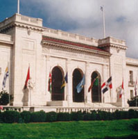
This was the reception at the Organization of American States - and yes, that is a map on my necktie...
Technorati tags:ArcGIS, arcgisserver, conference, ea, EDN, enterprise architecture, ESRI, ESRI developer network, federal, FedUC, geo, Geospatial, GIS, Intel, map, mapping, maps, metadata, OGC, spatial, trade shows, user interfaces, Washington, webmapping, WFS
As I mentioned in a prior post, the US Army Corps of Engineers Topographic Engineering Center was spotlighted at ESRI FedUC - CW4 Mike Harper gave an overview of quite a few interesting things going on in their enterprise, geared toward delivery of imagery and data down to the tactical level, along with collaborative data collection at the soldier level.
One interesting program is the award-winning BuckEye program, which gathers imagery using easily-deployable 39MP sensors, LIDAR, and other means, to provide imagery and DTM models which allow tremendous detail. Sample images shared with the audience included detail such as extension cords, individual slats of wooden pallets and other items to be identified - from imagery flown at 4000ft above the scene. These BuckEye soldiers and contractors have selflessly placed themselves in harms way toward gaining crucial data for military support, toward stabilizing volatile areas in Iraq and Afghanistan while minimizing noncombatant risk, particularly in urbanized areas, where detailed and granular intelligence is critical.
Other applications include the Urban Tactical Planner, Urban Skyline Explorer, and many others. Toward GPS and locational capabilities, TEC has been pursuing Defense Advanced GPS Receiver (DAGR), which allows military mapping products to be used as a backdrop - and as the demand for DAGR has outstripped production, TEC has also been working with Garmin toward allowing military mapping products from NGA to be brought into Garmin platforms as well.
Another interesting program described was in providing a framework for data collection at the tactical level - here soldiers can be debriefed or enter data directly, to be captured, geoenabled and databased, to provide a more transparent and collaborative means for sharing data at the tactical level.
Technorati tags:
3d, aerial photography, Afghanistan, analysis, applications, Army, cartography, collaboration, conference, coordination, DoD, DTM, federal, FedUC, Garmin, geo, Geospatial, GIS, GPS, imagery, Iraq, LIDAR, map, mapping, maps, Military, mobile, navigation, sensor, sensors, spatial, terrain
A provocative title for the post...
The FedUC conference wrapped up with an excellent lunch (aside from the staple in my veggies)... and a great presentation from CW4 Michael Harper of the USACE Topographic Engineering Center on Buckeye, DAGR and other interesting things going on there... may merit a separate post.
The good Doctor provided, as he so often does, a great Q&A session as a wrap-up. Some of the bullets from that discussion
- East coast tech support is coming - ESRI is standing up a tech-support team in North Carolina, to offer expanded AM hours, beginning at 6AM. Additionally, they may investigate the possibility of better search capabilities in the online tech support material, via Google.
- ESRI continues to work with the University of Redlands, with the 1-year Masters program - potentially to be expanded to similar programs at George Mason for those of us working in the DC area. The DC area is a hotbed of geospatial activity, with good talent scarce.
- Mr. Dangermond described some interesting things he has going on internally, to provide real-time financial reporting on the state of ESRI - which, no surprise - are geo-enabled. Being able to get this kind of reporting is an area of interest which I have no doubt will grow in other firms with a broad geographic reach.
- In conjunction with FedUC was the first Classified ESRI GIS community meeting, attended by 300 or so - featuring discussion of applications in the TS/SCI NOFORN arenas. Typically the pitfall is stovepipes, but being able to get cleared personnel together to discuss topics of common interest will be a boon to the DoD/Intel community.
- ESRI is trying to bolster its Java support, with their Java team growing and building better support for Java classes.
- The Geography Network is to be overhauled, and replaced with a more robust, more collaborative version.
- 9.3... Saving goodies for last. The 9.3 beta is scheduled for sometime this summer, probably around the Conference. Some improvements in the hopper for 9.3 include interoperability and OGC, improvements to ArcGIS Server, Mobile Applications development support, and addressing stability and known issues with 9.2. They are also looking at PostgreSQL.
- A next iteration is probably a year to year and a half away yet. Here, the focus will be simplification of the user interface, support for multiple views and multiple documents, and capability of storing all types of geofiles in a geodatabase - such as metadata catalogs, and so on.
Technorati tags:
ArcGIS, arcgisserver, conference, ea, EDN, enterprise architecture, ESRI, ESRI developer network, federal, FedUC, geo, Geospatial, GIS, Intel, map, mapping, maps, metadata, OGC, spatial, trade shows, user interfaces, Washington, webmapping, WFS
Just got home from FedUC and see snow on the ground here-

I actually ran out of room in my "little blue book" with all the thoughts and notes from the conference. Very productive, all in all.
I reckon I can probably share a few more of the thoughts going through my mind...
I followed some of the Enterprise Architecture track today... SAIC gave a presentation on DHS and their notional architecture, which was interesting, and applicable to where we are and where we want to be over at EPA. Their model consists of a foundational layer of geospatial data, harvested via ETL, consumed via web services, et cetera - essentially static data. Next, an OLAP layer, of analytical and modeling tools, and finally realtime, streamed and dynamic data. These are to then plug into an enterprise service bus, for consumption by clients which can make use of the BPEL, flows and integration platform provided by ESB.
We currently need an integration framework as well - we have been pursuing a few things in deconstructing and decomposing EnviroMapper into constituent parts, aligned with functional needs, to get them ready for this type of thing, but is ESB and BPEL really ready?
Now, here, Mark Eustis from SAIC is viewing OGC as the world's "virtual service bus". Is this really true? Are OGC services really up to the challenge - and further, ready to be plugged into ESB? Some say no. Time shall tell.
In another Enterprise GIS session, an application was demoed, using ArcGIS Server and IBM WebSphere Process Server as the ESB. ESRI does have ESB in mind for AGS, however here we are still ESRI-proprietary, which doesn't look good for mix-and-match map services in a dynamic application. What about WFS-T and transactional services?
I see I have much to learn about ESB. Seems exciting, but is it really ready for primetime? Our own pursuits of an integration platform are on hold in the meantime... but that doesn't mean we shouldn't still focus on build-out of services and look at the possibilities as things continue to mature...
Technorati tags:
.NET, .NET 2.0, AJAX, applications, ArcGIS, arcgisserver, architecture, BPEL, conference, developer, DHS, dotnet, ea, EDN, emergency response, enterprise architecture, enterprise service bus, ESB, ESRI developer network, federal, FedUC, geo, Geospatial, GIS, homeland security, IBM, internet, interoperability, map, mapping, maps, modeling, service-oriented architecture, SOA, trade shows, web-20, web 2.0, web services, web2.0, Websphere
Just got back from the reception at the Organization of American States - many great conversations, and overall a very productive day for me.
I sat in on a few of the Homeland Security and Emergency Response sessions - we are having an ever expanding role in that arena. Prominent was IRRIS, from our business partners and fellow Pennsylvania firm, GeoDecisions. We are currently looking at some possibilities for bringing data from mobile sensor platforms directly into IRRIS, as well as dynamic search and discovery possibilities for sensor data - will be interesting to see how it all unfolds.Other Homeland Security / Emergency Response sessions touched on EMMA, as a good model for statewide emergency management with wide stakeholder support.

There was a good session on NIMS, as it moves forward. The pieces are rapidly falling into place for broader integration and use of incident data, the vision of local-state-federal finally becoming more of a reality. Within NIMS, they mentioned the NOAA plume modeling facility, which is continually run for known sites, utilizing current weather conditions. My wonder is in how well this is or can be tied into available facility data for all of the applicable EPA FRS sites. The NIMS document is currently being revisited for updating, presenting many new opportunities to harmonize incident management efforts across agencies.
It makes a great deal of sense to get ever more stakeholders put together, not just for simple data sharing, but also for lessons learned, sharing of SOPs, models, types of analyses performed, and so on. One report cited as an excellent resource is the 2007 National Academy of Sciences Report, Successful Response Starts with a Map: Improving Geospatial Support for Disaster Management, which cites a number of areas for improvement - for example that data standards do not yet meet emergency response needs, and that training and exercises for responders need geospatial intelligence built into them.
While we didn't have a booth at this event, I saw at least one fellow SDVOSB exhibitor, Penobscot Bay Media - they are doing work in LIDAR scanning mounted on a robotic platform. We talked VETS GWAC a bit... My friends at the EPA booth saw some very brisk business, although they didn't manage to draw Jack Dangermond in. We did catch up with Jack later (will post the picture another time, as it was not my digital camera...)
I got a few minutes to chat with Adena Schutzberg, of Directions Magazine, All Points Blog, and many other good things - she was my Teaching Assistant way back when, at Penn State for Spatial Analysis with Dr. Peter Gould. A few encouraging words from her on my blog and the many diverse things I manage to get my fingers into...
The final sessions I got to sit in on - I had a few meetings here and there, which punctuated the day, and unfortunately ended up missing the GeoLoB discussion, but caught the tail end of the Geospatial One Stop presentation by Rob Dollison of USGS. He discussed a number of things coming down the pike in the next few months, as build 2.1 gets pushed to production in the next month or so, 2.2 in March-June timeframe, followed by 2.3 - many interesting enhancements, such as search relevance, search booleans, viewing results as a bounding box, a fast base map, 3D viewing, and so on. Exciting stuff. On our end, we are looking for ways to tie our GPT instance at EPA, the GeoData Gateway, into GOS, through the EPA firewall, and using integrated security. We are lucky there to have Marten Hogeweg and the same ESRI team working with us that developed GOS.
One thing that had me wondering on the implementation was "authoritative data sources". Here, the intent would be to present "authoritative data sources" in the search results near the top. Will this be another field in the metadata record? Is it determined by virtue of its' publisher?
At any rate, it was an enjoyable day, saw many friends, had a lot of exciting and productive discussion, and I am looking forward to more of the same tomorrow. But now, I'm ready for bed...
As soon as I finish getting a few more things out the door, I am heading down to the ESRI Federal Users Conference. Had a few too many things on the plate today, but hopefully I will be able to attend tomorrow and Thursday... I am curious if any fellow geobloggers will be in attendance. Haven't seen any postings on FedUC yet.
Tomorrow morning I'm boarding my flight to head out to San Diego for the 2006 ESRI User Conference - I am looking forward to getting away for a few days, and am looking forward to the conference. Quite a few friends and colleagues will be there once again... It will probably mostly be EPA-centric for me (you may find me helping out at their booth at several points), as a majority of my work is still focused on their projects. 85 people representing EPA, from program offices, to regions, to some of their contractors like CSC will be attending.
It's been a few years since I last went... I usually end up swamped with too many things on my plate, or with other competing events going on. So this time I end up hitting both FedUC and the regular UC in the same year. I am also expecting to see several of my other friends from MetaCarta and other companies and organizations there - and am also hoping to make some new friends and contacts.
Technorati tags:
AJAX, analysis, ArcGIS, ArcGIS explorer, arcgisexplorer, arcgisserver, ArcIMS, ArcWeb, California, conference, developer, EPA, ESRI, ESRI developer network, events, geo, Geospatial, GIS, Google earth, map, mapping, MetaCarta, modeling, OGC, San Diego, service-oriented architecture, SOA, software, spatial, technology, trade shows, web services, webmapping, xml
I've been delinquent on updating my blog- lots of stuff going on, fortunately most of it good. A little while back I attended the MetaCarta Users Group meeting with Dave Catlin of the EPA Geoservices team, we presented the Window To My Environment prototype that features deep integration of MetaCarta search technology. We're finally also working through some of the agency bureaucracy to move the MetaCarta appliance toward a production environment and allowing it to be populated with real data, as opposed to the months-old canned data we had been using to date. We did a trial crawl with the unit, and it behaved quite well- EPA National Computing Center staff had evidently been worried about it running rampant and consuming all available bandwidth, crashing servers, et cetera. We can tweak its crawling behavior quite well, though...
One of the comments at the MetaCarta Users Group was that it was an interesting and unusal thing to have EPA and CIA in the same venue presenting together. At any rate, some creative seat-of-the-pants flying involving wi-fi to VPN to remote desktop connection and we were able to demo the application live, in addition to the PowerPoint material (aside from applications live in MetaCarta's shop, everyone else's presentation was canned...)
The MetaCarta team had a number of great things they shared at the Users Group meeting. One of the things I thought was pretty exciting was the new ArcGIS functionality, which can provide temporal views of the data, when used with Tracking Analyst. There were a few presentations which show DoD and Intel applications of the technology in analyzing message traffic, to provide near-realtime spatial and temporal data mining and display capabilities. Great stuff. What became a running bit from one presentation to the next was the obligatory example of IEDs in Iraq...
They also discussed MetaCarta labs - some public betas of various MetaCarta experiments. More on those later, but they are doing a lot of fun stuff with Google-style AJAX. I hadn't realized it but Schuyler Erle, coauthor of Google Maps Hacks is now working with MetaCarta as well...
I apparently also missed a chance to meet face to face with GeoMullah, of the Fantom Planet blog... Have had some discussions with him since, on Open Source solutions.
Some previous MetaCarta-related posts:
- Architecture, MetaCarta and other stuff....
- Back from FedUC
- ESRI Federal Users Conference Tomorrow...
- Feedback wanted
- ESRI Federal User Conference
- Pitfalls of Appliance-based Technology...
- Map Symbology
- Viva Las Vegas!
- EPA Environmental Symposium in Las Vegas
Technorati tags:
AJAX, analysis, applications, arcgis, arcgis desktop, blog, blogger, blogging, blogs, book, books, epa, esri, federal, geo, Geospatial, gis, google maps, Intel, Iraq, mapping, metacarta, open source, search engine, search engines, spatial, temporal, time, tools
Directions Magazine has an article about a free ESRI Virtual Campus session about FEMA's HAZUS tool for use in ArcGIS in disaster management and mitigation applications. I certainly plan to check it out- in light of some of the recent Lessons Learned sessions we have been going through with federal agencies on GIS support for Katrina and Rita, it will be good to see other tools and options for emergency response.
At the FedUC conference, I did sit in on the session put on by Matt Felton of Towson University on how they are working with the state of Maryland, discussing their MEGIN and EMMA tools - MEGIN provides a secure interagency (state, regional and local) portal for access to geospatial data and WebEOC, and EMMA is the GIS viewer component of this platform. Some of the issues encountered that we were aware of is that some tools like WebEOC couldn't peacefully coexist with secure firewalled networks, and robust identity management had been difficult to achieve in a large and distributed enterprise. There were a number of other sessions which I would have liked to have sat in on at FedUC.
Technorati tags:
applications, arcgis, arcgis desktop, collaboration, emergency response, esri, events, extensions, federal, geo, Geospatial, gis, interoperability, Katrina, mapping, Maryland, portal, rescue, security, seismic, WebEOC
Just got home from Washington DC, but it was an extremely busy week with one meeting after another all around the beltway- Rumor is still circulating about us being asked to attend at the State of the Union address... Well, one sad truth is that I ultimately only got to spend about three hours at the ESRI FedUC conference yesterday afternoon. One business development opportunity after another this week - many interesting things brewing.
Got to see a bunch of familiar faces- my friends from the EPA geospatial world were present- Dave Wolf and Dave Catlin of the EPA Internet Geoservices team, Kevin Kirby, point man for the Locational Data Improvement and other initiatives, and Wendy Blake-Coleman, who I've been working with on next-generation architecture for EPA geospatial business. I understand GIO Brenda Smith was slated to speak this morning- unfortunately I was tied up in a meeting to discuss a couple of upcoming DOD projects.
My friends from the Metacarta crew had a nice hospitality room, they want me to get together with their marketing folks to promote our recent successess with integrating their products in EPA. They have a few new tools in the works for their DOD and Intel customers, including an analyst function that includes customizable alert features via e-mail and other notifications, as well as RSS feeds, to provide instant updates when a match of specific geographic and keyword parameters is made- they also have several other new things out and in the process of coming out.
There was a contingent of fellow Pennsylvanians present- PA GIS coordinator Jim Knudson and his deputy Stacy White were there- although I unfortunately didn't get to see Jim, I did say hello to Stacy. I also saw GeoDecisions had a booth- and found out later, over a few beers with a friend from Lockheed-Martin that we have some mutual friends and potential collaborative projects brewing between our company, Lockheed and GeoDecisions. PA firm Michael Baker was also present - who I did business with years back, though manned by the Virginia contingent. Here was Bob Austin, who has also recently been brought into our Integrated Project Team for the EPA Geospatial Data, Metadata and Services Architecture project I have been working on with Wendy Blake-Coleman. It's exciting to see so much synergy between different pieces of different projects, customers and agencies, and past and present partners of ours suddenly converging in many interesting ways.
Well, I've got much to catch up on and much to digest- was a very interesting week, even though most of it was outside of the FedUC context. Certainly there will be more bits and pieces to post as I get caught up tomorrow and over the weekend.
As I had back to back meetings around DC and various fires to put out most of the day today, so I unfortunately didn't get to enjoy the ESRI Federal User Conference (FedUC) yet. Tomorrow looks promising, though- I have a few things going on in the AM but it looks like I'll be able to break away to attend the afternoon.
I'm looking forward to it....
In the meanwhile, today revealed a few wonderful insights and excellent opportunities for future projects in rearchitecting core GIS processes for one of our major customers... Hopefully I will be able to reveal some of this exciting news in months to come.
Meanwhile I'm hunkered down in my hotel room awaiting the State of the Union address... should be interesting to see what the Bush vision for the near future is...
I'm registered for the ESRI Federal Users Conference tomorrow through Thursday... I'm looking forward to seeing the speakers, vendors, exhibits and old cameraderies, particularly our friends, partners and folks that we have done work with over the years, like Metacarta, SRA International Inc., Topcon Positioning Systems, Inc., BAE Systems ADR, i-cubed, Michael Baker, GeoDecisions, Trimble, Thales Navigation, Safe, and others... however things are going to be tough.
I have quite a few other meetings around the DC area booked throughout the week as well. I'm hoping to do a couple of hit-and-run attendances throughout the week but as far as any substantial block of time, it looks rough.
For anyone else who is thinking about attending but who doesn't have the info, I'd highly recommend it...
http://www.esri.com/events/feduc/index.html
Hope to see you there!
Technorati tags:
aerial photography, analysis, applications, arcgis, arcgis desktop, arcgis explorer, arcgisexplorer, arcgisserver, arcims, arcsde, arcweb, business, cartography, e-government, esri, esri developer network, events, federal, geo, Geospatial, gis, gps, mapping, metacarta, navigation, professional, remote sensing, spatial, usgs, webmapping