Surveying, Mapping and GIS

Exploring all aspects of mapping and geography, from field data collection, to mapping and analysis, to integration, applications development and enterprise architecture...

  • Geospatial Technology, End to End...

    Exploring all aspects of mapping and geography, from field data collection, to mapping and analysis, to integration, applications development, enterprise architecture and policy
Showing posts with label analysis. Show all posts

As pressures of economics and tightening budgets, increasing population and infrastructure demands, and limited resources continue to confront states, municipalities, and the nation as a whole, some harsh realities begin to emerge, of how much we can actually, pragmatically accomplish.


As just one example of this, studies of number of vehicle lane miles traveled, compared to number of vehicle lane miles constructed and maintained shows a clear divergence, and sends the message that demand by far has been outstripping supply:

One solution to this would be to just try and keep building roads everywhere – however this is a simplistic, and ultimately unsustainable solution.  Certainly, we DO need to stabilize current infrastructure and address some critical physical issues of capacity bottlenecks, and in some instances we do need to improve circulation and flow in existing transportation networks.  But we also need to change our thinking, in terms of how we assess, monitor and manage traffic and congestion. 


Here, approaches such as use of Intelligent Transportation Systems can provide better visibility into traffic issues and offer solutions toward better management of the transportation network.  


Via any number of technologies, such as embedded sensors, cameras, on-board systems and GPS, message boards and other forms of providing traffic advisory data, and hazards monitoring, traffic crises can be averted, congestion can be managed, and traffic rerouted to make optimal use of existing transportation networks.  The use cases for embedded technology are numerous – while repairing or replacing our crumbling bridges, we can consider technologies to monitor bridge decks for icing conditions, and so on.  We can utilize available traffic data along with spatial, temporal and predictive analysis, e.g. virtual origin-destination studies and other approaches to recognize patterns and trends, toward avoiding traffic jams or even conditions which may be prone to promoting accidents.


As another example, decades of poor, unsustainable planning, zoning, and land development practices have promoted suburban sprawl, pedestrian-unfriendly areas, dependence on cars for even the most mundane of errands, particularly as residential and commercial areas have become separated from each other in artificial models.  In some areas, this has been recognized, as we see a return in some locales to “town center” concepts, where residents can find amenities within walking distance.  Here again, proper tools and geospatial data are required by planners to correct these planning paradigms on a macro scale to recognize these bedroom community relationships, as well as on a micro scale, for example to best maximize pedestrian travel and optimize these local networks.


Additionally, we need to continue to promote mass transit options, aligned to serve core needs – commuters, shopping, and similar needs, based on observation of current traffic flows.  If mass transit becomes enough of a convenience factor, it will continue to be utilized.  Similarly, other mass-transit-related infrastructure needs to be examined.  Here, spatial and temporal analysis of the network can reap great benefit toward maximizing mass transit networks and flows, their alignment to need (supply and demand for transit) and their efficiency.


These types of solutions are in need all around us - for example, as a regular visitor to the Washington, DC area, I often use their otherwise-excellent WMATA Metro system – however many demand issues and patterns rapidly become evident to even the casual eye– in out-lying areas served by the Metro, most of the parking lots and garages fill immediately in the AM and become deserted after work hours – a sign that commuters from outlying areas.  To anyone arriving at, say, 10AM, there’s a good likelihood that some of these parking facilities will be long filled, forcing potential users to travel further before being able to avail themselves of mass transit.  Here again, in even just expanding parking capacity, exists opportunity lost to get traffic off of the streets.


Even these types of things relating to commuting via Metro can also tie into Intelligent Transportation Systems, by providing parking advisories (e.g. saving commuters the grief of trying to find a space in a particular lot when parking may already be full) or by advising pedestrians right at street-level when the next train is arriving or of capacity issues (particularly when it may actually be worthwhile to just walk a few blocks to a different station); or by allowing better means of assessing travel options via web and/or location-aware mobile devices.  Here, geospatial approaches can even allow users to get custom travel directions and planning via walking, mass transit, or for handicapped persons, routing via ADA curb cuts, avoidance of stairs, steep inclines, and other useful information toward ensuring safe and reasonable travel, even delivered directly to their phone or other mobile devices.


With HR1 and discussion of massive infrastructure investments on the horizon, we strongly need to consider an integrated strategy and investment for integrated data and analysis, to include remote sensing, geospatial, temporal and others -  to go hand-in-hand with hard, bricks-and-mortar infrastructure investments – such that we may better manage the assets.  And yes, this could be done independently in dozens of disparate efforts, but would be best leveraged through discourse and technical coordination and information sharing on a broader scale to leverage planning capabilities, modeling, and much more; again, it points up the need for a national vision and strategy for spatial data infrastructure.


If we are going to do this at all, we need to get it right.


While efforts remain local, we need a paradigm shift on many levels- to think beyond our traditional project-by-project approach, and think on a bigger level, to integrate IT into our planning process, as well as integrating it directly into our bricks-and-mortar infrastructure investments, and to better coordinate and leverage investments and efforts to provide this long-term benefit.

< >

Research Triangle Institute

Posted by Dave Smith On 4/29/2007 08:18:00 PM 0 comments

Toward the end of this week I had the pleasure of spending two days with the folks at Research Triangle Institute. RTI is a 501(c) operated by Duke University, UNC Chapel Hill, North Carolina State University, and North Carolina Central University and was formed in 1958 as one of the charter members of North Carolina's Research Triangle.

I had been bumping into a number of their people over the last couple of years, and it always seemed that we had many mutual interests. At any rate, we may well be forming some more solid alliances with RTI moving forward, to pursue geospatial applications development and environmental science. I was impressed with their capabilities, their ethic and many other aspects of how they operate.

They have many interesting things going on, such as a bioinformatics division, which is doing such things as modeling avian influenza on synthetic populations using a Linux supercomputing cluster, as well as much work for USEPA Office of Research and Development. Excellent breadth and depth in environmental and life sciences.

I could do a lot with an organization like this behind me - May this be a long and happy relationship...

Trimble VX Spatial Station

Posted by Dave Smith On 3/06/2007 01:41:00 PM 2 comments


I got a mailing today, probably several others of you did as well - announcing the Trimble VX Spatial Station. I had to chuckle, looking at the Matrix theme they put together for the ad campaign, considering the target as the typical pragmatic, grizzled, muddy-boots, over-50 demographic of surveyors... "wake up, Neo..."


I shouldn't tease Trimble - it is probably a lot more reflective of their own young and forward-looking demographic within Trimble, given their leadership and innovation in many other areas recently. Looks like a great product, and the next natural sequence of evolution as the Robotic/Reflectorless Total Station fuses with the 3D Scanner. It's the sort of thing that gets people like me thinking, what is the next phase of evolution.

For example, I was interested to see such things as fellow SDVOSB Penobscot Bay mounting scanners on robots, as well as another firm that we've worked with in the past, Spatial Integrated Systems / SIS, who has stripped-down scanners for confined spaces, such as on submarines.

So what's next in the far, or maybe not-so-far future? Perhaps a fusion of GPS and other technologies as well - a device you can carry in your pocket, which, when whipped out, establishes its geodetic position to centimeter level, scans the environment, and instantly constructs a georeferenced, 3-D spatial and temporal virtual environment, and stitches it in with other models already captured for a seamless database. Perhaps hyperspectral sensors, spectroscopy to determine the materials of the environment and more...

Imagine the design tools - you capture the environment, then don a headset which lets you mold and sculpt the environment in 3-D almost like it was wet clay. As you modify things, a number of models run simultaneously - finite elements analysis examining the structural details, other routines running to examine other impacts - stormwater and erosion, traffic, you name it.

Hey, a guy can dream, can't he?


In the Amazon Mechanical Turk effort to analyze imagery for potential clues in the disappearance of Jim Gray, I thus far managed to log 185 units of 5 images each, the count was well over 4000 when I started, and the last one I completed said 1 remaining. It was plainly evident that I had a great deal of company throughout this effort.

Certainly there were several instances of images where boats, along with their associated wakes, could be seen in the images, however a great many were difficult to read, with a great deal of reflectance, cloud cover, and so on.

It will be interesting to see what the next steps are - whether more data or additional passes will be offered up through Mechanical Turk, and if any of what participants identified will ultimately be able to correlated to other activity in the vicinity, or indeed provide clues to Gray's location.

UPDATE: Some additional images from a NASA aircraft have been posted to Mechanical Turk - see the following link: http://www.mturk.com/mturk/preview?groupId=J0XZ58STDWJZ5QY4F9M0

I have also located a blog site operated by the folks who have been organizing this effort: http://openphi.net/tenacious/
- They have posted quite a few updates and insights into the nature of the imagery and ongoing effort

The Search for Jim Gray

Posted by Dave Smith On 2/03/2007 10:17:00 AM 0 comments


I have been trying my hand at Amazon's Mechanical Turk - scouring imagery in search of missing Microsoft Research guru Jim Gray. Dr. Gray is the father of TerraServer and many other groundbreaking pursuits at Microsoft. Coast Guard efforts to date have been fruitless, as the story continues to unfold. Through a collaborative effort, recent imagery of the search area has been posted on Amazon's Mechanical Turk, in the hopes that signs of his 40-foot sailboat, life rafts or any other signs can be found, in a collaborative effort.


It is somewhat challenging, as image resolutions and scene conditions for the images I have had are not optimal for finding a 40-foot sailboat, let alone smaller features, such as a liferaft, but it is good to see that efforts like Mechanical Turk are becoming available toward organizing massive human effort toward detection and other tasks.

My hopes and prayers remain with Dr. Gray's family, friends and colleagues.

Looking for GIS integration experience

Posted by Dave Smith On 1/28/2007 08:04:00 AM 0 comments


I am looking for someone with TS/SCI clearance, a geospatial background, and integration expertise in Java, Perl, and Python - to work with a partner firm in Vienna, VA - send resumes to dsmith (at) synergist-tech.com


Technorati tags:
, , , , , , , , , , , , , , , , , , , , , , ,


Just received this announcement from a colleague:


National Land Cover Database (NLCD 2001)
The U.S. Geological Survey, on behalf of the interagency Multi-Resolution Land Characteristics Consortium (MRLC), is pleased to announce the availability of NLCD 2001 products for the conterminous United States. These products are web enabled for download from the MRLC website at www.mrlc.gov. NLCD 2001 products include 21 classes of land cover, percent tree canopy and percent urban imperviousness at 30 m resolution derived from Landsat imagery. NLCD 2001 will support a wide variety of users, institutional sectors and local- to national-scale applications with this updated land-cover data. Alaska, Hawaii, and Puerto Rico will be completed by December of 2007, which will then represent the first compilation of nationwide land cover ever produced at 30-meter resolution.


Great news for a wide variety of applications - I was just looking at a watershed application, myself, where this data will fit quite nicely.

I did a quick check, it's not yet visible in the MRLC map viewer, however the data is available via FTP - visit the Multi-Resolution Land Characteristics site: http://www.mrlc.gov/


Technorati tags:
, , , , , , , , , , , , , , , , , , , , , , , , ,

Take-home goodies...

Posted by Dave Smith On 1/13/2007 07:40:00 PM 0 comments

Having a five-year-old in the house, I usually snag any little conference goodies, such as the LizardTech lizards, yo-yos, and other things of interest... And ESRI never fails to please with a few goodies of their own at the User Conferences.

One interesting one is the Mapping for Congress book, published by ESRI press, it was distributed in the conference bags at sign-in. In usual case-study style, they present a gallery of interesting maps that were developed in response to various Congressional inquiries and toward exhibits and policy development by the Library of Congress Congressional Cartography Program. Plenty of great studies toward support of public policy, social justice and other areas to be found in this book.

Another one that I grabbed at the conference was GIS for Homeland Security, which in a vest-pocket size, provides a good high-level overview of various initiatives, Homeland Security Presidential Directives, and other ongoing efforts toward preparedness and response. A great feature of this book is the extensive glossary, which provides over 30 pages of definitions and explanations of the various terms, definitions and TLAs (three-letter acronyms) that one encounters in the Homeland Security arena.

What appears to be a real gem that was handed out in the conference bags is Standards for Success: GIS for Federal Progress and Accountability which as a sort of follow-on to Measuring Up: The Business Case for GIS - it is of particular interest to me, as it presents many federal geospatial projects - and here, the business case needs to begin getting aligned with the OMB GeoLoB, Agency Blueprints, FEA, CPIC and other directions. This book doesn't appear to touch on these directly, but does provide a high-level overview that is spot on, when it comes to streamlining business, collaboration, business logic and decision support, and optimal use of resources.

Going to have to read that one in a bit more detail.


Technorati tags:
, , , , , , , , , , , , , , , , , , , , , , , , , , , , , ,


USACE Topographic Engineering Center

Posted by Dave Smith On 1/13/2007 10:12:00 AM 0 comments

As I mentioned in a prior post, the US Army Corps of Engineers Topographic Engineering Center was spotlighted at ESRI FedUC - CW4 Mike Harper gave an overview of quite a few interesting things going on in their enterprise, geared toward delivery of imagery and data down to the tactical level, along with collaborative data collection at the soldier level.

One interesting program is the award-winning BuckEye program, which gathers imagery using easily-deployable 39MP sensors, LIDAR, and other means, to provide imagery and DTM models which allow tremendous detail. Sample images shared with the audience included detail such as extension cords, individual slats of wooden pallets and other items to be identified - from imagery flown at 4000ft above the scene. These BuckEye soldiers and contractors have selflessly placed themselves in harms way toward gaining crucial data for military support, toward stabilizing volatile areas in Iraq and Afghanistan while minimizing noncombatant risk, particularly in urbanized areas, where detailed and granular intelligence is critical.

Other applications include the Urban Tactical Planner, Urban Skyline Explorer, and many others. Toward GPS and locational capabilities, TEC has been pursuing Defense Advanced GPS Receiver (DAGR), which allows military mapping products to be used as a backdrop - and as the demand for DAGR has outstripped production, TEC has also been working with Garmin toward allowing military mapping products from NGA to be brought into Garmin platforms as well.

Another interesting program described was in providing a framework for data collection at the tactical level - here soldiers can be debriefed or enter data directly, to be captured, geoenabled and databased, to provide a more transparent and collaborative means for sharing data at the tactical level.


Technorati tags:
, , , , , , , , , , , , , , , , , , , , , , , , , , , , , , ,

ESRI FedUC Wednesday...

Posted by Dave Smith On 1/10/2007 11:25:00 PM 0 comments

Just got back from the reception at the Organization of American States - many great conversations, and overall a very productive day for me.

Organization of American States


I sat in on a few of the Homeland Security and Emergency Response sessions - we are having an ever expanding role in that arena. Prominent was IRRIS, from our business partners and fellow Pennsylvania firm, GeoDecisions. We are currently looking at some possibilities for bringing data from mobile sensor platforms directly into IRRIS, as well as dynamic search and discovery possibilities for sensor data - will be interesting to see how it all unfolds.

Other Homeland Security / Emergency Response sessions touched on EMMA, as a good model for statewide emergency management with wide stakeholder support.

There was a good session on NIMS, as it moves forward. The pieces are rapidly falling into place for broader integration and use of incident data, the vision of local-state-federal finally becoming more of a reality. Within NIMS, they mentioned the NOAA plume modeling facility, which is continually run for known sites, utilizing current weather conditions. My wonder is in how well this is or can be tied into available facility data for all of the applicable EPA FRS sites. The NIMS document is currently being revisited for updating, presenting many new opportunities to harmonize incident management efforts across agencies.

It makes a great deal of sense to get ever more stakeholders put together, not just for simple data sharing, but also for lessons learned, sharing of SOPs, models, types of analyses performed, and so on. One report cited as an excellent resource is the 2007 National Academy of Sciences Report, Successful Response Starts with a Map: Improving Geospatial Support for Disaster Management, which cites a number of areas for improvement - for example that data standards do not yet meet emergency response needs, and that training and exercises for responders need geospatial intelligence built into them.

While we didn't have a booth at this event, I saw at least one fellow SDVOSB exhibitor, Penobscot Bay Media - they are doing work in LIDAR scanning mounted on a robotic platform. We talked VETS GWAC a bit... My friends at the EPA booth saw some very brisk business, although they didn't manage to draw Jack Dangermond in. We did catch up with Jack later (will post the picture another time, as it was not my digital camera...)

I got a few minutes to chat with Adena Schutzberg, of Directions Magazine, All Points Blog, and many other good things - she was my Teaching Assistant way back when, at Penn State for Spatial Analysis with Dr. Peter Gould. A few encouraging words from her on my blog and the many diverse things I manage to get my fingers into...

The final sessions I got to sit in on - I had a few meetings here and there, which punctuated the day, and unfortunately ended up missing the GeoLoB discussion, but caught the tail end of the Geospatial One Stop presentation by Rob Dollison of USGS. He discussed a number of things coming down the pike in the next few months, as build 2.1 gets pushed to production in the next month or so, 2.2 in March-June timeframe, followed by 2.3 - many interesting enhancements, such as search relevance, search booleans, viewing results as a bounding box, a fast base map, 3D viewing, and so on. Exciting stuff. On our end, we are looking for ways to tie our GPT instance at EPA, the GeoData Gateway, into GOS, through the EPA firewall, and using integrated security. We are lucky there to have Marten Hogeweg and the same ESRI team working with us that developed GOS.

One thing that had me wondering on the implementation was "authoritative data sources". Here, the intent would be to present "authoritative data sources" in the search results near the top. Will this be another field in the metadata record? Is it determined by virtue of its' publisher?

At any rate, it was an enjoyable day, saw many friends, had a lot of exciting and productive discussion, and I am looking forward to more of the same tomorrow. But now, I'm ready for bed...

To Savannah, Georgia...

Posted by Dave Smith On 11/20/2006 08:07:00 PM 0 comments

Gratefully, things are finally starting to sort themselves out on the move...

Currently I am gearing up to head south to the Savannah International Trade and Convention Center in Georgia, to attend the EPA Environmental Information Symposium from December 5th to December 7th. This afternoon, I just finished putting together a PowerPoint for a brief talk on ingestion, analysis and mapping of unstructured data during one of the sessions.

We are also hoping to put on a live demo - using MetaCarta web services integrated with ArcIMS and ASP-based Window to My Environment - we are also currently in the midst of a redesign for the infrastructure of Window to My Environment and EnviroMapper applications, to look at good stuff like integrating the application into the Oracle Portal environment, ESRI Geospatial Portal Toolkit, Service-Oriented Architecture, and Reusable Components.

Along the MetaCarta lines, there are a few other interesting tools emerging, with potential for geotagging - Aerotext, which I discussed previously, and SRA's NetOwl, developed for the CIA - which I may get an opportunity to see next week.

I had a great time in Las Vegas last time, so I am looking forward to this event as well...

Hype Cycle

Posted by Dave Smith On 8/20/2006 10:57:00 PM 1 comments

Where are things headed in technology? Harry Chen picked up on Gartner's updated Hype Cycle, which features their assessments and predictions for technology adoption. New to this year's chart are Ajax, folksonomies, and Wiki. Personally, I think standardizations, based on ISO, Marc, Dublin Core and other approaches beat the folksonomy, but it is interesting to see all of these technologies in a big picture, and to compare notes. I have some slightly differing opinions on some of these technologies. Further, it might be interesting to look at a similar diagram, as it pertains specifically to geospatial technologies, such as location-based services, temporal analysis, common operational picture, interoperability, wireless, web services, geoprocessing, BPEL and other areas...


In the diagrams, they show technologies passing through 5 major phases...

  1. Technology Trigger: The first phase of a Hype Cycle is the “technology trigger” or breakthrough, product launch or other event that generates significant press and interest.
  2. Inflated Expectations:In the next phase, a frenzy of publicity typically generates over-enthusiasm and unrealistic expectations. There may be some successful applications of a technology, but there are typically more failures.
  3. Trough of Disillusionment:Technologies enter the “trough of disillusionment” because they fail to meet expectations and quickly become unfashionable. Consequently, the press usually abandons the topic and the technology.
  4. Slope of Enlightenment: Although the press may have stopped covering the technology, some businesses continue through the “slope of enlightenment” and experiment to understand the benefits and practical application of the technology.
  5. Plateau of Productivity: A technology reaches the “plateau of productivity” as the benefits of it become widely demonstrated and accepted. The technology becomes increasingly stable and evolves in second and third generations. The final height of the plateau varies according to whether the technology is broadly applicable or benefits only a niche market.


Technorati tags:
, , , , , , , , , , , , , , , , , , ,

ESRI UC

Posted by Dave Smith On 8/11/2006 06:31:00 PM 0 comments

Still unwinding from the ESRI User Conference - I had meant to post during the conference but there just wasn't enough time, from the daily activities and parties after.

Now, I still have a few hours to kill in San Diego before my flight, and am finally taking it easy. The Conference was a lot of fun - Though being in that mode of hundreds of intense 5-minute conversations over the course of the day can tend to put one in an odd state of mind - by the end of that day, you can scarcely remember who you talked to, or about what... And too much going on, at a frenetic pace. I had to step out of quite a few sessions to support a few ongoing things with our federal customers, so it was definitely a working vacation...

At any rate, a lot of old friends, colleagues and adversaries at USDA, EPA, other agencies, as well as CSC, Perot Systems, Lockheed, Jim Knudson, my MetaCarta buddies, Chris Cappelli from ESRI and others from PA and elsewhere, as well as many excellent and interesting new contacts made, and as always a lot of excellent intel and takeaways - I did get a brief chance to talk to keynote speaker, Senator Bob Kerrey, now of the New School such as Kim Ollivier, who is the father of the New Zealand national Transverse Mercator grid, and some who I've known for years but never actually met, like Mike Binge - he and I have been on the same side, preaching the Surveying and GIS message for years, and often diametric opposites, busting each others' chops on political issues...

The biggest thing for me - some of my main customers were there... And though there's plenty of excellent showcasing and eyepopping demos, sometimes one has to put the brakes on and use a cautious and critical eye. We are currently in the midst of going from just ArcIMS in our shop to Geospatial Portal Toolkit and ArcGIS Server for Web development, (yay, great new toys!), but there are still some questions and concerns that linger, with regard to placing too much dependency on some of the more granular out-of-the-box ESRI pieces that these ship with, for map viewers, for instance - with developer ADFs not yet completely standardized and harmonized, not all versions of map viewers standardized, and the very distinct possibility in some instances of an ESRI update rollout breaking our apps where we have plugged them into our customizations.

The good news is that the new architecture I have been developing decouples components anyways, so I will be more able to plug in some robust ESRI pieces rather than reinvent the wheel, and this strategy also reduces potential breakage and/or makes the breaks much simpler to fix, and the second half-full glass is that a more standardized and harmonized ADF is coming coming, and not necessarily terribly far off. I think the ESRI team has come quite a ways.

So... on to ArcGIS Server...


Technorati tags:
, , , , , , , , , , , , , , , , , , , , , , , , , , , , , , , , ,

ESRI User Conference...

Posted by Dave Smith On 8/05/2006 03:31:00 PM 0 comments

Tomorrow morning I'm boarding my flight to head out to San Diego for the 2006 ESRI User Conference - I am looking forward to getting away for a few days, and am looking forward to the conference. Quite a few friends and colleagues will be there once again... It will probably mostly be EPA-centric for me (you may find me helping out at their booth at several points), as a majority of my work is still focused on their projects. 85 people representing EPA, from program offices, to regions, to some of their contractors like CSC will be attending.

It's been a few years since I last went... I usually end up swamped with too many things on my plate, or with other competing events going on. So this time I end up hitting both FedUC and the regular UC in the same year. I am also expecting to see several of my other friends from MetaCarta and other companies and organizations there - and am also hoping to make some new friends and contacts.


Technorati tags:
, , , , , , , , , , , , , , , , , , , , , , , , , , , , , , , , ,

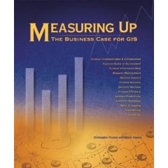
Measuring Up: The Business Case for GIS

Posted by Dave Smith On 6/01/2006 09:48:00 PM 0 comments

I finally got a chance to finish reading the last group of case studies in Measuring Up: The Business Case for GIS. I had started reading the book a few months ago, while embroiled in some of my current GIS Architecture efforts - while I enjoyed the case studies, I was at the time looking for some good meat for building up business case documentation, to also include regulatory compliance, discussion and analysis of requirements and use cases, cost-benefit analysis, and, in general, a lot more technical material and discussion of business case approach, development and documentation.

Unfortunately this book does not provide much depth in those areas. What the book does provide, however, is a robust and broad collection of case studies, much like the ESRI Map Books or several of Winnie Tang's books.

Back in February or so, the book came recommended to me by EPA GIO Brenda Smith - and indeed it is a great idea book, to illustrate by example how business cases can be met by GIS.

The book presents about 75 case studies, arranged topically as follows:

  • Save money/cost avoidance
  • Save time
  • Increase efficiency
  • Increase accuracy
  • Increase productivity
  • Increase communication and collaboration
  • Generate revenue
  • Support decision making
  • Aid budgeting
  • Automate work flow
  • Build and information base
  • Manage resources
  • Improve access to Government
  • Enterprise GIS

The authors, Christopher Thomas and Milton Ospina additionally ensured they also had a good mix of industries, such as Business, Government, Natural Resources, Transportation and Utilities.

In general, I have typically seen the two key drivers to be savings / cost avoidance and legislative or other regulatory mandate. Beneath these, some of the others, such as automation of workflow, increased efficiency and productivity, increased accuracy typically fall, as a means to the higher ends. In planning Enterprise GIS implementations, however ALL should be considered, and then plugged in wherever they may support direct drivers, as aforementioned.

Since quickly perusing the book and reading many of the case studies back in February, I am glad I was able to slow down enough to pick it up again and look through it in detail again. However, at some point it would be great to see some good material available on how to thoroughly develop the business case, in terms of cost-benefit analysis, use case analysis, requirements analysis, and the like.

For anyone else who may find it of use, I pass along the details:

Measuring Up: The Business Case for GIS
Christopher Thomas and Milton Ospina
Paperback: 200 pages
Publisher: Esri Press (September 28, 2004)
Language: English
ISBN: 1589480880


Technorati tags:
, , , , , , , , , , , , , , , , , , , , , , , , , ,

Microsoft and Spatial Databases?

Posted by Dave Smith On 4/10/2006 05:18:00 PM 0 comments

Some signs that Microsoft is trying to catch up and seeing the importance of geospatial support- Paul Flessner, Microsoft senior Vice President of Data and Storage Platforms touched on it in CRN recently - From the CRN article:

Flessner expanded on the company's data-and-storage vision, saying that the data store of the future must handle sound and graphical data types as well as the more standard relational and non-relational text information.

"We've got to go past words and numbers and get to sounds and sights," he told CRN in an interview Thursday.

One problem is that "pattern matching is not there yet," Flessner said.

Microsoft's plan for a unified store to handle all these data types is still on, but timing is unclear. He expects more and more data--including satellite information-- to flow into stores from sensors and that will enable creation of richer applications.

"You will see an investment in spatial indexing, geometry libraries. I want to do a good job supporting ESRI and other geo-spatial guys and make a good
library available so if you can't afford those packages do good spatial analysis without them," Flessner said.

(
ESRI is a leading maker of geographic information systems and mapping software.)

When will that happen? The next four to six years, although he'd like to get more done "sooner rather than later."

At PDC last year, Microsoft Chairman Bill Gates said that the "unified store" vision, already promised and late, would come with the next SQL Server or "Katmai" release wave.


We shall see... They have a lot of catching up to do to get up to effectively compete with Oracle Spatial and PostGIS...


Technorati tags:
, , , , , , , , , , , , , , , , , , , , , , , ,

2006 MetaCarta Users Group

Posted by Dave Smith On 3/05/2006 12:04:00 PM 0 comments

I've been delinquent on updating my blog- lots of stuff going on, fortunately most of it good. A little while back I attended the MetaCarta Users Group meeting with Dave Catlin of the EPA Geoservices team, we presented the Window To My Environment prototype that features deep integration of MetaCarta search technology. We're finally also working through some of the agency bureaucracy to move the MetaCarta appliance toward a production environment and allowing it to be populated with real data, as opposed to the months-old canned data we had been using to date. We did a trial crawl with the unit, and it behaved quite well- EPA National Computing Center staff had evidently been worried about it running rampant and consuming all available bandwidth, crashing servers, et cetera. We can tweak its crawling behavior quite well, though...

One of the comments at the MetaCarta Users Group was that it was an interesting and unusal thing to have EPA and CIA in the same venue presenting together. At any rate, some creative seat-of-the-pants flying involving wi-fi to VPN to remote desktop connection and we were able to demo the application live, in addition to the PowerPoint material (aside from applications live in MetaCarta's shop, everyone else's presentation was canned...)

The MetaCarta team had a number of great things they shared at the Users Group meeting. One of the things I thought was pretty exciting was the new ArcGIS functionality, which can provide temporal views of the data, when used with Tracking Analyst. There were a few presentations which show DoD and Intel applications of the technology in analyzing message traffic, to provide near-realtime spatial and temporal data mining and display capabilities. Great stuff. What became a running bit from one presentation to the next was the obligatory example of IEDs in Iraq...

They also discussed MetaCarta labs - some public betas of various MetaCarta experiments. More on those later, but they are doing a lot of fun stuff with Google-style AJAX. I hadn't realized it but Schuyler Erle, coauthor of Google Maps Hacks is now working with MetaCarta as well...

I apparently also missed a chance to meet face to face with GeoMullah, of the Fantom Planet blog... Have had some discussions with him since, on Open Source solutions.

Some previous MetaCarta-related posts:


Technorati tags:
, , , , , , , , , , , , , , , , , , , , , , , , , , , ,

Laser Scanning, Archaeology, Metadata....

Posted by Dave Smith On 3/04/2006 10:35:00 AM 2 comments

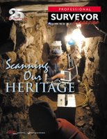
Catching up on a backlog of mail and other things that have been sitting around - I just read my March '06 edition of Professional Surveyor, and enjoyed a couple of articles - their theme in this edition, "Scanning our Heritage" combines a couple of things that I enjoy - surveying and archaeology.

Laser Scanning and Archaeology: One article highlights the application of laser scanning in creating detailed records and models of archaeological sites. I think this is a wonderful application of the technology, as it's still an unfortunate truth that once sites are discovered, even after hundreds and thousands of years of protection by simply being lost, they tend to rapidly deteriorate due to intentional vandalism and looting, or even wear and tear due to well-intentioned tourism.

Additionally, it allows subterranean features to be move effectively mapped, and allows modeling and analysis to try and better understand ancient cultures. Furthermore, the point clouds and photographic values that are collected with modern laser scanning solutions allow three-dimensional virtual models to be created, allowing greater options for allowing virtual visitors to do a walkthrough of the site without any harm to the actual site.

Surveyors and Metadata: There was also an article in this issue discussing metadata, with contrasting opinions from a surveyor's viewpoint versus a GIS professional's perspective. The surveyor's opinion is that the typical surveyor's plat contains the metadata up front, in the title block and notes. On the other hand, he makes issue of the GIS not having this metadata up-front. Yes, but... While the surveyor's boundary may have known accuracy in terms of closure, this is many times not disclosed specifically, and many times coordinate system is likewise not disclosed. Surveyors tend to be very adverse to publishing coordinates. Additionally, while the surveyor may be comfortable with the metadata aspects that he does describe in his title block and other notes and disclosures, he must defer to the constraints of other data that he may incorporate into his plat, such as FEMA flood zones (as opposed to physically determined flood zones), NWI wetlands (as opposed to physically located wetlands), soils or other data which is typically overlaid (with no indication of accuracy estimation).

From my more recent perspective working in large federal enterprises with many autonomous components, metadata is certainly a huge issue. In many instances the metadata itself may not exist for many datasets, or the metadata that does exist may be of poor quality. Finding metadata can be an issue if it does exist. Sometimes datasets are dynamic, with continuous updates which may not be reflected in the metadata (such as collection date, method of collection and collection accuracy), which may undermine the data. Or, in an example given about emergency response, data may give false negatives or false positives, which may lead to loss of life and/or property.

At any rate, data should be better than no data, and data or metadata or lack thereof should never be a complete substitute for domain expertise and common sense. In emergency response operations, metadata should serve to allow decisionmakers to make informed decisions about usefulness of data (for example avoidance or second-guessing of the outdated dataset). If properly documented, datasets can be evaluated and prioritized for use. From the surveying world to the GIS world, things get a little more complicated. Certainly surveyors understand the potential shortcomings of data if it does not meet locational criteria. And I think the upshot is that surveyors DO in a sense use metadata in their product as pointed out in the article, and for them to be able to convey their metadata along with their data into GIS and LIS systems (which are ultimately collaborative) will serve to provide continuous quality improvements.


Technorati tags:
, , , , , , , , , , , , , , , , , , , , , , , , ,

DIPEx Image Processing and Exploitation

Posted by Dave Smith On 2/11/2006 03:13:00 PM 0 comments

Yesterday I got to see a live demo of a remarkable product, DIPEx, which was developed by DataStar, which is one of our teammates on the USEPA ITS-ESE contract. DIPEx leverages NASA's ELAS software for image processing by adding web-enabled Java GUIs and also by making the entire application accessible and extensible via OGC Web Services, complete with WSDLs for easy integration. The whole system is built on Open Source technology, running on Apache, with PostGIS on the backend.

In the demo, they showed a number of features and functions, such as a full-featured web-based frontend to rival any ArcIMS-based application I have seen, with transactional WFS capabilities to edit vector data, then used the newly created vector to in turn initiate a workflow to modify an aerial image in raster and bring it back into the web view, with the multiple OGC-based vector and raster map services in various different map projections and other things going on.

Particularly given that their strength is in remote sensing imagery processing, these guys have some great things going on, and somehow have managed to fly under the radar with it. I'm hoping we can bring in their technology and capabilities to leverage some of what we are doing in our enterprise efforts...


Technorati tags:
, , , , , , , , , , , , , , , , , , , , , , , , , , , , , , , , , , , , ,

ESRI Federal Users Conference Tomorrow...

Posted by Dave Smith On 1/30/2006 06:08:00 PM 0 comments

I'm registered for the ESRI Federal Users Conference tomorrow through Thursday... I'm looking forward to seeing the speakers, vendors, exhibits and old cameraderies, particularly our friends, partners and folks that we have done work with over the years, like Metacarta, SRA International Inc., Topcon Positioning Systems, Inc., BAE Systems ADR, i-cubed, Michael Baker, GeoDecisions, Trimble, Thales Navigation, Safe, and others... however things are going to be tough.

I have quite a few other meetings around the DC area booked throughout the week as well. I'm hoping to do a couple of hit-and-run attendances throughout the week but as far as any substantial block of time, it looks rough.

For anyone else who is thinking about attending but who doesn't have the info, I'd highly recommend it...

http://www.esri.com/events/feduc/index.html

Hope to see you there!


Technorati tags:
, , , , , , , , , , , , , , , , , , , , , , , , , , , , ,

Search