Surveying, Mapping and GIS

Exploring all aspects of mapping and geography, from field data collection, to mapping and analysis, to integration, applications development and enterprise architecture...

  • Geospatial Technology, End to End...

    Exploring all aspects of mapping and geography, from field data collection, to mapping and analysis, to integration, applications development, enterprise architecture and policy
Showing posts with label environment. Show all posts

U.S. Environmental Protection Agency...

Posted by Dave Smith On 4/05/2010 05:52:00 PM 4 comments


My big news to report:  After 6 years at Synergist Technology Group, Inc., I am changing directions.  I have accepted a position at the U.S. Environmental Protection Agency's Office of Environmental Information.  I will be starting at USEPA the week of April 26th, 2010.

I greatly enjoyed the work I was doing at Synergist, having been involved in everything from business development to writing code and everything in between, supporting geospatial, mapping and integration efforts to support diverse business areas from environmental protection to emergency response to transportation to military and intelligence applications.  I enjoyed the diversity.

I have worked in private sector, consulting for over 20 years, but all throughout this, have always been solutions-focused, and have always had a keen interest in supporting the core mission of the agencies that I worked with - though, the downside of private sector consulting is always in the vagaries of its' occasionally fragmentary nature, with competetive bidding and teaming arrangements often dynamic and changing.

So, coming into Federal service brings a whole gamut of new things.  In some ways, I will get to dig deep into some of my core passions of environmental protection, geospatial technology and integration - and I look forward to this. However, it will surely bring many other challenges along with it - but I am up for any challenge.

My new role will, among other things, involve support to EPA's Facility Registry System (FRS), which is a repository for facilities data for 2.5 million unique facilities regulated under a variety of environmental laws and statutes. Herein, I see opportunity for further geo-enablement of Agency business processes, along with continued integration potential, to put hooks and eyes into a variety of other processes for ever-improving analytical, reporting and querying capabilities, cross-media, cross-agency, cross-domain, cross-dimension, as well as facilitating further partnership-building, between local, state, and federal government, tribes, academia, industry and the public, and supporting data publishing, OGI and transparency initiatives.

I anticipate I will also be pulled into a variety of other geospatial efforts across EPA as well... In many ways, I will essentially continue to do many of the things I already did - only, from the other side of the fence. In terms of physical logistics, I have already essentially been commuting to Washington DC for 6 years - though, now having a permanent duty station there, I can now consider getting a place to stay, as opposed to living out of hotels and bouncing between various locales as I have been.

So - mixed emotions - I will certainly miss working with Synergist, but likewise, there is a great team at EPA, and I am sure I will have a great time there.

EPA Environmental Information Symposium

Posted by Dave Smith On 12/29/2008 04:33:00 PM 0 comments

Earlier in the month, I attended the EPA's Environmental Information Symposium - While I didn't post any updates here during the conference, I will now take the opportunity to carry over some of the more fun posts that I made to the Ning site that was set up for the Symposium:
Wordle: Web 2.0 Themes for the EPA Environmental Information Symposium
"Liberate The Data"

A Web 2.0 Success Story: Apps for Democracy

I touched on this during my presentation:


  • “Smarter, Better, Faster, Cheaper: Pick 4” – Vivek Kundra, District of Columbia CTO


  • The District of Columbia published an Open Data Catalog: GeoRSS, XML, KML and other data types


  • They then posted a contest and allowed the public to build applications, built on their Open Data Catalog


  • RESULT: In 30 days: 47 new applications for the web, facebook and mobile clients, over $2,000,000 in development at a cost of $50,000 = over 4000% ROI


  • http://www.appsfordemocracy.org/

The Web is the Platform

As a potential future paradigm, web-enabled connectivity binds together disparate resources, across EPA program offices, regions, labs, both horizontally and vertically, by transparently supporting access to data, analysis and resources:


For external stakeholders, those EPA resources then similarly become transparent, as part of the "EPA cloud" on the web, whereby the public, whether academia, industry, state or other government alike can access available resources toward supporting their own business requirements, whether watershed stewardship groups, regulated reporting industry, ecology research in academia or others:

Environmental Information Symposium 2008

Posted by Dave Smith On 12/01/2008 03:58:00 PM 2 comments


I will be flying out to Phoenix, Arizona December 9th-12th, to attend the US Environmental Protection Agency's annual Environmental Information Symposium... This year, I will be participating on a panel, to discuss collaborative geospatial tools, web services and data publishing, integration and visualization frameworks for environmental science, such as Microsoft Virtual Earth and Google Earth. I am definitely looking forward to sparking some discussion and engaging more people who collect, manage, consume or make decisions based on environmental data... My particular interest at this point is not just in publishing data via open, standards-based (not just OGC, but REST, JSON and others), accessible, dynamic data resources, but also in modeling and analysis, and beginning to look at workflows toward solving a wide variety of environmental problems.

Last year, I got to have a lot of fun developing a turbo Virtual Earth integration in 36 hours, for the Puget Sound Information Challenge. To blow my own horn, my application was recognized by EPA's CIO as one of the most interesting contributions made to the effort. Needless to say, I am really looking forward to attending again this year.

The event will be held at the JW Marriott Desert Ridge Resort in Phoenix,

Can't attend in person? Live streaming will be available as well.

(and thanks to Sean Gillies...)

EPA GIS Workgroup

Posted by Dave Smith On 5/12/2008 09:37:00 AM 0 comments

While everyone else is off to Where, et cetera - I'm going off to the EPA GIS Workgroup meeting in New York City...


Always great to see what's going on in terms of GIS and remote sensing for visualization, modeling and analysis in the realm of environmental protection - usually most EPA regions and program offices are represented, along with other organizations and agencies... Lots of geo friends in attendance.

Looking forward to it.

Sustainable Transportation

Posted by Dave Smith On 1/14/2008 07:24:00 PM 0 comments

Seems cars and transportation have been a hot topic this week... Some big items in the news were the Tata Motors Nano car, targeted to make family transportation affordable in India at $2,500, and the AFS Trinity, a hybrid SUV capable of 150 miles per gallon.

The first of these, the Tata Nano, notable as it was cited as bridging the affordability gap between a motorcycle and an automobile. For families, passenger capability on a motorcycle is an issue... However, while a boon, this is bound to increase petro demand, emissions impact, and come bundled with a host of other environmental tradeoffs in India and other parts of the world with similar economies. It would be interesting to see development of affordable, yet safe and efficient mass transit to go concurrent with this, however tradeoffs between urban and regional transportation demand create other wrinkles. Hopefully the developing world does not fall into the trap of pedestrian-unfriendly, mass-transit-unfriendly, highway-oriented development models, as the United States has.


The second of these, the AFS Trinity is announced as an "extreme hybrid" - it essentially gets much of its power via overnight charging, while also having gasoline-powered hybrid capability. It tremendously reduces dependency on gasoline, and also allows alternative electric sources to be utilized via the grid - whether solar, wind, hydro or more conventional power sources. The size (similar to a smaller SUV), range (400 miles), acceleration (0-60 in 6.9 secs in full hybrid mode), top speed (87 MPH) and low operating cost ($15.49 for combined electric and gasoline cost for 340 miles a week, vs. $47.60 for comparable vehicles in gasoline cost) make it quite respectable on the road. The company also suggested they are planning to target a 250MPG sedan in the future.

Finally, some interesting approaches toward sustainability and transportation have been featured on the Science Channel's Invention Nation series. Here, the show's three young hosts travel cross-country in a bus, which they initially powered with processed biodiesel, then converted it over to a dual-fuel system which also accomodates scavenged vegetable oil from restaurants via a heated tank and fuel line, along with a filtration bank to capture impurities. They also installed a solar panel and a garden on the roof of the bus. In the show, the team visit various inventors, including an individual making house-scale wind generators, a guy building human-powered cars, as well as company making bicycle frames from bamboo and hemp fiber as an alternative to high-tech carbon fiber. Truly, a great series showing innovative approaches toward conservation, stewardship and sustainability.

Puget Sound Information Challenge

Posted by Dave Smith On 11/15/2007 11:59:00 AM 1 comments

Posting live from EPA's Environmental Symposium in St. Louis - One of the things that's being discussed there is a challenge put forth by Bill Ruckelshaus, former EPA Administrator, who is now heading up the Puget Sound Initiative, to clean up this natural resource that forms a big part of Northwest Washington State.

As part of this, they established a wiki, and are having mashup camps to rapidly get as much content relating to Puget Sound and its' environment as possible:

In a few short hours, I was able to develop a Virtual Earth mashup, which performs MetaCarta searches against EPA and other federal and state documents, pulls in EPA Toxic Release Inventory for Washington State as a KML layer, WMS layers for USGS Wetlands and Land Cover (NLCD), as well as NHD layers showing streams and impaired waters.


There is also a great OpenLayers-based mashup builder and other tools - anyone interested in improving the environment in the Puget Sound area will be encouraged to participate as things move forward.

I also built a standalone version here: http://www.synergist-tech.com/Demo1/PugetSound.html

ESRI Kumbaya moment?

Posted by Dave Smith On 6/19/2007 04:42:00 PM 0 comments

ESRI Kumbaya moment?

Yes, go plant a tree...

P1010047

The Green Belt Movement (GBM) was founded by 2004 Nobel Peace Prize Laureate, Dr. Wangari Maathai


GBM provides income and sustenance to millions of people in Kenya through the planting of trees. It also conducts educational campaigns to raise awareness about women's rights, civic empowerment, and the environment throughout Kenya and Africa.

How You Can Help
There are many ways to contribute to our work. Make a donation directly to GBM. Find out more about our Green Belt Safaris. Offset your carbon footprint by planting trees (forthcoming). Or buy Wangari Maathai’s books.


It's an inspiring movement - essentially organizing women to plant trees as crops, to provide sustainability to Africa, by reducing deforestation, erosion, poor water quality issues and other forms of environmental degradation. With this comes community stewardship and a number of other things - "think globally, act locally".

USEPA GIS Workgroup

Posted by Dave Smith On 4/22/2007 04:47:00 PM 0 comments

I am looking forward to attending the EPA GIS Workgroup meeting coming up in Boston. This time around, the spring meeting will be in Boston, at the Omni Parker House Hotel, May 15th to 18th.

It will be good to refresh some contacts and make some new ones. We are hoping to make some further inroads in the EPA GIS community, combining our present USEPA geospatial expertise and SDVOSB status to reach out and support USEPA regions and other USEPA program offices. For me, it's also another opportunity to go and visit with my relatives in Massachusetts.

Earth Day 2007

Posted by Dave Smith On 4/21/2007 06:00:00 PM 0 comments

Tomorrow, Sunday 22nd, 2007 marks the annual celebration of Earth Day.

I regard this as an excellent opportunity to give homage and thanks to our planet for all that it has provided us, particularly this rich life that we enjoy.

Regardless of any controversy over Climate Change, certain truths are self-evident. We should, we must be good stewards of our planet. We must accept responsibility for our impact on this planet. We must live our lives in a sustainable fashion. No political argument, no economic argument will ever remove the moral and ethical responsibility to minimize and mitigate our adverse impacts on our environment.

Toward these aims, we must promote good science and technology - we must continue to pursue cleaner, more efficient technologies. We must continue to pursue clean, sustainable energy sources. We must continue to find ways to conserve resources. We must find a proper balance in our existence, to reduce suburban sprawl development, reduce the number of vehicle miles traveled, to preserve forests and farmland, to restore watersheds, and improve air quality.

Will we leave this planet as we found it, in worse, or better condition?

We owe it to this planet, which gave us life and which has sustained us, to in return preserve her life and sustain her.

Limnic Eruptions

Posted by Dave Smith On 3/24/2007 10:52:00 AM 1 comments

In examining Rwanda and Cameroon, I came across a number of articles discussing limnic eruptions - this is a natural event, where large amounts of dissolved and trapped gases in lakes suddenly and catastrophically become released, causing death to all living things within a substantial radius of the lake.

Typically this is due to volcanic vents, which release CO2, which becomes trapped in stratified layers deep in the lake. The trapped gases may remain undisturbed and in solution for long periods of time, and may continue to accumulate until an external event triggers instability, such as earthquake, landslide, rapid thermal change, or the like.

One particularly catastrophic and more well-known instance of this phenomenon is Lake Nyos, in Cameroon, where in August of 1986, an estimated 1,800 people and large amounts of livestock died due to suffocation. It is estimated that 1.6 million metric tons of CO2 were released in that instance. As CO2 is heavier than air, the gas fills valleys, and finds its way to low-lying areas in great concentration.

Fortunately this is a relatively uncommon occurrence - few lakes are known to have this type of supersaturation of gases and potential for catastrophic overturn. Lake Nyos is a fairly small lake, of 1.2 km2 - Lake Monoun is another small lake in Cameroon which has had similar catastropic incidents and loss of life in the past.

Another lake that is somewhat disconcerting is Lake Kivu, bordering Rwanda and the Democratic Republic of Congo - Lake Kivu is much larger - 2,700 km2, with a much larger population along its shores than these other lakes. It is unknown if Kivu is susceptible to similar massive overturn events, and Kivu has considerably greater depth that the two Cameroonian lakes, however it similarly displays the unusual supersaturation of gases characteristic of the other two lakes - and situated over the Rift Zone, and in proximity to Mount Nyiragongo, which last erupted in 2002- it is entirely possible that the same circumstances exist for continued contribution of CO2 and other gases.

In some instances, the lakes are being degassed, via pipes which seek to gradually release the concentrated gases, similar to slowly letting the fizz out of a soda can.
One such project is being conducted by the Lake Nyos and Monoun Degassing Project.

Geospatial Data, Security and Protecting the Public

Posted by Dave Smith On 2/14/2007 09:10:00 AM 0 comments

Jeff Thurston at Vector One has posted a great article on geospatial data and the interplay of security, restrictions, and censorship versus freedom, citizen-centric government, and the ever-dynamic geospatial industry. I agree wholeheartedly with him on many aspects of his argument and perspective. I believe that, in an ideal world, access to data should be transparent.

However, I do think that there are more things at stake than just military and homeland security's wishes for data to be controlled. There is also an aspect of protection of the public from accidental misuse of data, and intentional abuse of data. Where harm to the public may be an issue, typically professional licensure, security clearances, or other safeguards come into play.

There are many datasets that can fall into this category - for example, there have been several publicized cases involving the misuse of GIS tax parcel mapping to attempt to enforce such things as building setbacks and other ordinances, to the harm and detriment of property owners who may in retrospect have actually turned out to be in compliance with the ordinances - though in some instances only through costly litigation and/or demolition of a structure. In some instances, actual surveyed boundaries were rejected by undereducated GIS staff or other bureaucrats, in favor of digitized-and-rubbersheeted GIS parcel boundaries or misused COGO routines in the hands of people who do not have a solid understanding of surveying. Clearly this is unacceptable misuse of GIS data.

Among other things, I work extensively with GIS data for facilities, which may contain toxic or hazardous materials - certainly agencies which regulate their activities and emergency responders need to have ready access to what is onsite, and what the consequences of a catastropic event at one of these facilities might be on the community - but aside from keeping this data from the hands of would-be agents of terror, certainly that facility's competitors might be able to gain some competetive edge from knowing what this facility is working with. This is generally known as "Confidential Business Information" (CBI). It is a classified data category apart from the usual Governmental Secret or TS/SCI classification hierarchies.

Another area with tremendous potential for misuse is in traffic incident data - Departments of Transportation collect information on reported accidents and incidents, and plot them on roadway maps - the analysis of this can help the DOT in triaging, prioritizing, budgeting and sequencing improvements to the roadway for safety. However, in the wrong hands, this type of data can also lead to litigation - "you knew this was a bad intersection, yet you didn't do anything". Often a DOT is aware of problems for many years, but given budgetary or organizational constraints may be unable to act on them in as timely a fashion as would be liked - and a multimillion-dollar court award or settlement is generally only going to take away money from being able to address the problem properly.

Another example from personal experience comes from some of the Emergency Response work we had done in conjunction with Hurricanes Katrina and Rita. Here, GIS data on accidental spills and contamination relating to the flood event must be captured, however given Agency issues with cost recovery, along with civil litigation and other issues, often this data must be tightly controlled, to avoid misuse which might undermine cleanup and remediation in the future.

These are just a handful of examples - many more come to mind. GIS is, at the end of the day, just a tool. The ever-emergent plethora of geospatial data and the ubiquitousness of GIS tools available to the public is certainly wonderful, however data and a tool in the hands of one, either without the adequate domain expertise to use the data properly - leading to unintentional harm; or the intentional abuse by one who wishes to exploit the data toward personal gain at expense of the public, or toward the outright, intentional harm of the public, can be a dangerous thing.

Just received this announcement from a colleague:


National Land Cover Database (NLCD 2001)
The U.S. Geological Survey, on behalf of the interagency Multi-Resolution Land Characteristics Consortium (MRLC), is pleased to announce the availability of NLCD 2001 products for the conterminous United States. These products are web enabled for download from the MRLC website at www.mrlc.gov. NLCD 2001 products include 21 classes of land cover, percent tree canopy and percent urban imperviousness at 30 m resolution derived from Landsat imagery. NLCD 2001 will support a wide variety of users, institutional sectors and local- to national-scale applications with this updated land-cover data. Alaska, Hawaii, and Puerto Rico will be completed by December of 2007, which will then represent the first compilation of nationwide land cover ever produced at 30-meter resolution.


Great news for a wide variety of applications - I was just looking at a watershed application, myself, where this data will fit quite nicely.

I did a quick check, it's not yet visible in the MRLC map viewer, however the data is available via FTP - visit the Multi-Resolution Land Characteristics site: http://www.mrlc.gov/


Technorati tags:
, , , , , , , , , , , , , , , , , , , , , , , , ,

FedUC Thursday - Enterprise Service Bus?

Posted by Dave Smith On 1/11/2007 09:18:00 PM 0 comments

Just got home from FedUC and see snow on the ground here-

I actually ran out of room in my "little blue book" with all the thoughts and notes from the conference. Very productive, all in all.

I reckon I can probably share a few more of the thoughts going through my mind...

I followed some of the Enterprise Architecture track today... SAIC gave a presentation on DHS and their notional architecture, which was interesting, and applicable to where we are and where we want to be over at EPA. Their model consists of a foundational layer of geospatial data, harvested via ETL, consumed via web services, et cetera - essentially static data. Next, an OLAP layer, of analytical and modeling tools, and finally realtime, streamed and dynamic data. These are to then plug into an enterprise service bus, for consumption by clients which can make use of the BPEL, flows and integration platform provided by ESB.

We currently need an integration framework as well - we have been pursuing a few things in deconstructing and decomposing EnviroMapper into constituent parts, aligned with functional needs, to get them ready for this type of thing, but is ESB and BPEL really ready?

Now, here, Mark Eustis from SAIC is viewing OGC as the world's "virtual service bus". Is this really true? Are OGC services really up to the challenge - and further, ready to be plugged into ESB? Some say no. Time shall tell.

In another Enterprise GIS session, an application was demoed, using ArcGIS Server and IBM WebSphere Process Server as the ESB. ESRI does have ESB in mind for AGS, however here we are still ESRI-proprietary, which doesn't look good for mix-and-match map services in a dynamic application. What about WFS-T and transactional services?

I see I have much to learn about ESB. Seems exciting, but is it really ready for primetime? Our own pursuits of an integration platform are on hold in the meantime... but that doesn't mean we shouldn't still focus on build-out of services and look at the possibilities as things continue to mature...


Technorati tags:
, , , , , , , , , , , , , , , , , , , , , , , , , , , , , , , , , , , , , , ,

ESRI FedUC Wednesday...

Posted by Dave Smith On 1/10/2007 11:25:00 PM 0 comments

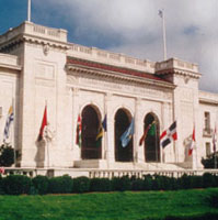
Just got back from the reception at the Organization of American States - many great conversations, and overall a very productive day for me.

Organization of American States


I sat in on a few of the Homeland Security and Emergency Response sessions - we are having an ever expanding role in that arena. Prominent was IRRIS, from our business partners and fellow Pennsylvania firm, GeoDecisions. We are currently looking at some possibilities for bringing data from mobile sensor platforms directly into IRRIS, as well as dynamic search and discovery possibilities for sensor data - will be interesting to see how it all unfolds.

Other Homeland Security / Emergency Response sessions touched on EMMA, as a good model for statewide emergency management with wide stakeholder support.

There was a good session on NIMS, as it moves forward. The pieces are rapidly falling into place for broader integration and use of incident data, the vision of local-state-federal finally becoming more of a reality. Within NIMS, they mentioned the NOAA plume modeling facility, which is continually run for known sites, utilizing current weather conditions. My wonder is in how well this is or can be tied into available facility data for all of the applicable EPA FRS sites. The NIMS document is currently being revisited for updating, presenting many new opportunities to harmonize incident management efforts across agencies.

It makes a great deal of sense to get ever more stakeholders put together, not just for simple data sharing, but also for lessons learned, sharing of SOPs, models, types of analyses performed, and so on. One report cited as an excellent resource is the 2007 National Academy of Sciences Report, Successful Response Starts with a Map: Improving Geospatial Support for Disaster Management, which cites a number of areas for improvement - for example that data standards do not yet meet emergency response needs, and that training and exercises for responders need geospatial intelligence built into them.

While we didn't have a booth at this event, I saw at least one fellow SDVOSB exhibitor, Penobscot Bay Media - they are doing work in LIDAR scanning mounted on a robotic platform. We talked VETS GWAC a bit... My friends at the EPA booth saw some very brisk business, although they didn't manage to draw Jack Dangermond in. We did catch up with Jack later (will post the picture another time, as it was not my digital camera...)

I got a few minutes to chat with Adena Schutzberg, of Directions Magazine, All Points Blog, and many other good things - she was my Teaching Assistant way back when, at Penn State for Spatial Analysis with Dr. Peter Gould. A few encouraging words from her on my blog and the many diverse things I manage to get my fingers into...

The final sessions I got to sit in on - I had a few meetings here and there, which punctuated the day, and unfortunately ended up missing the GeoLoB discussion, but caught the tail end of the Geospatial One Stop presentation by Rob Dollison of USGS. He discussed a number of things coming down the pike in the next few months, as build 2.1 gets pushed to production in the next month or so, 2.2 in March-June timeframe, followed by 2.3 - many interesting enhancements, such as search relevance, search booleans, viewing results as a bounding box, a fast base map, 3D viewing, and so on. Exciting stuff. On our end, we are looking for ways to tie our GPT instance at EPA, the GeoData Gateway, into GOS, through the EPA firewall, and using integrated security. We are lucky there to have Marten Hogeweg and the same ESRI team working with us that developed GOS.

One thing that had me wondering on the implementation was "authoritative data sources". Here, the intent would be to present "authoritative data sources" in the search results near the top. Will this be another field in the metadata record? Is it determined by virtue of its' publisher?

At any rate, it was an enjoyable day, saw many friends, had a lot of exciting and productive discussion, and I am looking forward to more of the same tomorrow. But now, I'm ready for bed...

USEPA Geospatial Information Officer

Posted by Dave Smith On 1/03/2007 01:26:00 PM 1 comments


The USEPA Geospatial Information Officer (GIO) position was posted on USAJobs last week - finally Brenda Smith's shoes will hopefully be filled. Beyond this, from all I have heard, this will indeed be a very high-level position within the agency, which should bode well for the future.

Aside from applications development, much of what I have been doing to date within EPA has been getting a handle on the Geospatial Segment Architecture, identifying alignment with FEA Geospatial Profile and GeoLoB, and other projects, to lay the groundwork for leveraging and harmonizing all of the GIS-related efforts within EPA. This might be a perfect job for me - however, I am thinking I might like to stay in the private sector...

To Savannah, Georgia...

Posted by Dave Smith On 11/20/2006 08:07:00 PM 0 comments

Gratefully, things are finally starting to sort themselves out on the move...

Currently I am gearing up to head south to the Savannah International Trade and Convention Center in Georgia, to attend the EPA Environmental Information Symposium from December 5th to December 7th. This afternoon, I just finished putting together a PowerPoint for a brief talk on ingestion, analysis and mapping of unstructured data during one of the sessions.

We are also hoping to put on a live demo - using MetaCarta web services integrated with ArcIMS and ASP-based Window to My Environment - we are also currently in the midst of a redesign for the infrastructure of Window to My Environment and EnviroMapper applications, to look at good stuff like integrating the application into the Oracle Portal environment, ESRI Geospatial Portal Toolkit, Service-Oriented Architecture, and Reusable Components.

Along the MetaCarta lines, there are a few other interesting tools emerging, with potential for geotagging - Aerotext, which I discussed previously, and SRA's NetOwl, developed for the CIA - which I may get an opportunity to see next week.

I had a great time in Las Vegas last time, so I am looking forward to this event as well...

SAFE joins the GeoBlogging scene

Posted by Dave Smith On 11/15/2006 10:03:00 PM 0 comments

The folks at Safe Software have joined the GeoBlogging scene - They sent out the following:

Announcing Safe Software's Blog
We are pleased to inform
you that Safe Software now maintains a weblog (blog) at
spatial-etl.blogspot.com.

We plan to use our blog to:

  • keep you informed by posting breaking news about product updates
  • share our insights into developments in our rapidly-evolving industry
  • post information on upcoming Safe Software eventsdirect you to podcasts and
    articles prepared by Safe staff
  • point to slide presentations from conferences and workshops
  • surprise you every so often with a light-hearted posting, just to keep
    things lively.

We hope you'll visit our blog, and check back often.

They have been a good group of people to work with - they were very responsive and knowledgeable for us during Katrina for some of our ETL needs, particularly their wizard Juan Chu Chow.

We also hope to be working with them again on one of our EPA projects in the near future - after all, while there is no "true" ETL for spatial data yet, but.... the Safe folks have thus far come much closer than anyone, hands down.

ESRI UC

Posted by Dave Smith On 8/11/2006 06:31:00 PM 0 comments

Still unwinding from the ESRI User Conference - I had meant to post during the conference but there just wasn't enough time, from the daily activities and parties after.

Now, I still have a few hours to kill in San Diego before my flight, and am finally taking it easy. The Conference was a lot of fun - Though being in that mode of hundreds of intense 5-minute conversations over the course of the day can tend to put one in an odd state of mind - by the end of that day, you can scarcely remember who you talked to, or about what... And too much going on, at a frenetic pace. I had to step out of quite a few sessions to support a few ongoing things with our federal customers, so it was definitely a working vacation...

At any rate, a lot of old friends, colleagues and adversaries at USDA, EPA, other agencies, as well as CSC, Perot Systems, Lockheed, Jim Knudson, my MetaCarta buddies, Chris Cappelli from ESRI and others from PA and elsewhere, as well as many excellent and interesting new contacts made, and as always a lot of excellent intel and takeaways - I did get a brief chance to talk to keynote speaker, Senator Bob Kerrey, now of the New School such as Kim Ollivier, who is the father of the New Zealand national Transverse Mercator grid, and some who I've known for years but never actually met, like Mike Binge - he and I have been on the same side, preaching the Surveying and GIS message for years, and often diametric opposites, busting each others' chops on political issues...

The biggest thing for me - some of my main customers were there... And though there's plenty of excellent showcasing and eyepopping demos, sometimes one has to put the brakes on and use a cautious and critical eye. We are currently in the midst of going from just ArcIMS in our shop to Geospatial Portal Toolkit and ArcGIS Server for Web development, (yay, great new toys!), but there are still some questions and concerns that linger, with regard to placing too much dependency on some of the more granular out-of-the-box ESRI pieces that these ship with, for map viewers, for instance - with developer ADFs not yet completely standardized and harmonized, not all versions of map viewers standardized, and the very distinct possibility in some instances of an ESRI update rollout breaking our apps where we have plugged them into our customizations.

The good news is that the new architecture I have been developing decouples components anyways, so I will be more able to plug in some robust ESRI pieces rather than reinvent the wheel, and this strategy also reduces potential breakage and/or makes the breaks much simpler to fix, and the second half-full glass is that a more standardized and harmonized ADF is coming coming, and not necessarily terribly far off. I think the ESRI team has come quite a ways.

So... on to ArcGIS Server...


Technorati tags:
, , , , , , , , , , , , , , , , , , , , , , , , , , , , , , , , ,

ESRI User Conference...

Posted by Dave Smith On 8/05/2006 03:31:00 PM 0 comments

Tomorrow morning I'm boarding my flight to head out to San Diego for the 2006 ESRI User Conference - I am looking forward to getting away for a few days, and am looking forward to the conference. Quite a few friends and colleagues will be there once again... It will probably mostly be EPA-centric for me (you may find me helping out at their booth at several points), as a majority of my work is still focused on their projects. 85 people representing EPA, from program offices, to regions, to some of their contractors like CSC will be attending.

It's been a few years since I last went... I usually end up swamped with too many things on my plate, or with other competing events going on. So this time I end up hitting both FedUC and the regular UC in the same year. I am also expecting to see several of my other friends from MetaCarta and other companies and organizations there - and am also hoping to make some new friends and contacts.


Technorati tags:
, , , , , , , , , , , , , , , , , , , , , , , , , , , , , , , , ,

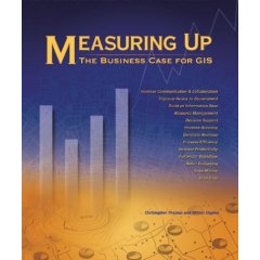
Measuring Up: The Business Case for GIS

Posted by Dave Smith On 6/01/2006 09:48:00 PM 0 comments

I finally got a chance to finish reading the last group of case studies in Measuring Up: The Business Case for GIS. I had started reading the book a few months ago, while embroiled in some of my current GIS Architecture efforts - while I enjoyed the case studies, I was at the time looking for some good meat for building up business case documentation, to also include regulatory compliance, discussion and analysis of requirements and use cases, cost-benefit analysis, and, in general, a lot more technical material and discussion of business case approach, development and documentation.

Unfortunately this book does not provide much depth in those areas. What the book does provide, however, is a robust and broad collection of case studies, much like the ESRI Map Books or several of Winnie Tang's books.

Back in February or so, the book came recommended to me by EPA GIO Brenda Smith - and indeed it is a great idea book, to illustrate by example how business cases can be met by GIS.

The book presents about 75 case studies, arranged topically as follows:

  • Save money/cost avoidance
  • Save time
  • Increase efficiency
  • Increase accuracy
  • Increase productivity
  • Increase communication and collaboration
  • Generate revenue
  • Support decision making
  • Aid budgeting
  • Automate work flow
  • Build and information base
  • Manage resources
  • Improve access to Government
  • Enterprise GIS

The authors, Christopher Thomas and Milton Ospina additionally ensured they also had a good mix of industries, such as Business, Government, Natural Resources, Transportation and Utilities.

In general, I have typically seen the two key drivers to be savings / cost avoidance and legislative or other regulatory mandate. Beneath these, some of the others, such as automation of workflow, increased efficiency and productivity, increased accuracy typically fall, as a means to the higher ends. In planning Enterprise GIS implementations, however ALL should be considered, and then plugged in wherever they may support direct drivers, as aforementioned.

Since quickly perusing the book and reading many of the case studies back in February, I am glad I was able to slow down enough to pick it up again and look through it in detail again. However, at some point it would be great to see some good material available on how to thoroughly develop the business case, in terms of cost-benefit analysis, use case analysis, requirements analysis, and the like.

For anyone else who may find it of use, I pass along the details:

Measuring Up: The Business Case for GIS
Christopher Thomas and Milton Ospina
Paperback: 200 pages
Publisher: Esri Press (September 28, 2004)
Language: English
ISBN: 1589480880


Technorati tags:
, , , , , , , , , , , , , , , , , , , , , , , , , ,

Search