 A provocative title for the post...
The FedUC conference wrapped up with an excellent lunch (aside from the staple in my veggies)... and a great presentation from CW4 Michael Harper of the USACE Topographic Engineering Center on Buckeye, DAGR and other interesting things going on there... may merit a separate post.
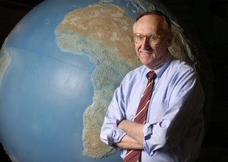
The good Doctor provided, as he so often does, a great Q&A session as a wrap-up. Some of the bullets from that discussion
- East coast tech support is coming - ESRI is standing up a tech-support team in North Carolina, to offer expanded AM hours, beginning at 6AM. Additionally, they may investigate the possibility of better search capabilities in the online tech support material, via Google.
- ESRI continues to work with the University of Redlands, with the 1-year Masters program - potentially to be expanded to similar programs at George Mason for those of us working in the DC area. The DC area is a hotbed of geospatial activity, with good talent scarce.
- Mr. Dangermond described some interesting things he has going on internally, to provide real-time financial reporting on the state of ESRI - which, no surprise - are geo-enabled. Being able to get this kind of reporting is an area of interest which I have no doubt will grow in other firms with a broad geographic reach.
- In conjunction with FedUC was the first Classified ESRI GIS community meeting, attended by 300 or so - featuring discussion of applications in the TS/SCI NOFORN arenas. Typically the pitfall is stovepipes, but being able to get cleared personnel together to discuss topics of common interest will be a boon to the DoD/Intel community.
- ESRI is trying to bolster its Java support, with their Java team growing and building better support for Java classes.
- The Geography Network is to be overhauled, and replaced with a more robust, more collaborative version.
- 9.3... Saving goodies for last. The 9.3 beta is scheduled for sometime this summer, probably around the Conference. Some improvements in the hopper for 9.3 include interoperability and OGC, improvements to ArcGIS Server, Mobile Applications development support, and addressing stability and known issues with 9.2. They are also looking at PostgreSQL.
- A next iteration is probably a year to year and a half away yet. Here, the focus will be simplification of the user interface, support for multiple views and multiple documents, and capability of storing all types of geofiles in a geodatabase - such as metadata catalogs, and so on.
Technorati tags:
ArcGIS, arcgisserver, conference, ea, EDN, enterprise architecture, ESRI, ESRI developer network, federal, FedUC, geo, Geospatial, GIS, Intel, map, mapping, maps, metadata, OGC, spatial, trade shows, user interfaces, Washington, webmapping, WFS


Thanks for the notes....but since when is Jack Dangermond a Dr.????
Canuck, sorry if you took it the wrong way or were offended.
For me it's partly association with my college days, as Dangermond collaborated with some of my profs, such as Dr. Donna Peuquet - and also his physician-like interaction with his customer base, sort of like a bedside consult. In that, I tend to think he has good bedside manner and appears generally interested in the all-around well-being of his customer, not just "how's business, and can we sell you a couple more licenses".
But in any regard, having been in the GIS business for nigh on 20 years myself, I know of precious few who are of adequate stratus to look down and quibble about Jack Dangermond's resume and achievements.