ESRI International User Conference 2007

Plenary Session, 6/18/2007 - Continued
Here continues my posting of notes from the UC... I left off with enhancements through the 9.2 SP 3, SP4 and 9.3 releases...
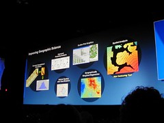
Imagery
ArcGIS Server will bring improved support for imagery, to allow more sophisticated processing and hyperspectral imagery. Tools from ERDAS and Leica systems will be able to work with imagery hosted on ArcGIS Server.
Raw imagery will be able to be sent directly to a web service.
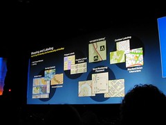
Web Mapping
Web mapping tools will improve, with Ajax Map Tips, and transparent tools (such as for navigation).
ArcGIS Mobile
ArcGIS Mobile is a new set of components as a lightweight alternative to ArcPad, which allows integration with GPS, connected and disconnected editing.
ArcGIS Explorer
ArcGIS Explorer and ArcGIS Online continue to evolve.
Open Standards and Interoperability
Toward expanded support for Open Standards and Interoperability, a REST API for ArcGIS Server is being developed. Additionally, stronger OGC support is being pursued, along with improved ability to support mashups in Google and Microsoft Virtual Earth.
CAD Interoperability
ESRI Continues to develop and enhance ArcGIS for AutoCAD, and is pursuing improvements to support the CAD->GIS Workflow. In polling, 50% of ESRI users indicated they also use CAD software.
I wonder if ESRI is pursuing complete, if simple, CAD capabilities, to obviate the need for CAD packages for more casual users.
Other Notes:
Continued support for mashups is being pursued. Additionally, Replication within ArcSDE is being developed and expanded, to support work within an organization, where multiple departments must be coordinated.
ArcGIS Explorer and ArcGIS Online
Bernie Szukalski gave an overview of ArcGIS Online. ArcGIS Online makes a number of ready-to-use resources available to ArcGIS Explorer. These come in the form of prepublished map services and documents, which can be saved as .lyr files, and then consumed within ArcGIS Explorer. These include resources such as 1m US imagery, 2.5m SPOT imagery, and a number of other other data assets.
The ArcGIS Online site provides links to a number of online resources. Additionally, user data assets can be brought in. In an ArcGIS Explorer demo, USGS topos were brought in and draped over topography. Additionally, the Swipe tool allows users to swipe-drag layer visibility status to examine changes.
Another demo showed an ArcGIS Explorer task to perform ALOHA modelling of a toxic plume in ArcGIS Explorer. Here, a user could create a custom task to allow the user to specify a point and supply parameters, and then fetch and overlay the resultant plume.
Another ArcGIS Online feature discussed was online data delivery, using DataDoors technology, or via FTP or DVD.
Another new technology being promoted is the availability of ArcGIS Data Appliances. Here, ArcGIS data could be deployed in the field to remote locations, or deployed to secure environments residing behind an enterprise firewall. It was noted that currently ESRI is the leading provider of demographic data.
Other new technologies:
- ArcWeb Services - continues to be developed and expanded
- Geospatial Portal Toolkit - a new release is coming on the horizon
- JTX - for Workflow management
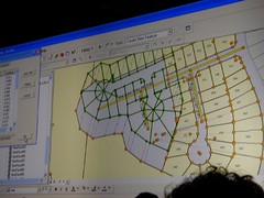
ArcLogistics
ArcLogistics was demonstrated by Carl Terry, which allows users to perform more sophisticated, rules-based routing and logistics than conventional routing tools such as ArcIMS Route Server and others offer. For example, ridership rules, appointment times, vehicle capacities and other parameters can be entered to build optimized routes. Terry stated 15-30% savings could be almost instantly realized for enterprises through the use of this type of logistics optimization.
Tech Support, Training and Education
Nick Frunzi gave an overview of efforts ongoing in customer support, training and other areas - he cited demand as resulting in a gap in support that was seen with the release of 9.2. Toward mitigating and improving customer support, his team is adding 30% more staff, and embedding support staff with developer teams to provide more robust domain expertise. As other new embedded support capability, diagnostic reporting and crash analysis is to be released in 9.3 products.
One piece of particularly exciting self-service support news is that in the next month, the internal ESRI knowledge base would be made available, in an online support center.
So overall, how is ESRI Doing?
15% growth this year...
(To be continued...)
 I am looking forward to spending this week in Washington DC, despite any further threats of snow (1"-3" expected tonight)... Living in Northeastern Pennsylvania, 1 to 3 inches of snow is no big thing. But the 30+ that hit the Washington area last week are astounding. Hopefully, much of the prior accumulation is now under control.


 Finally back home, after spending a week on the road for a few meetings around the country, including the
  The sessions I attended:
 While I'm airing complaints... I was amazed to see that the San Diego Trolley system does not accept credit or debit cards for purchases. So cash only. And then, they don't give out any more than $5 in change (maybe all you have is a $20...)
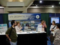
 As with ESRI User Conferences in the past, there were several cancelled paper sessions. Not that this is unusual in and of itself, but it did seem that there were more cancellations than usual this time around. For example, one person commented that virtually everything relating to geology was cancelled.