Surveying, Mapping and GIS

Exploring all aspects of mapping and geography, from field data collection, to mapping and analysis, to integration, applications development and enterprise architecture...

  • Geospatial Technology, End to End...

    Exploring all aspects of mapping and geography, from field data collection, to mapping and analysis, to integration, applications development, enterprise architecture and policy

OpenStreetMap

Posted by Dave Smith On 11/27/2009 10:20:00 PM 3 comments


Recently one of my little side pursuits has been playing with OpenStreetMap. I had tinkered with it a little bit some time ago, and decided to revisit it.


For those who have not yet looked at OpenStreetMap, it is an open mapping framework, which utilizes public domain and crowdsourced data: http://www.openstreetmap.org/

Currently, there are a number of excellent tools available for working with OSM, such as the Potlatch web editing environment (within OSM, click on the 'edit' tab and away you go - it provides basic tools for adding points of interest, moving and deleting items, and adding attributes to existing points...

For a quick start, help information is available via a wiki here: http://wiki.openstreetmap.org/wiki/Main_Page

With regard to other tools for editing OSM, I've been using Merkaartor in a Windows environment - http://www.merkaartor.org/ - several other users use a Java tool, JOSM - http://josm.openstreetmap.de/ - they both appear to have comparable feature sets.

Potlatch also provides some basic aerial photos, however Merkaartor and JOSM also allow users to work with WMS services, ESRI shapefiles and other sources of data toward fast digitization and capture of data.

On committing editing changes, new tiles are rendered rather quickly, allowing OSM to allow rapid development of base maps. Many people are also using GPS for track logs, which can then be uploaded to OSM as GPX to facilitate capture of trails and unmapped streets.

In many places, OSM is being used to create maps where there previously were none, such as in developing countries - this might serve efforts such as Engineers Without Borders - and I plan to revisit some of the GIS data I've collected up for places like Cameroon and Rwanda on behalf of EWB and look at getting it posted to OSM where appropriate.

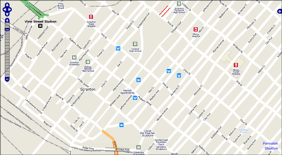
Locally, I have been playing with the mapping for my own town - I found that it essentially just had some older TIGER data and Points of Interest (POIs) from USGS Geonames (GNIS). The road network came up jagged and inaccurate, many features missing, outdated and so on. Here's where local knowledge and feet on the ground comes into play in crowdsourcing.

I essentially started out with something that looks like this:
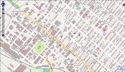
And have quickly been going to something that looks like this:
Here, I've been using orthophoto WMS services and other datasets for correcting streets and railroads, digitizing streams, putting in building footprints, parks, trails and amenities, and in just a short time am rapidly going to a useful and reasonably attractive map (note that this is still in progress). Further, the data can also be reused in a variety of ways, such as in Open Source routing services, using custom styling and symbology and so on.

I would highly encourage others to take a look and play with it: http://www.openstreetmap.org/ - however, with the caveat that it can be addicting...

Building a Headless Linux GeoServer Box

Posted by Dave Smith On 8/30/2009 08:40:00 AM 17 comments

I recently inherited some older machines and, to support some ongoing in-house experimentation I've been involved in, set them up as quick-and-dirty servers to help serve up geospatial data services - the approach I took was to build what are essentially minimal machines running linux in command-line mode, and then load GeoServer on them to serve the data - As I haven't blogged in a while, a friend suggested that posting a quick description of the mechanics of this might be a good thing to share for folks who haven't dipped their toes into Linux much.

As a disclaimer, I do not claim to profess guruhood when it comes to Linux or the other packages, this is not necessarily warranted to be a "hardened-and-tweaked" system for production, it's just some very quick and dirty steps toward standing up a headless Linux-based GeoServer instance. Note that this uses the default Jetty install - some folks prefer to run it under Tomcat, which is a different path.

So, I started out with the "minimal install CD" for Ubuntu 9.04, available here:

https://help.ubuntu.com/community/Installation/MinimalCD


Select a package appropriate for the CPU you are using - in my case, I chose Ubuntu 9.04 for 32-bit PC.

Burn the ISO and follow the prompts to install from the text-based installer as command-line interface (CLI). I essentially went with the defaults. You will want to have the machine connected to the internet so that it can identify and set up the network connection and grab any files needed during install.

Once you've installed a minimal version of Linux, you will be ready to configure and install the other goodies.


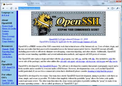
For remote administration, you may want to install OpenSSH- http://www.openssh.com/


The step for doing this is simple:

Log in to your Linux machine, and use the following command:

sudo apt-get install openssh-server

This will download and install the OpenSSH package. For folks new to Linux, sudo tells it to use superuser privileges and permissions, and will ask for the root password used when you installed Linux. apt-get install uses the Advanced Package Tool to search for, retrieve and install software packages for Linux - this makes installation of much standard software in Linux easy.

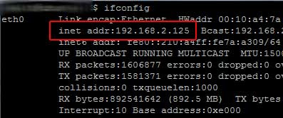
For remote administration, you'll want to know how to reach your machine on the network - you can get the IP address by using the ifconfig command, which will give results something like this:


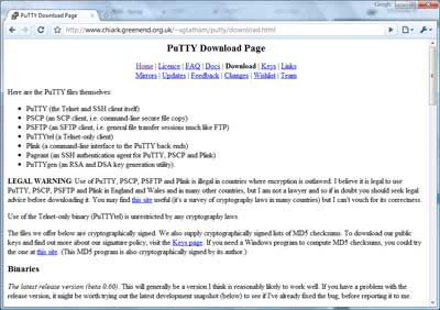
If you use Windows as a primary OS for your other work, you can then access the box from a Windows machine using an SSH client. I usually use PuTTY: http://www.chiark.greenend.org.uk/~sgtatham/putty/download.html


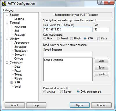
From there, you can install PuTTY on your windows machine and then access the Linux box via command-line interface remotely for administration.

Plug in the IP address you got above:


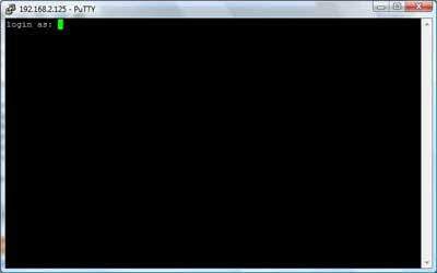
and voila - you should be presented with a login screen for your linux box:


Tools like PuTTY are a great asset when it comes to administering boxes.

Side trip into remote administration aside, on to the REAL stuff: Installing GeoServer.

As a prerequisite, you will need to install the Java JDK - the GeoServer install page gives some recommendations, and here's how you would do it from the command line:

sudo apt-get install sun-java6-jdk

Next, you will need to do some configuration of the JDK

Define the default Java to use:
sudo update-java-alternatives -s java-6-sun

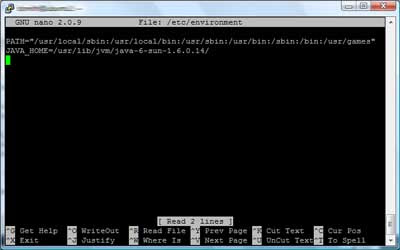
And set the JAVA_HOME directory - this is doable in a number of ways, you may or may not want to define it in /etc/environment. I really like 'nano' as an editor for command-line Linux environments and it comes pre-installed in the minimal Ubuntu 9.04 version.

sudo nano /etc/environment

Again 'sudo' makes sure you have an appropriate privilege level to write the changes.

In nano, you can navigate around in the file using your arrow keys. Insert the following:

JAVA_HOME=/usr/lib/jvm/java-6-sun-1.6.0.14/


nano is intuitive and easy to use, following the commands along the bottom of the screen, e.g. ctrl-O to write changes, ctrl-X to exit.

Now on to the fun stuff - installing GeoServer.

GeoServer isn't available via apt - so you will need to download and unzip it to install it.

To be able to use ZIP archives, sudo apt-get install unzip will provide that capability. Next, you can download GeoServer.

Decide where you want to put it - some folks put it in /usr/local, or /usr/share, or if you are just experimenting, you could even leave it in your home directory - if putting it /usr/share in you would cd /usr/share

To download it, the download location given on the GeoServer page is http://downloads.sourceforge.net/geoserver/geoserver-1.7.6-bin.zip

Thus, to download it, use wget -

sudo wget http://downloads.sourceforge.net/geoserver/geoserver-1.7.6-bin.zip

Then, unzip it

sudo unzip geoserver-1.7.6-bin.zip
and you should see the files extracting into a geoserver-1.7.6 folder.

Depending on where you put it and privileges held by the account you are using, you may also need to ensure you have ability to access and run GeoServer and that GeoServer can create any files it needs.

chown will change ownership, using -R makes it recursive through subfolders and files:

sudo chown -R geoserver_username geoserver-1.7.6 would change all files and directories to be owned by the user specified (geoserver_username as a placeholder).

You can list files using ls and navigate directories using cd.

You may or may not also then want to configure directories, such as defining the location of your GeoServer installation directory, e.g. GEOSERVER_HOME="/usr/share/geoserver-1.7.6" - again, you could do this using nano to edit /etc/environment - and there are also plenty of other ways to do this. You could also define other parts of GeoServer, such as GEOSERVER_DATA_DIR at this point as well - consult the GeoServer docs for details there... http://docs.geoserver.org/1.7.x/en/user/

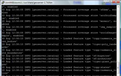
Pretty much ready to run now... cd to the /bin directory under your geoserver install, e.g. cd /usr/share/geoserver-1.7.6/bin" and launch the startup script sh startup.sh and voila... You will see some program output scroll by,
ultimately resulting with an output line like

[main] INFO org.mortbay.log - Started SelectChannelConnector@0.0.0.0:8080 - this should tell you that the GeoServer Jetty container is up and listening for connections on 8080.

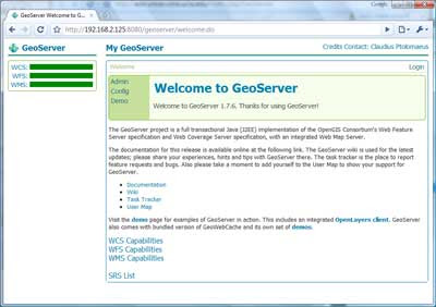
Now, open a browser, point it to your machine's IP address and enter it, pointing to port 8080 and the geoserver instance, e.g. http://192.168.2.125:8080/geoserver/ and after an initial "loading" screen you should get the GeoServer web interface:


And you are off to the races... Confirm that it works via the demos:

OpenLayers NYC Tiger map

Again, this is just meant to be a quick-and-dirty guide - enough to make even someone with minimal Linux experience armed and dangerous - and from here, there are many tweaks and customizations that can be made, such as optimizing performance, hardening and security and so on (there are plenty of discussions around the web and on listservs regarding this)- but I figured, I'd at least share this as a quick start for anyone looking to play with GeoServer in a minimal Linux environment...

National Environmental Information Exchange Network

Posted by Dave Smith On 4/11/2009 06:54:00 PM 2 comments

Here's another exiting bit of news - my firm is teamed with CGI Federal on USEPA's Software Engineering & Specialized Scientific Support (SES3) Contract, and we just got word that our team has won EPA's Central Data Exchange (CDX) task. This is very exciting news, CDX and the Exchange Network serve the community via facilitating exchange of a wide variety of environmental data between federal, state, tribal and other partnerships - it is a partnership that has proven itself to be tremendously effective and a great model for other types of data exchanges as well.

What I am particularly excited about is in leveraging the infrastructure that has already been built toward more robustly supporting geodata services, and ultimately toward enhanced reporting, metrics, analytical capabilities, and other capabilities to support feds, states, tribes and others in informed decisionmaking toward environmental policy and stewardship.

As such - we also anticipate we will be looking to grow as a company, and will be looking to hire additional technical gurus with capabilities in data exchange, data management and data flows, particularly if you have prior capabilities and knowledge of EPA's Exchange Network and CDX, and/or geospatial technology.

If you are interested, drop me a line at dsmith (at) synergist.tech.com

Microsoft Virtual Earth MVP

Posted by Dave Smith On 4/11/2009 05:58:00 PM 5 comments

The last several weeks have been quite hectic - busy on a number of fronts, which is a thankful thing, given the economy has slowed down a bit - but here is something quick that I wanted to share - I was awarded "Most Valuable Professional" (MVP) status by Microsoft for some of my ongoing work in Virtual Earth. Hierarchically, there isn't exactly a "VE MVP" program, but VE falls within Microsoft's broader Live Platform.


While I am quite thrilled and honored to be recognized by Microsoft, this is not to toot my own horn - but rather to get the word out to fellow geospatial developers that this is a great program, and to encourage them to look into it if they are doing integration work with VE.   Only a week into it, I am finding that the program provides a tremendous amount of outreach, technical resources and other things, such as teleconferences, message boards, newsletters and other great technical information (awardees are required to sign and comply with an NDA) and best of all, a complimentary subscription to Microsoft's Developer Network (MSDN).  There are also other great nontechnical benefits, such as $150 in credit at the Microsoft store and others which I am only just beginning to explore.

The way it works is that they receive nominations on a periodic basis - folks with talents in a given Microsoft technology can have friends nominate them - I would recommend putting together a portfolio of projects and related items, demonstrating innovation and engagement in the community, such as technical blog articles, engagement in online technical forums, any pro-bono work, and so on, and ask folks who are already MVPs to nominate you for your work.  It's a great program, and a great idea from Microsoft toward promoting and evangelizing their platform that they are supporting their developer community so well.  

With ESRI now partnering so tightly with Microsoft and supporting VE and Silverlight integration and other MS-oriented capabilities, this type of program is something that would be fabulous to see from them as well...  (hint to Jack Dangermond...)

A Blast from the Past

Posted by Dave Smith On 3/31/2009 07:38:00 PM 10 comments

Some late night discussion with @GeoBabbler (Bill Dollins) and others last night led to this little flight of fancy...  Bill was wondering if there were still any old copies of ArcView 1.0 around.  Being a GIS geezer and a bit of a technology packrat, it turns out I still had a copy.  Scary.  As @FantomPlanet suggested, I reckon I have a bit of a Museum of GIS Antiquity going on - I believe I actually still have ancient copies of MapInfo, Atlas, GeoMedia, AutoCAD Map 1.0 and others floating around, plus quite a bit of hand-coded stuff from the days when COTS GIS was not even widely available.


Scarier yet, I still have copies of MS-DOS and Windows 3.1 around.  

And...  to top it off, I was actually able to lay my hands on them and try things out again.

Actually, what I did was stand up a VirtualBox instance and load up Windows for Workgroups 3.11 (ArcView 1 does not run on Win95 and up) and lo and behold, I then got ArcView 1.0 loaded up.

Prepare to enter the time machine and go back over 15 years into the past:
Above:  Note the MDI interface
Above:  Supplied "neweng.av" Tutorial data with choropleth mapping of New England...

Above:  Version "1.0a"

Above:  "maplewd.av" Tutorial data...

Supported data types: Arc/Info coverages, workspaces images (note .bil image supplied as part of the AV1.0 tutorial data), address coverage...  Note also that shapefiles are NOT supported.


An interesting look at the past. A capable GIS viewing and querying tool, though no editing capability was supplied with 1.0. So... Why would one want to load up ArcView 1.0? You probably don't - probably best to live vicariously through my little adventure here. But... if you ever do, VirtualBox provides some dicey support for it (I did still get the divide By zero error initially, but eventually it started working) - and, you can actually still download a copy of 1.0 here: ftp://download1.geocomm.com/sd2/ARCVIEW10.ZIP and if you still have a copy of MS-DOS and Windows 3.1, you should be good to go.

Fun stuff!  Brought back some memories...

[edit - removed the hyperlinks from the images (and thereby the preview snapshots, per comment below)...  not sure why blogger wants to insert them by default anyways...]

ESRI Federal User Conference Highlights

My recently-retired EPA friend and colleague Dave Wolf was the recipient of the "Making a Difference" award. Dave was involved in pioneering efforts in web mapping at EPA, with EnviroMapper and other efforts.

I unfortunately arrived a bit late, and missed the discussion of ArcGIS Explorer Build 900 - fortunately Jithen Singh has a good overview of it here: http://mandown.co.nz/esri/arcgis-explorer-build-900-showcased-at-the-esri-federal-user-conference-2009/

As I arrived, I noted that there was a big focus being put on integration between ArcGIS and remote sensing imagery capability, specifically with ENVI and IDL: http://www.ittvis.com/ProductServices/ENVI.aspx. Dan Zimble led into presentations showing some of this capability, particularly integration of IDL scripts with ModelBuilder

Other highlights and demos:

  • Time Layer Animation
  • Keyless License Manager capability
  • Microsoft Virtual Earth data as a subscription service
  • APIs: Demonstration of ArcGIS Server Flex API via Solar Boston map: http://gis.cityofboston.gov/solarboston/
In general, there seemed to be a big focus on themes mirroring very topical and current issues, particularly stimulus and infrastructure investment - in the case of Solar Boston, energy - another demonstrated "smart routing" for alternative-fuel vehicles, based on availability of CNG fuel.

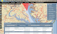
Relating to water issues, another demonstration featuring the Flex API was for the Chesapeake Bay Program: http://wdcb10.esri.com/cbprl/

This showed use of federated assets, such as USGS stream gauges, USEPA STORET water quality data, and so on, and provides many tools for assessment, management and best practices for improving water quality for the Chesapeake Bay.

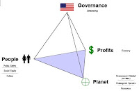
Colonel Alex Dornstauder of the US Army Corps of Engineers gave a good presentation on what USACE is doing relating to watersheds and water quality, using an approach of "3D decision space" and cross-agency "lenses". The approach utilized several different datasets and attributes with ModelBuilder to get a baseline assessment, which can then be utilized to in the target, with a collaborative vision to triage risk and prioritize investments to water quality.

(3d Decision Space image gleaned from a related presentation by Col. Dornstauder: http://gis.esri.com/library/userconf/ieug08/papers/watershed_dornstauder.pdf)

The Colonel closed with an excellent quote from George Washington, "Let us raise a standard to which the wise and honest can repair"

There was also discussion and demos of
  • Situational Awareness tools built on the Flex API in the code gallery (http://resources.esri.com)
  • ArcGIS Mobile SDK, with a demonstration, showing field data collection, domains, subtypes, dropdown list support.
  • 3D and network analysis - modeling of movement within a building in 3d (pedestrian egress via stairs, et cetera) - 3D proximity analysis
  • There was discussion of food safety, with a case study of the Hawaii Food Safety Center
  • Economic security and urban growth
  • Demonstration of ordinary least squares analysis vs. geographically weighted regression


Maryland Governor Martin O'Malley gave an excellent discussion, hitting many excellent notes - with many things that resonated: "can you show me my house" - which he tied in well in how "show me my house" repeatedly resonated in context of geography with the many case studies he presented. Other highlights "Maryland is ESRI Customer #008" -
He discussed trying to remedy many of the issues facing Baltimore, "hopeless & vacant hearts" and how CityStat http://www.baltimorecity.gov/government/citistat/ and iMap http://maps.baltimorecity.gov/imap/ have provided far more performance-oriented approaches - he touched on how previously, information had been collected in such a way as to not make it to management in any meaningful way, with emphasis on measurement of inputs, but not of outputs and outcomes - and the new paradigm of viewing outcomes against the map, tells where challenges lie. These types of geospatial approaches allow relentless followup and assessment, and drive the effort to move the graphs in right direction, with improvements in city services, reductions in shootings and homicides, improved response times - cleaning out and boarding of vacant houses, mapping service problems and opportunities for daily review. "The map does not care if neighborhood is white/black, rich/poor, republican/democrat"

As Governor now, he has taken this mapping-oriented and performance-oriented approach to the next level on a statewide level, with StateStat http://www.statestat.maryland.gov/ and BayStat http://www.baystat.maryland.gov/, and GreenPrint, which provides an ecological assessment of every single parcel in Maryland, along with ecological measures being put in force: http://www.greenprint.maryland.gov/ - and tie-in of stakeholders at all levels - "if it's not about the relationship, it's not about anything".

Governor O'Malley left the audience with a Native American proverb, "how we treat one another is reflected in how we treat the earth"

I did visit the EXPO floor and looked at some of the maps - the floor was definitely quite crowded. By one account, there were 2800 registrants this year for the ESRI Federal User Conference.

Some of the ESRI schwag:


(I don't think the DevSummit attendees will be getting ESRI umbrellas to go with their weather...)

As posted previously, I will try to live tweet more coverage tomorrow, using hashtag #feduc

If you are also attending and want to meet up, by all means, drop a line - dsmith (at) synergist-tech.com - while I have a few meetings, both inside, during FedUC, and a few outside meetings in the DC area next week, I will generally try to make FedUC my base of operations and will blog wherever conditions permit (if conference WiFi is available and/or my AT&T 3G service cooperates).

Also, I will try to post updates from my phone and laptop via Twitter - http://twitter.com/DruidSmith using the hashtag #feduc - if others are attending, I'd suggest using #feduc as well, tools such as TweetGrid will be helpful for tracking twitter traffic in realtime - here's a sample 1x1 TweetGrid already set up for tracking #feduc: http://tweetgrid.com/grid?l=0&q1=%23feduc

ESRI Federal User Conference

Posted by Dave Smith On 2/13/2009 08:09:00 PM 1 comments

I'm planning on attending at least part of the ESRI Federal User Conference next week - it's always good to get together with others working in the Federal community, to cross-pollinate ideas, talk, and see all the great things going on...

The details, from: http://www.esri.com/events/feduc/

GIS: The Geographic Approach for the Nation

Explore what geographic information system (GIS) technology can do for your agency at the largest geospatial conference dedicated to federal government. Whatever your GIS experience, the FedUC will give you the knowledge and resources you need to apply geography to problem solving, decision making, and accomplishing your missions.

Join other leaders, decision makers, and GIS professionals February 18–20, 2009, in Washington, D.C.

February 18–20, 2009
Walter E. Washington Convention Center
Washington, D.C.

Agenda-at-a-Glance

2009 Agenda [PDF]

Wednesday, February 18

9:30 a.m.–3:00 p.m. Plenary Session
2:30 p.m. Keynote Speaker
3:00 p.m.–6:00 p.m. GIS Solutions EXPO and Map Gallery Reception

Thursday, February 19

8:30 a.m.–5:30 p.m. Concepts of GIS Sessions

Paper Sessions

Technical Workshops
8:30 a.m.–5:30 p.m. Map Gallery
8:30 a.m.–6:00 p.m. Hands-On Learning Center
10:00 a.m.–4:00 p.m. GIS Solutions EXPO
4:00 p.m.–5:30 p.m. Industry Focus Session
5:30 p.m.–8:30 p.m. Thursday Night Social

Friday, February 20

8:30 a.m.–noon Paper Sessions

Technical Workshops

Industry Focus Sessions
9:30 a.m.–5:00 p.m. User Group Meetings
Noon–2:00 p.m. Closing Session

Who Should Attend and Why

Take the Geographic Approach

The FedUC is the ultimate resource when it comes to using geospatial technology in government. The conference offers presentations from technical and industry experts, valuable insight from your colleagues, and the latest solutions that fit your agency. Professionals across organizations are invited to discover effective and efficient ways to meet goals, overcome challenges, and address issues.

What You'll Experience

  • Hear from Jack
    Explore the future of GIS in government with ESRI president Jack Dangermond during the Plenary Session. Listen to him and a team of experts share what you can do with ArcGIS 9.3 in your organization. Plus, watch real-world demonstrations of ways government agencies are leveraging GIS.
  • Stay up-to-date
    Learn about the newest ArcGIS tools and capabilities. Hear firsthand from ESRI staff, your peers, solution providers, and consultants as you attend paper sessions, technical workshops, and the GIS Solutions EXPO.
  • Network with your colleagues and ESRI staff
    Build relationships with government and GIS professionals from both the public and private sectors as well as ESRI staff and business partners. Connect during sessions, exhibit times, and the evening reception.
  • Increase your knowledge of GIS
    Discover more about how GIS works and what it can do for your team and agency. See ways GIS is being used—from data sharing to security to budget control. Attend presentations given by professionals from across the nation and learn about successful implementations, best practices, tips, and tricks.
  • Learn how to meet your agency’s needs
    From compliance and accountability to visualizing patterns and trends, find out how taking the geographic approach improves your operations and decisions. Whether you work in federal, state, or local government, see how GIS can meet your organization’s unique needs.
  • Examine the most advanced technology
    Experiment with state-of-the-art tools you can use right away. Learn about recent developments for geotechnologies in your fields, from hardware, software, and data solutions to innovative applications and services.
  • Get your questions answered
    Pose your questions about GIS software, data, and implementation to ESRI staff members. Meet for a quick one-on-one discussion or set up a meeting to brainstorm and discuss project plans.

See geography in action.

If you are also attending and want to meet up, by all means, drop a line - dsmith (at) synergist-tech.com - while I have a few meetings, both inside, during FedUC, and a few outside meetings in the DC area next week, I will generally try to make FedUC my base of operations and will blog wherever conditions permit (if conference WiFi is available and/or my AT&T 3G service cooperates).

Also, I will try to post updates from my phone and laptop via Twitter - http://twitter.com/DruidSmith using the hashtag #feduc - if others are attending, I'd suggest using #feduc as well, tools such as TweetGrid will be helpful for tracking twitter traffic in realtime - here's a sample 1x1 TweetGrid already set up for tracking #feduc: http://tweetgrid.com/grid?l=0&q1=%23feduc

I am hoping to catch the Plenary, and am hoping to see what discussion ensues relating to the passage of the Stimulus bill, infrastructure investment and planning and National Spatial Data Infrastructure - I also hope to see old friends, and am looking forward to it...

NSDI for Democracy

Posted by Dave Smith On 2/07/2009 03:13:00 PM 0 comments

With news of Vivek Kundra joining the Obama administration to serve the Office of Management and Budget (OMB) as their top IT visionary, it brings me great encouragement. Vivek Kundra has been serving as the District of Columbia’s Chief Technology Officer, and he recently created some excitement through his Apps for Democracy initiative, where he pursued development of an “Open Data Catalog” containing over 250 data assets of various flavors (e.g. XML, Text/CSV, KML, ATOM/GeoRSS and ESRI Shapefile formats), and then promoted a contest wrapped around the Open Data Catalog, for development of innovative mashup-oriented applications. In just a short amount of time, 47 excellent applications were submitted, dealing with a broad range of topics and providing many innovative solutions, a great success.

So what is OMB all about – and what might Kundra’s joining OMB mean?
From Wikipedia, http://en.wikipedia.org/wiki/Office_of_management_and_budget

The Office of Management and Budget (OMB) is a Cabinet-level office, and is the largest office within the Executive Office of the President of the United States (EOP). It is an important conduit by which the White House oversees the activities of federal agencies. OMB is tasked with giving expert advice to senior White House officials on a range of topics relating to federal policy, management, legislative, regulatory, and budgetary issues. The bulk of OMB's 500 employees are charged with monitoring the adherence of their assigned federal programs to presidential policies. OMB performs its coordination role by gathering, filtering, and promulgating the President's annual budget request, by issuing bulletins, memoranda and circulars dictating agency management practices, by overseeing the "President's Management Agenda", and by reviewing agency regulations.

Executive oversight of federal agencies – via expert advice on federal policy, management, legislative, regulatory, and budgetary issues, to be implemented and monitored for adherence via the President’s Management Agenda. That’s quite powerful. And under the Bush administration, OMB has already begun engaging in some basic monitoring activities relating to geospatial technology and investments, under the Geospatial Line of Business (GeoLoB).

So where do we go from here? And what does Kundra’s selection mean in this mix? Only Kundra really has the answer to this, at present - however I do believe that we can make some informed guesses as to what may be on his mind, based on his past track record and accomplishments. District of Columbia’s Open Data Catalog? Think in terms of doing this across all of Federal government. Strengthen and bolster the existing OMB A-16 mandate, and drive publishing of open data. That certainly forms some excellent pieces of the National Spatial Data Infrastructure.

Foster partnership-building and collaboration, ala the Apps for Democracy effort. Perhaps, on a cross-government level, we should also be looking at approaches such as Forge.mil, where agencies can collaborate and share GOTS technology investments, and work together to enhance and expand technology and capability, as opposed to continually reinventing the wheel.

Other things for Kundra to look at? Alignment of efforts across government. Currently USGS and EPA collaborate on efforts to build and densify hydrology data, as the National Hydrology Dataset (NHD), and are working with states to get this to a 1:4,800 level. Meanwhile, FEMA is developing DFIRMs for flood mapping, based on county and other types of data for stream centerlines. How do we align such things as linear referencing between USGS stream gauges and FEMA for looking at flooding issues? Coordinate between NOAA and NWS for realtime storm tracking, and have models available, using all best-possible data, toward stream flood prediction? What if a truck tumbles off of a bridge and ends up in a river, releasing hazardous waste into the river – is the information flow adequate to deal with hazardous waste cleanup even where that river crosses the border into the next state downstream? Pieces and parts of these types of things are starting to happen, but where they do, it is typically only in an ad-hoc, reactive fashion, with very limited coordination or common framework. Where does one thing end and the next begin? What are the gaps? Overlaps?

Or, consider a military convoy, heading across multiple states to an exercise. Due to an emergency bridge closure, they are diverted off of the main highway and onto local roads. They may be carrying sensitive and/or high value goods, such as weapons systems. Who knows? Who SHOULD know? Perhaps local bridge weight restrictions restrict their travel even further. How do we handle this in any coordinated fashion? Who’s doing what, and who’s able to supply what data to smoothly deal with these types of situations? Federal government places some mandates on states to collect roadway data, but again, is there any mechanism for establishing data capture, transparent access and flow? What’s covered, and what isn’t? State-to-state, if there is a serious roadway closure issue just inside one state’s border, will the adjacent state know this and be able to notify motorists via VMS boards and other means?

Although there are a few exceptions here and there, more often than not, the answer to these types of questions and scenarios is “no/had no idea/what am I supposed to do about it” accompanied by shrugs. Streams do not care about political boundaries, they only understand watersheds. Roads are networks. Cars and trucks do not just reach the Edge of the Knowne Worlde and drift off into space when they cross the state line. Information access and flows must be able to bridge these gaps.

It’s pretty much a given that 90% of most business processes in Federal government touch on or deal with location in some form or fashion. Where are assets, where are people, who’s being served, and so on. Through implementation of best practices and through making data access and exchange more timely, transparent, and complete, through better alignment of technology investments and reduction of gaps and overlaps, these *shrug* moments start to vanish, and the *AHA* moments start to happen. I am hoping that Mr. Kundra is thinking the same way. If what lies ahead of us is anything like his efforts to date, we indeed have a bright future ahead of us.

As pressures of economics and tightening budgets, increasing population and infrastructure demands, and limited resources continue to confront states, municipalities, and the nation as a whole, some harsh realities begin to emerge, of how much we can actually, pragmatically accomplish.


As just one example of this, studies of number of vehicle lane miles traveled, compared to number of vehicle lane miles constructed and maintained shows a clear divergence, and sends the message that demand by far has been outstripping supply:

One solution to this would be to just try and keep building roads everywhere – however this is a simplistic, and ultimately unsustainable solution.  Certainly, we DO need to stabilize current infrastructure and address some critical physical issues of capacity bottlenecks, and in some instances we do need to improve circulation and flow in existing transportation networks.  But we also need to change our thinking, in terms of how we assess, monitor and manage traffic and congestion. 


Here, approaches such as use of Intelligent Transportation Systems can provide better visibility into traffic issues and offer solutions toward better management of the transportation network.  


Via any number of technologies, such as embedded sensors, cameras, on-board systems and GPS, message boards and other forms of providing traffic advisory data, and hazards monitoring, traffic crises can be averted, congestion can be managed, and traffic rerouted to make optimal use of existing transportation networks.  The use cases for embedded technology are numerous – while repairing or replacing our crumbling bridges, we can consider technologies to monitor bridge decks for icing conditions, and so on.  We can utilize available traffic data along with spatial, temporal and predictive analysis, e.g. virtual origin-destination studies and other approaches to recognize patterns and trends, toward avoiding traffic jams or even conditions which may be prone to promoting accidents.


As another example, decades of poor, unsustainable planning, zoning, and land development practices have promoted suburban sprawl, pedestrian-unfriendly areas, dependence on cars for even the most mundane of errands, particularly as residential and commercial areas have become separated from each other in artificial models.  In some areas, this has been recognized, as we see a return in some locales to “town center” concepts, where residents can find amenities within walking distance.  Here again, proper tools and geospatial data are required by planners to correct these planning paradigms on a macro scale to recognize these bedroom community relationships, as well as on a micro scale, for example to best maximize pedestrian travel and optimize these local networks.


Additionally, we need to continue to promote mass transit options, aligned to serve core needs – commuters, shopping, and similar needs, based on observation of current traffic flows.  If mass transit becomes enough of a convenience factor, it will continue to be utilized.  Similarly, other mass-transit-related infrastructure needs to be examined.  Here, spatial and temporal analysis of the network can reap great benefit toward maximizing mass transit networks and flows, their alignment to need (supply and demand for transit) and their efficiency.


These types of solutions are in need all around us - for example, as a regular visitor to the Washington, DC area, I often use their otherwise-excellent WMATA Metro system – however many demand issues and patterns rapidly become evident to even the casual eye– in out-lying areas served by the Metro, most of the parking lots and garages fill immediately in the AM and become deserted after work hours – a sign that commuters from outlying areas.  To anyone arriving at, say, 10AM, there’s a good likelihood that some of these parking facilities will be long filled, forcing potential users to travel further before being able to avail themselves of mass transit.  Here again, in even just expanding parking capacity, exists opportunity lost to get traffic off of the streets.


Even these types of things relating to commuting via Metro can also tie into Intelligent Transportation Systems, by providing parking advisories (e.g. saving commuters the grief of trying to find a space in a particular lot when parking may already be full) or by advising pedestrians right at street-level when the next train is arriving or of capacity issues (particularly when it may actually be worthwhile to just walk a few blocks to a different station); or by allowing better means of assessing travel options via web and/or location-aware mobile devices.  Here, geospatial approaches can even allow users to get custom travel directions and planning via walking, mass transit, or for handicapped persons, routing via ADA curb cuts, avoidance of stairs, steep inclines, and other useful information toward ensuring safe and reasonable travel, even delivered directly to their phone or other mobile devices.


With HR1 and discussion of massive infrastructure investments on the horizon, we strongly need to consider an integrated strategy and investment for integrated data and analysis, to include remote sensing, geospatial, temporal and others -  to go hand-in-hand with hard, bricks-and-mortar infrastructure investments – such that we may better manage the assets.  And yes, this could be done independently in dozens of disparate efforts, but would be best leveraged through discourse and technical coordination and information sharing on a broader scale to leverage planning capabilities, modeling, and much more; again, it points up the need for a national vision and strategy for spatial data infrastructure.


If we are going to do this at all, we need to get it right.


While efforts remain local, we need a paradigm shift on many levels- to think beyond our traditional project-by-project approach, and think on a bigger level, to integrate IT into our planning process, as well as integrating it directly into our bricks-and-mortar infrastructure investments, and to better coordinate and leverage investments and efforts to provide this long-term benefit.

< >

Landscape of National GIS...

Posted by Dave Smith On 2/01/2009 12:43:00 AM 4 comments

In considering the current state of geospatial data in the nation, it runs the gamut. A substantial amount of data is collected and developed at the local level. Some is collected and developed at the state and federal level, some by tribes, some by academia, some by non-profits, and some by private sector. Some of this data is generated on a regular basis, as part of an established program; some is purely on an ad-hoc basis. Some is mandated, such as some of the data collected on environmental data through the National Environmental Information Exchange Network, some is collected, purely incidental to other activities.

Some datasets exist on a national basis, some do not. And all throughout, there are myriad overlapping use cases, which may additionally place differing requirements on datasets. For example, in some cases, a roadway GIS dataset may be geared to roadway maintenance needs; in others, toward network and traffic analysis. In some cases, the requirements, dataset characteristics and attributes can converge and be accommodated in a single dataset. In others, they may not be able to converge, but the needed datasets can be developed by means of value-added attributes or joins. In some cases, derivative data is required. In many cases, there is tremendous need for consistency and authoritative datasets.

The landscape that quickly begins to emerge is one which is a patchwork, full of seams, overlaps, disjoints, gaps and disconnects- but- also one which holds much potential for leveraging disparate investments, and providing economies of scale, along with increasing richness of data, increased update frequency, increased accuracy and completeness.

How can these gaps and disjoints be bridged? Through a framework, forum and national dialogue, bringing together stakeholders at all levels – federal, state, local, tribal, academia, non-profit, and industry; through partnerships; through collaboration - organizations like NSGIC, like Federal and other agency GIS workgroups, like CUAHSI and many others. This is what holds a National Spatial Data Infrastructure together and brings success.  


The first step is in considering the concept.

Act Locally, Think Globally.

Stimulus and Infrastructure Planning

Posted by Dave Smith On 1/31/2009 10:32:00 AM 1 comments

With considerable debate and controversy, HR 1, the Stimulus bill has passed in the House of Representatives and has moved on to the Senate for additional debate and deliberation.


Current Bill Status

The full HR 1 text and various summaries are posted below:
(note: these may change as HR 1 works its way through the Senate)

Additional Supporting Documentation:
There are also a few additional sites discussing the Stimulus, such as the GOP-driven http://readthestimulus.org/ which nonetheless provide useful resources.

Within the Stimulus bill, there are a number of investments proposed, e.g. transportation funding, mass transit, broadband infrastructure and much more.

Question is, how do we intend to properly assess, triage and plan how and where best, geographically, to make these investments to provide maximal benefit without spatial data on a national level? How can these investments be expended without an adequately informed decisionmaking process?

This need points toward NSDI, the National Map and the related pieces that serve it, and a core need for geospatial data and analysis, which should be an integral part of any of these planning and investment processes, as well as embedding geo-enabled technologies within the investments themselves.

Investment in infrastructure without also investing in the underlying planning process and supporting data and decisionmaking tools represents tremendous opportunity lost, in terms of making adequately informed decisions, leveraging efforts, and properly targeting infrastructure improvements to where they provide the greatest good to the American people as a whole.


National Spatial Data Infrastructure 2.0

Posted by Dave Smith On 1/28/2009 03:02:00 PM 2 comments

Recently there has been a great deal of discussion about "NSDI 2.0" - and yet it seems there is much confusion about what it is or isn't - and what we should do, or whether we should bother discussing it at all.

History
To step backward in time, it primarily deals with National Spatial Data Infrastructure from a federal perspective, as enacted through the Office of Management and Budget Circular A-16.

This document was originally issued in 1990, followed by Presidential Executive Order 12906, and then subsequently updated in 2002 (which incorporated EO 12906).

OMB Circular A-16 (as revised 2002)

In its present form, the NSDI (if you were to consider it NSDI 1.0) consists of:

  • Defined data themes (geodetic control, orthoimagery, elevation, transportation, hydrography, governmental units, and cadastral information)
  • Metadata (FGDC Metadata Format)
  • The National Spatial Data Clearinghouse (Geospatial One-Stop)
  • Standards (developed only when no existing voluntary standards exist, in accordance with OMB Circular A-119)
  • Partnerships
Within the NSDI, oversight is provided by the Federal Geographic Data Committee (FGDC)

Additionally, A-16 pursues the following:
  • Privacy and Security of raw and processed citizens' personal data and accuracy of statistical data
  • Access to these data, subject to OMB Circular A-130
  • Protection of proprietary interests to these data 
  • Interoperability between various federal agencies' information systems within these data
The NSDI supports the advancement for a Global Spatial Data Infrastructure that coincides with National Security interests. Any Federal system that develops international data in accordance with these systems must follow international voluntary standards as outlined by Circular A-119.

The Current Situation
With the FGDC and OMB mandate, this prior effort more than anything, establishes a framework.  This framework, in turn, is something that individual agencies and data stewards can build to.  Similarly, the recent Office of Management and Budget (OMB) Geospatial Line of Business (GeoLoB) and other initiatives, such as the Federal CIO Council's Federal Enterprise Architecture (FEA) Geospatial Profile 1.1 provide guidance toward harmonizing investment, technology and architecture.  Further, the recently-formed National Geospatial Advisory Committee (NGAC) has been formed under the Federal Advisory Committee Act to provide advice, from a community cross-section, to FGDC.

Here nonetheless remains the challenge of populating this framework.  Many diverse efforts are ongoing, which align with these efforts, such as Imagery For The Nation, such as EPA's Exchange Network, however some of these efforts still lack adequate resources for completion, may have issues with stovepipes, lack of interoperability, lack of access, and so on.

The drivers for completing this work are manifold - such as providing adequate tools for planning, to better allow informed decision-making for such things as roadways and transportation, for analysis of demographics toward broadband investments, for homeland security, for planning improvements to municipal sewers, for protecting natural and archaeological heritage and biodiversity, and so on.   As such, with discussion of massive stimulus and the H.R. 1 bill geared toward many of these things, it is imperative that decisions and investments be made in an informed fashion.

Currently multiple documents of relevance and proposals toward populating this framework and advancing the various initiatives are currently circulating within the GIS community:
All of these speak to the need for populating the NSDI framework.  The questions and differences only remain in approaches.    Many elements are crucial to success, such as:
  • Satisfying clear mandates, requirements and drivers for geospatial data
  • Delivering data in an accessible, vendor-neutral, platform-agnostic and interoperable fashion
  • Leveraging and dovetailing into existing initiatives and investments
  • Partnerships:  Federal/State/Local/Tribal/Academia/NGO/Industry
  • And many more...  These need to be considered carefully.
The hope is that the community can have an open, informed discussion of these elements and proposals, along with all of the key context, history and background.  And hopefully adequate open forums will become available for doing so.

Search