Surveying, Mapping and GIS

Exploring all aspects of mapping and geography, from field data collection, to mapping and analysis, to integration, applications development and enterprise architecture...

  • Geospatial Technology, End to End...

    Exploring all aspects of mapping and geography, from field data collection, to mapping and analysis, to integration, applications development, enterprise architecture and policy

EPA has a new CIO

Posted by Dave Smith On 3/29/2006 08:42:00 AM 0 comments

The announcement went out yesterday morning - President Bush has nominated a new CIO for EPA, to replace Kim Nelson, who left late last year. The new CIO is Molly O'Neill, who has been heading EPA's Environmental Council of States (ECOS) efforts within the Exchange Network for bringing data in from the states. To date, Linda Travers had been filling the post as acting AA. Hopefully O'Neill will bring her experience in what's involved in integration of data from external sources toward further supporting ongoing efforts for internal integration and SOA.

I have been working extensively on the Geospatial side, toward mapping and modelling as-is and to-be architectures for the entire horizontal sector of Geobusiness across EPA. "Line of Business" is becoming a major issue within OMB these days, and Geospatial processes may be part of that equation. I also has been preparing for a presentation on MetaCarta to Linda Travers - this may now become my introduction to the new CIO instead.


Technorati tags:
, , , , , , , , , , , , , , , , , , ,

Cherry blossoms...

Posted by Dave Smith On 3/27/2006 04:04:00 PM 0 comments

I currently commute from Northeastern PA to Washington, DC about once a week - I usually spend two days down in the DC area, and the rest of the week working out of my Pennsylvania office. One of the tough parts is the disparity in the weather, even though only four hours away.

Last week, I noted the beginning of the season for the famous cherry blossoms in Washington... and Friday night, on my way home I run into snow.

At least the weather is starting to get better here in PA again... it's a beautiful sunny day today...


Technorati tags:
, , , , , ,

Not going to GIS Workgroup

Posted by Dave Smith On 3/27/2006 03:54:00 PM 0 comments

I'm not going to the EPA GIS Workgroup meeting after all - my dance card filled quite rapidly these last few weeks, including far more pressing EPA geospatial business. I have quite a few other interesting appointments this week to take their place, including a large Homeland Security project... We also just got done submitting a major proposal for the Navy... There's a lot going on as people get new dollars allocated and new plans for '06-'07 worked out...


Technorati tags:
, , , , , , , , , , , , , , , , , ,

EPA GIO Brenda Smith leaves

Posted by Dave Smith On 3/27/2006 03:40:00 PM 0 comments


Haven't posted in a while - not because there's nothing newsworthy, but rather because there's been too much going on...

At any rate, one of the larger pieces of news I've been sitting on is that EPA's Geospatial Information Officer Brenda Smith has left the agency for other pursuits. I had the pleasure of working with Brenda quite a bit over the last six months, as we have been developing the agency's Geospatial Data, Metadata and Services Architecture. Brenda had great vision and helped to consolidate a number of efforts, and toward steering the agency toward SOA and some of the geospatial direction coming from OMB.

Currently word is that EPA is looking to replace her with someone from the outside - and hopefully Wendy Blake-Coleman and our team can help get the new GIO back up to speed without much loss of momentum.


Technorati tags:
, , , , , , , , , , , , , , , , , , ,

Still looking for another GIS developer

Posted by Dave Smith On 3/13/2006 10:10:00 PM 0 comments

Our EPA GIS Center of Excellence team did manage to get a couple more people aboard, they are starting in two weeks, but we still have room for one more GIS developer.

The main thrust of the work involves GIS web applications (such as ArcIMS-based apps), along with GIS web services (OGC WMS and WFS) and GIS database development (Oracle 9i/10g / Oracle Spatial and SDE 9.1 environment)...

A full description is available here.


Technorati tags:
, , , , , , , , , , , , , , , , , , , , , , , , , , , , , , , , , , , , , , , , , , , , , , , , , , , , , , , , , , , , , , ,

ESRI Geospatial Portal Toolkit on Oracle

Posted by Dave Smith On 3/13/2006 05:47:00 PM 0 comments


This morning, I had a meeting with Richard Lawrence and Marten Hogeweg from ESRI to discuss their current efforts at implementing the ESRI Geospatial Portal Toolkit at EPA's National Computing Center. Man, am I relieved... previously every discussion revolved around the IBM WebSphere platform (ala GOS), but now that everyone's getting deeper into it and they have actively engaged ESRI in the effort, it appears that ESRI's made their implementation very platform-independent. The Portal platform of choice is Oracle - having an Oracle-based implementation will make it so much smoother and easier for the rest of us to work with.

The Oracle environment will help to integrate it with the single-sign-on Identity Management that our team is working on, as well as so many other portal and portlet-based things flying around in some of our current conceptual work... Best news I've heard in a while.

By the way, though they are both involved in ESRI's GPT implementations, Marten Hogeweg is no relation to Gerco Hoogeweg (I met Gerco at Research Triangle Park last fall) - Marten says Gerco's from a wealthier family, since they could afford to buy an extra vowel... I always loved the dutch language... as I grew up in Germany, we used to spend our summer vacations at the shore on the North Sea in Holland....


Technorati tags:
, , , , , , , , , , , , , , , , , , , , , , , , , , , , , , , ,

EPA GIS Workgroup

Posted by Dave Smith On 3/10/2006 10:28:00 PM 0 comments

I'm going to go to the EPA GIS Workgroup meeting in Annapolis in a few weeks - March 28-31. Should be interesting, and I have a small part in some of the things being presented. Some of the topics will be Emergency Response, looks at geospatial activities in other agencies - NOAA and NGS, some commercial stuff (ArcGIS Explorer, Google Earth, TeleAtlas, ArcWeb, GlobeXplorer...) A big focus will also be SOA. Looking forward to it...


Technorati tags:
, , , , , , , , , , , , , , , , , , , , , , , , , , , , ,

The "Hate-To-Say-It-But-I-Told-You-So" Department...

Posted by Dave Smith On 3/06/2006 05:52:00 PM 2 comments

I previously posted about my concerns about Mac owners smugly professing to be running a much more secure OS than Windows... My thought being that it wasn't that OSX couldn't be hacked or infected by viruses, but rather that nobody really took the time to try, that it simply wasn't as attractive a target as big and mighty Microsoft's offerings... That it very likely also suffered from its own share of bugs and vulnerabilities (and it does).

Turns out my suspicions have been vindicated - Turns out a "smug Mac owner" put up a server running OSX boldly challenging folks to hack it - and the rest has been ugly. Hacked and defaced within 30 minutes. The tune has been rapidly changing...


Technorati tags:
, , , , , , , ,

2006 MetaCarta Users Group

Posted by Dave Smith On 3/05/2006 12:04:00 PM 0 comments

I've been delinquent on updating my blog- lots of stuff going on, fortunately most of it good. A little while back I attended the MetaCarta Users Group meeting with Dave Catlin of the EPA Geoservices team, we presented the Window To My Environment prototype that features deep integration of MetaCarta search technology. We're finally also working through some of the agency bureaucracy to move the MetaCarta appliance toward a production environment and allowing it to be populated with real data, as opposed to the months-old canned data we had been using to date. We did a trial crawl with the unit, and it behaved quite well- EPA National Computing Center staff had evidently been worried about it running rampant and consuming all available bandwidth, crashing servers, et cetera. We can tweak its crawling behavior quite well, though...

One of the comments at the MetaCarta Users Group was that it was an interesting and unusal thing to have EPA and CIA in the same venue presenting together. At any rate, some creative seat-of-the-pants flying involving wi-fi to VPN to remote desktop connection and we were able to demo the application live, in addition to the PowerPoint material (aside from applications live in MetaCarta's shop, everyone else's presentation was canned...)

The MetaCarta team had a number of great things they shared at the Users Group meeting. One of the things I thought was pretty exciting was the new ArcGIS functionality, which can provide temporal views of the data, when used with Tracking Analyst. There were a few presentations which show DoD and Intel applications of the technology in analyzing message traffic, to provide near-realtime spatial and temporal data mining and display capabilities. Great stuff. What became a running bit from one presentation to the next was the obligatory example of IEDs in Iraq...

They also discussed MetaCarta labs - some public betas of various MetaCarta experiments. More on those later, but they are doing a lot of fun stuff with Google-style AJAX. I hadn't realized it but Schuyler Erle, coauthor of Google Maps Hacks is now working with MetaCarta as well...

I apparently also missed a chance to meet face to face with GeoMullah, of the Fantom Planet blog... Have had some discussions with him since, on Open Source solutions.

Some previous MetaCarta-related posts:


Technorati tags:
, , , , , , , , , , , , , , , , , , , , , , , , , , , ,

Laser Scanning, Archaeology, Metadata....

Posted by Dave Smith On 3/04/2006 10:35:00 AM 2 comments

Catching up on a backlog of mail and other things that have been sitting around - I just read my March '06 edition of Professional Surveyor, and enjoyed a couple of articles - their theme in this edition, "Scanning our Heritage" combines a couple of things that I enjoy - surveying and archaeology.
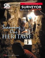
Laser Scanning and Archaeology: One article highlights the application of laser scanning in creating detailed records and models of archaeological sites. I think this is a wonderful application of the technology, as it's still an unfortunate truth that once sites are discovered, even after hundreds and thousands of years of protection by simply being lost, they tend to rapidly deteriorate due to intentional vandalism and looting, or even wear and tear due to well-intentioned tourism.

Additionally, it allows subterranean features to be move effectively mapped, and allows modeling and analysis to try and better understand ancient cultures. Furthermore, the point clouds and photographic values that are collected with modern laser scanning solutions allow three-dimensional virtual models to be created, allowing greater options for allowing virtual visitors to do a walkthrough of the site without any harm to the actual site.

Surveyors and Metadata: There was also an article in this issue discussing metadata, with contrasting opinions from a surveyor's viewpoint versus a GIS professional's perspective. The surveyor's opinion is that the typical surveyor's plat contains the metadata up front, in the title block and notes. On the other hand, he makes issue of the GIS not having this metadata up-front. Yes, but... While the surveyor's boundary may have known accuracy in terms of closure, this is many times not disclosed specifically, and many times coordinate system is likewise not disclosed. Surveyors tend to be very adverse to publishing coordinates. Additionally, while the surveyor may be comfortable with the metadata aspects that he does describe in his title block and other notes and disclosures, he must defer to the constraints of other data that he may incorporate into his plat, such as FEMA flood zones (as opposed to physically determined flood zones), NWI wetlands (as opposed to physically located wetlands), soils or other data which is typically overlaid (with no indication of accuracy estimation).

From my more recent perspective working in large federal enterprises with many autonomous components, metadata is certainly a huge issue. In many instances the metadata itself may not exist for many datasets, or the metadata that does exist may be of poor quality. Finding metadata can be an issue if it does exist. Sometimes datasets are dynamic, with continuous updates which may not be reflected in the metadata (such as collection date, method of collection and collection accuracy), which may undermine the data. Or, in an example given about emergency response, data may give false negatives or false positives, which may lead to loss of life and/or property.

At any rate, data should be better than no data, and data or metadata or lack thereof should never be a complete substitute for domain expertise and common sense. In emergency response operations, metadata should serve to allow decisionmakers to make informed decisions about usefulness of data (for example avoidance or second-guessing of the outdated dataset). If properly documented, datasets can be evaluated and prioritized for use. From the surveying world to the GIS world, things get a little more complicated. Certainly surveyors understand the potential shortcomings of data if it does not meet locational criteria. And I think the upshot is that surveyors DO in a sense use metadata in their product as pointed out in the article, and for them to be able to convey their metadata along with their data into GIS and LIS systems (which are ultimately collaborative) will serve to provide continuous quality improvements.


Technorati tags:
, , , , , , , , , , , , , , , , , , , , , , , , ,

GeoWeb 2006... signs of things to come?

Posted by Dave Smith On 3/02/2006 10:28:00 PM 0 comments


GISUser posts an update on the GeoWeb 2006 conference coming up in July in Vancouver, BC. This appears to be the burgeoning spearpoint of SOA in the geospatial world, and an event that I would just love to sit in on, given some of the work I have recently been engaged in.

The interesting thing is that the article notes Microsoft will be lead sponsor for the event. Microsoft appears to be positioning itself ever more for providing tools and the IDE for OGC-based technology.

As I continue to watch the evolution of such things as CarbonTools, which is .NET-based. As a user and fan of .NET myself, and having developed a WFS service using .NET, it makes great sense to me. Will see what the competition has to say... Oracle will be there, but no sign of ESRI. Not a good sign.

Unfortunately I think I will probably not be able to attend...

Search