Surveying, Mapping and GIS

Exploring all aspects of mapping and geography, from field data collection, to mapping and analysis, to integration, applications development and enterprise architecture...

  • Geospatial Technology, End to End...

    Exploring all aspects of mapping and geography, from field data collection, to mapping and analysis, to integration, applications development, enterprise architecture and policy
Showing posts with label geo. Show all posts

NSDI for Democracy

Posted by Dave Smith On 2/07/2009 03:13:00 PM 0 comments

With news of Vivek Kundra joining the Obama administration to serve the Office of Management and Budget (OMB) as their top IT visionary, it brings me great encouragement. Vivek Kundra has been serving as the District of Columbia’s Chief Technology Officer, and he recently created some excitement through his Apps for Democracy initiative, where he pursued development of an “Open Data Catalog” containing over 250 data assets of various flavors (e.g. XML, Text/CSV, KML, ATOM/GeoRSS and ESRI Shapefile formats), and then promoted a contest wrapped around the Open Data Catalog, for development of innovative mashup-oriented applications. In just a short amount of time, 47 excellent applications were submitted, dealing with a broad range of topics and providing many innovative solutions, a great success.

So what is OMB all about – and what might Kundra’s joining OMB mean?
From Wikipedia, http://en.wikipedia.org/wiki/Office_of_management_and_budget

The Office of Management and Budget (OMB) is a Cabinet-level office, and is the largest office within the Executive Office of the President of the United States (EOP). It is an important conduit by which the White House oversees the activities of federal agencies. OMB is tasked with giving expert advice to senior White House officials on a range of topics relating to federal policy, management, legislative, regulatory, and budgetary issues. The bulk of OMB's 500 employees are charged with monitoring the adherence of their assigned federal programs to presidential policies. OMB performs its coordination role by gathering, filtering, and promulgating the President's annual budget request, by issuing bulletins, memoranda and circulars dictating agency management practices, by overseeing the "President's Management Agenda", and by reviewing agency regulations.

Executive oversight of federal agencies – via expert advice on federal policy, management, legislative, regulatory, and budgetary issues, to be implemented and monitored for adherence via the President’s Management Agenda. That’s quite powerful. And under the Bush administration, OMB has already begun engaging in some basic monitoring activities relating to geospatial technology and investments, under the Geospatial Line of Business (GeoLoB).

So where do we go from here? And what does Kundra’s selection mean in this mix? Only Kundra really has the answer to this, at present - however I do believe that we can make some informed guesses as to what may be on his mind, based on his past track record and accomplishments. District of Columbia’s Open Data Catalog? Think in terms of doing this across all of Federal government. Strengthen and bolster the existing OMB A-16 mandate, and drive publishing of open data. That certainly forms some excellent pieces of the National Spatial Data Infrastructure.

Foster partnership-building and collaboration, ala the Apps for Democracy effort. Perhaps, on a cross-government level, we should also be looking at approaches such as Forge.mil, where agencies can collaborate and share GOTS technology investments, and work together to enhance and expand technology and capability, as opposed to continually reinventing the wheel.

Other things for Kundra to look at? Alignment of efforts across government. Currently USGS and EPA collaborate on efforts to build and densify hydrology data, as the National Hydrology Dataset (NHD), and are working with states to get this to a 1:4,800 level. Meanwhile, FEMA is developing DFIRMs for flood mapping, based on county and other types of data for stream centerlines. How do we align such things as linear referencing between USGS stream gauges and FEMA for looking at flooding issues? Coordinate between NOAA and NWS for realtime storm tracking, and have models available, using all best-possible data, toward stream flood prediction? What if a truck tumbles off of a bridge and ends up in a river, releasing hazardous waste into the river – is the information flow adequate to deal with hazardous waste cleanup even where that river crosses the border into the next state downstream? Pieces and parts of these types of things are starting to happen, but where they do, it is typically only in an ad-hoc, reactive fashion, with very limited coordination or common framework. Where does one thing end and the next begin? What are the gaps? Overlaps?

Or, consider a military convoy, heading across multiple states to an exercise. Due to an emergency bridge closure, they are diverted off of the main highway and onto local roads. They may be carrying sensitive and/or high value goods, such as weapons systems. Who knows? Who SHOULD know? Perhaps local bridge weight restrictions restrict their travel even further. How do we handle this in any coordinated fashion? Who’s doing what, and who’s able to supply what data to smoothly deal with these types of situations? Federal government places some mandates on states to collect roadway data, but again, is there any mechanism for establishing data capture, transparent access and flow? What’s covered, and what isn’t? State-to-state, if there is a serious roadway closure issue just inside one state’s border, will the adjacent state know this and be able to notify motorists via VMS boards and other means?

Although there are a few exceptions here and there, more often than not, the answer to these types of questions and scenarios is “no/had no idea/what am I supposed to do about it” accompanied by shrugs. Streams do not care about political boundaries, they only understand watersheds. Roads are networks. Cars and trucks do not just reach the Edge of the Knowne Worlde and drift off into space when they cross the state line. Information access and flows must be able to bridge these gaps.

It’s pretty much a given that 90% of most business processes in Federal government touch on or deal with location in some form or fashion. Where are assets, where are people, who’s being served, and so on. Through implementation of best practices and through making data access and exchange more timely, transparent, and complete, through better alignment of technology investments and reduction of gaps and overlaps, these *shrug* moments start to vanish, and the *AHA* moments start to happen. I am hoping that Mr. Kundra is thinking the same way. If what lies ahead of us is anything like his efforts to date, we indeed have a bright future ahead of us.

EPA GIS Workgroup

Posted by Dave Smith On 5/12/2008 09:37:00 AM 0 comments

While everyone else is off to Where, et cetera - I'm going off to the EPA GIS Workgroup meeting in New York City...


Always great to see what's going on in terms of GIS and remote sensing for visualization, modeling and analysis in the realm of environmental protection - usually most EPA regions and program offices are represented, along with other organizations and agencies... Lots of geo friends in attendance.

Looking forward to it.

ESRI FedUC - Day 2 (sort-of...)

Posted by Dave Smith On 2/21/2008 09:01:00 PM 1 comments

I am just now making my way back on the Metro back from the reception at the National Geographic, tacking together some unfiltered notes from earlier in the day- my meeting was punctuated by outside meetings in Alexandria and Fairfax, so I managed to get in about 1.6 sessions, and got back just in time to find that the EPA Q&A session was shut out by the passionate Bern Szukalski.

Nonetheless, I attended the "What's New in ArcGIS Server 9.3" session this morning, hosted by Dave Wrazien.

Dave touched on a number of things slated for release, and which gave me some cause for interest, most notably the new APIs

Some bullet points and excerpts from my notes:

Effort is being made by the Server development team to reduce server roundtrips and traffic, via AJAX requests and the ASP.NET approach

A number of JavaScript enhancements have been made to improve the user experience, with an expanded JavaScript library, providing feedback and visual cues ala Flash and Silverlight, such as informative progress bars, pixel-zoom and fade-in zooms as the next zoom level loads.

In terms of OGC interop, AGS 9.3 features support for:

WMS and SLD: 1.0, 1.1, 1.1.1, 1.3 / ISO19128
WFS 1.1, GML 3.0, WFS-T 1.1
WCS 1.0, 1.1, 1.1.1

The REST and JavaScript APIs are probably the most exciting for me. Here, Dave highlighted integration opportunities for VE, Google, Yahoo and others, along with functionality for basic map display, navigation, querying, geocoding, and geoprocessing. Later on, there was mention that the JavaScript API makes use of the REST endpoints.

With respect to platform support, some of the highlights mentioned were

JDK 5.0
PostgreSQL/PostGIS
DB2 and Z/OS
SQL Server 2008 (to come in a service pack release)

In terms of usability, the aim in 9.3 is for fewer button clicks, enhancements to the web map viewer, streamlined processes and a simplified UI.

Improvements to Server Manager are likewise on the horizon for 9.3, with wizards to simplify:

Access Control
Cache Management

Along with a Mobile Management Console and a Web Map Migration Utility.

Cache Management makes some significant strides, allowing static datasets to be prerendered- and in the Mobile Management Console, improvements driven by user use cases allows opportunity for populating mobile devices with lower server and communications overhead. Additionally, while 9.2 only provided mobile developers with an SDK, 9.3 provides templates and other resources toward jumpstart.

More to follow…

A flying paleobeastie in the lobby of National Geographic...

ESRI FedUC Day 1

Posted by Dave Smith On 2/20/2008 08:18:00 PM 0 comments

You actually won't find a whole lot from me here on ESRI FedUC - today was mainly taken up by the Plenary session, and due to a number of meetings, I was bouncing in and out for a chunk of the day - but some of the highlights I picked up on:


A big emphasis was put on ArcGIS Explorer - speaking to notes, lightweight pushpin objects and other things which will enhance the geobrowser experience. Some good examples again highlighting custom tasks, however not a lot of detail on the plumbing and integration experience.

The other big highlight for me - ArcGIS Server previews - One very cool thing I noticed was the JavaScript API, where they did what appeared to be some very fast, painless and very nice integration with Virtual Earth, via JavaScript arcgisve_service calls. Definitely one feature I'd like to kick the tires on a bit.

The keynote was given via a prerecorded presentation from the Secretary of the Interior - this was followed by a few presentations and points from other areas within DOI - featuring NILS - the National Integrated Land System within GeoCommunicator: http://www.blm.gov/wo/st/en/prog/more/nils.html

But for me, the meetings have thus far been the highlight of the day....

And now... the obligatory blurry camera phone of the backs of heads:

IMAG0454

And next... the comments about "lame blogging" and "why couldn't James be there..."

ESRI FedUC - February 20-22 2008

Posted by Dave Smith On 2/11/2008 09:31:00 PM 0 comments


One event coming up that I do plan on attending - the 2008 ESRI Federal User Conference: http://www.esri.com/events/feduc/index.html

Looking forward to attending it again, a lot of my friends in the federal sector and federal contracting will be attending. I also like the size, kind of like a mini San Diego.

Haven't yet heard if anyone's organizing a geoblogger meetup in any formal fashion... but I did create a Facebook event for it - http://www.facebook.com/event.php?eid=8865086825

February 20-22, 2008
Washington DC Convention Center,
801 Mount Vernon Place NW
Washington, DC

Treasured Maps of New York City

Posted by Dave Smith On 1/14/2008 12:41:00 PM 0 comments

The New York Post has an article today, titled "Treasured Maps" - highlighting the work of Scott Stringer, who is charged with preserving historic maps of New York City - among them, the Randel Farm map, which laid out the grid of Manhattan Island from Houston to 155th St.

These historic maps show many features of streams, wetlands, lakes and other things which have since been reshaped through development - a timeline of the good, bad, and the ugly contained in a map repository going back to 1748.

The world needs more Scott Stringers - he is steward for New York County's maps - I unfortunately hear periodically of plenty of other instances where maps lie crumbling, for lack of proper preservation.

NeoGeo Wars...

Posted by Dave Smith On 12/05/2007 05:23:00 PM 0 comments

Seems a post on All Points Blog regarding NeoGeography has unleashed a flurry of posts relating to "paleo" versus neo and a whole lot of other issues.

I think I have a slightly different of a take on it... I view the two as sort of a Venn diagram, with each representing expanding spheres, with an equally expanding area of overlap and merging between them.


Note, my little 5-minute Visio diagram is not by any means intended to be comprehensive... But the fuzziness and overlap is fully intended.

I do not view them as "in competition" - each has its own stakeholders and requirements, and between the two there is a considerable area of commonality. The exciting thing about neogeography, however, is that it's about empowerment and putting tools and capabilities into the hands of the public, which previously would have been inaccessible. Additionally, it's about fusion and collaboration - which benefits both communities.

And along the whole NeoGeo theme, I will leave with this:

Mobile Geospatial

Posted by Dave Smith On 11/29/2007 08:06:00 AM 1 comments

I finally got around to upgrading my mobile platform. I had been toting around my Motorola cellphone, iPaq, Holux GPSlim 240 bluetooth GPS, and all of the associated iGo tips and other associated cables...

I looked at a number of units, Blackberries, Treos, Nokia N95 (very nice), along with the Samsung BlackJack (BlackJack II coming soon), Motorola MotoQ and others - but ultimately narrowed things down to Windows Mobile, as I have a lot of software for that platform (ArcPad, navigation, et cetera) - and Windows Mobile can run your selection of Java VM as well - best of both worlds.

Yesterday, I ended up getting the HTC TyTn II (also known as AT&T Tilt and by a few other names) - and I'm pretty happy with it thus far. It's the only Windows Mobile unit that I came across to feature BlueTooth, WiFi, 3G Data, and integrated GPS. It also has a 3 megapixel camera to boot.

Photo Sharing and Video Hosting at Photobucket

I'm still looking to pick up a nice big MicroSD card, so I haven't yet loaded it up with a lot of stuff, but I have been playing with Google Maps Mobile, Microsoft Live Search Mobile (Virtual Earth), and Mobile GMaps on the Esmertec JBed JVM that ships already installed on the HTC unit. Notably, when I went to Esmertec's site, I was greeted with an Android info page, so I may be looking at gPhone apps as well.

Pretty nice, so far! I am looking forward to developing some things that take advantage of this new platform...

USEPA Geospatial Information Officer Selected

Posted by Dave Smith On 7/02/2007 11:04:00 AM 0 comments

From a memo circulated by USEPA CIO and AA for USEPA's Office of Environmental Information (OEI), Molly O'Neill:

I am very pleased to announce and welcome Jerry L. Johnston, Ph.D as the new Geospatial Information Officer (GIO) for EPA. Jerry has many years of geospatial experience in a variety of public and private sector positions. Most recently, he was a manager in the Environmental Fate and Effects Division in the EPA Office of Pesticide Programs where he successfully integrated geospatial analysis into the regulatory assessment processes of OPPTS. Prior to joining EPA, Jerry was in private industry where he held numerous roles including that of a Chief Technology Officer.

Over the course of his distinguished career, Jerry has demonstrated an exceptional ability to apply geospatial technology to help solve complex environmental problems. His understanding of information technology, policy development, geospatial data, and the business processes of EPA will be invaluable as we develop new approaches for managing and using environmental information.

I have mentioned to several people that I believe our geospatial work is just beginning and there are great opportunities ahead. Jerry's experience, energy, and fresh perspective will be important to leading this effort and I am confident that he will work collaboratively with the entire GIS community at EPA to make huge strides.

Jerry will be joining us full-time in mid-July. Please join me in welcoming Jerry to OEI!
Congratulations to Mr. Johnston. This will be a challenging, key role in the agency moving forward, for governance, best practices, data stewardship, enterprise architecture, SOA, OMB GeoLoB and so on.

Vector Data, SOA and Scalability

Posted by Dave Smith On 6/26/2007 04:35:00 PM 3 comments

One of the things I am still trying to get my head around is scalability in vector-based web services, such as OGC Web Feature Services or ArcIMS Feature Services. Certainly with image services, one can do a lot of magic behind the scenes - such as tiling, caching, load balancing.

In many instances, an image service will suffice well, but for power users, for ad-hoc queries and analysis, the full geometry and attribute data is often needed. And in the case of a distributed enterprise, here is one place where a purely SOA-oriented approach begins to break down.

Things becomes a bit more difficult when it comes to vector geometry, as most GIS clients are still only geared toward consuming and processing vector data in one chunk.

Further, vector geometries can't well be broken into tiles without causing other breakage - polygons and linear features need to retain their topological integrity in order to work.

Yes, one can certainly cache vector feature services, provided the underlying data is relatively static, or apply constraints limiting the amount of data that one can fetch at a time, but is there any possibility, looking down the road, of utilizing more efficient serial or multiple parallel processes to rapidly and efficiently stream large and complex vector datasets?

I think there will need to be, and I don't yet see OGC, ESRI or anyone else looking at this. I'd be interested in hearing other folks' thoughts and experiences on this...

ESRI Plenary, yet more notes...

Posted by Dave Smith On 6/24/2007 10:32:00 AM 0 comments

ESRI International User Conference 2007

Plenary Session, 6/18/2007 - Continued

Here continues my posting of notes from the UC... Still enumerating new features for 9.3...

Multiple Views

Yes, the much-awaited multiple views for ArcGIS Desktop 9.3 are coming...

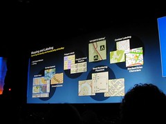
Labeling

9.3 brings enhanced label management, with a "pause labeling" feature, which skips labels in interim operations, and thereby allows faster redraws and navigation.

Polygon labeling offers new options as well - "label at fixed position within polygon", labeling of all polygons on a given layer at upper right, lower left, bottom center, and so on.

Contour labeling has been enhanced, to allow groups of contour labels to be linear, in holding with cartographic standards.

A "river labeling" style has been added, to better follow rivers.

P1010013

WYSIWYG Editing

ArcGIS 9.3 brings true What-You-See-Is-What-You-Get (WYSIWYG) editing of features and for cartographic representations. Currently, when a user drags an entity, it is shown in wireframe mode, but 9.3 dynamically shows what the actual feature will look like while being dragged.

Overlaps

9.3 has functionality that highlights overlaps, as well as a great new "disperse markers" feature, which allows overlapping markers to be automatically rearranged in a number of styles.

Cartographic Representations

For tips and tricks for enhanced cartographic standards and representations, and toward optimizing features and functionality in ArcGIS Desktop 9.3, ESRI has set up a "Mapping Center" website, located at http://mappingcenter.esri.com/.

Job Tracking Extension (JTX)

The new Job Tracking Extension offers interesting new functionalities for ArcGIS Desktop and Server 9.3. Essentially, it tracks and manages workflows.

(more to follow... trying to catch up with family first)

ESRI UC 2007 - Plenary Notes, Continued...

Posted by Dave Smith On 6/23/2007 09:57:00 PM 0 comments

ESRI International User Conference 2007


Plenary Session, 6/18/2007 - Continued


Here continues my posting of notes from the UC... I left off with enhancements through the 9.2 SP 3, SP4 and 9.3 releases...


Imagery


ArcGIS Server will bring improved support for imagery, to allow more sophisticated processing and hyperspectral imagery. Tools from ERDAS and Leica systems will be able to work with imagery hosted on ArcGIS Server.


Raw imagery will be able to be sent directly to a web service.


Web Mapping


Web mapping tools will improve, with Ajax Map Tips, and transparent tools (such as for navigation).


ArcGIS Mobile


ArcGIS Mobile is a new set of components as a lightweight alternative to ArcPad, which allows integration with GPS, connected and disconnected editing.


ArcGIS Explorer


ArcGIS Explorer and ArcGIS Online continue to evolve.


Open Standards and Interoperability


Toward expanded support for Open Standards and Interoperability, a REST API for ArcGIS Server is being developed. Additionally, stronger OGC support is being pursued, along with improved ability to support mashups in Google and Microsoft Virtual Earth.


CAD Interoperability


ESRI Continues to develop and enhance ArcGIS for AutoCAD, and is pursuing improvements to support the CAD->GIS Workflow. In polling, 50% of ESRI users indicated they also use CAD software.


I wonder if ESRI is pursuing complete, if simple, CAD capabilities, to obviate the need for CAD packages for more casual users.


Other Notes:


Continued support for mashups is being pursued. Additionally, Replication within ArcSDE is being developed and expanded, to support work within an organization, where multiple departments must be coordinated.


ArcGIS Explorer and ArcGIS Online


Bernie Szukalski gave an overview of ArcGIS Online. ArcGIS Online makes a number of ready-to-use resources available to ArcGIS Explorer. These come in the form of prepublished map services and documents, which can be saved as .lyr files, and then consumed within ArcGIS Explorer. These include resources such as 1m US imagery, 2.5m SPOT imagery, and a number of other other data assets.


The ArcGIS Online site provides links to a number of online resources. Additionally, user data assets can be brought in. In an ArcGIS Explorer demo, USGS topos were brought in and draped over topography. Additionally, the Swipe tool allows users to swipe-drag layer visibility status to examine changes.


Another demo showed an ArcGIS Explorer task to perform ALOHA modelling of a toxic plume in ArcGIS Explorer. Here, a user could create a custom task to allow the user to specify a point and supply parameters, and then fetch and overlay the resultant plume.


Another ArcGIS Online feature discussed was online data delivery, using DataDoors technology, or via FTP or DVD.


Another new technology being promoted is the availability of ArcGIS Data Appliances. Here, ArcGIS data could be deployed in the field to remote locations, or deployed to secure environments residing behind an enterprise firewall. It was noted that currently ESRI is the leading provider of demographic data.


Other new technologies:


  • ArcWeb Services - continues to be developed and expanded

  • Geospatial Portal Toolkit - a new release is coming on the horizon

  • JTX - for Workflow management


ArcLogistics


ArcLogistics was demonstrated by Carl Terry, which allows users to perform more sophisticated, rules-based routing and logistics than conventional routing tools such as ArcIMS Route Server and others offer. For example, ridership rules, appointment times, vehicle capacities and other parameters can be entered to build optimized routes. Terry stated 15-30% savings could be almost instantly realized for enterprises through the use of this type of logistics optimization.


Tech Support, Training and Education


Nick Frunzi gave an overview of efforts ongoing in customer support, training and other areas - he cited demand as resulting in a gap in support that was seen with the release of 9.2. Toward mitigating and improving customer support, his team is adding 30% more staff, and embedding support staff with developer teams to provide more robust domain expertise. As other new embedded support capability, diagnostic reporting and crash analysis is to be released in 9.3 products.


One piece of particularly exciting self-service support news is that in the next month, the internal ESRI knowledge base would be made available, in an online support center.


So overall, how is ESRI Doing?


15% growth this year...


(To be continued...)

FGDC Metadata Rant Du Jour

Posted by Dave Smith On 4/23/2007 10:06:00 AM 1 comments

I have been doing some work developing metadata records and automated processes for generating and updating metadata as part of data refresh and ETL processes lately. In the course of doing this, we are trying to develop means of providing very rich and well-documented, FGDC and Agency-profile metadata.

However, when it comes to attributes... Seems FGDC and ESRI both have put some disincentives in the way of capturing attribute data and documenting them painlessly.

http://www.fgdc.gov/metadata/csdgm/05.html

One could take the easy way out, and just put in an overview description and citation, and completely ignore any detailed description of the individual attributes.

Or, one could use ArcCatalog and extract a quick listing of attributes as <attr> elements - but.... ArcCatalog only captures and stores the <attrlabl> elements within this. In the infinite wisdom of the folks at FGDC and the folks that developed MetaParser, they then further require attribute domain <attrdomv> (and in my experience, 99.99% of most attribute data is either never validated against a domain, or validated outside of the GIS system, in the database, data capture or ETL process) and attribute value accuracy description <attrvai><attrvae> which I agree is valuable where applicable, but in many instances is not applicable, such as feature name, FID or other types of fields.

It tends to make providing detailed attribute information a disincentive, and steers folks toward taking the cop-out approach of just providing the overview description. Seems like an opportunity lost.

MetaCarta Public Sector Users Group

Posted by Dave Smith On 4/22/2007 08:28:00 AM 0 comments

MetaCarta will be having their third annual Public Sector Users Group meeting again in Tysons Corner on May 23rd.

Time and circumstances permitting, I am definitely going to try to attend again this year - Last year at their Users Group, we presented MetaCarta technology integrated with EPA mapping capabilities in EnviroMapper, specifically Window to My Environment.

It's always great to see how folks are geo-enabling and spatially mining their assets using technologies like MetaCarta. Last year, they also demonstrated quite a few other interesting emergent things from their labs - some of their innovations, such as OpenLayers and TileCache have been catching on like wildfire.

For details and registration info: http://www.metacarta.com/PublicSectorUG2007/ - and tell John Henry that I said hello...

Agency Metadata Editor

Posted by Dave Smith On 4/19/2007 09:14:00 PM 1 comments

Over the last few days I have been working with a great newly released metadata editor tool developed by our good friends over at Innovate!

It's based on the Coeur d'Alene Tribe "3-Tab" editor, and provides a customized environment which is database-driven and customizable for an Agency's needs, as well as highlighting some elements which are not mandatory for FGDC CSDGM compliance, but which are mandatory for Agency profile compliance above and beyond FGDC requirements.

The tool integrates seamlessly with ArcCatalog and also provides a validation tool, to ensure compliance with the Agency profile.

Tab 1: Basic Dataset Information

Tab 2: Quality, Coordinate System and Attribute Information

Tab 3: Distribution & Metadata Information


In just a matter of minutes, it's fairly easy to generate a complete, compliant metadata record, which passes validation in metaparser (mp).

Portuguese Discovery of Australia?

Posted by Dave Smith On 4/02/2007 09:49:00 AM 2 comments

The Map Room blog has an interesting article discussing a reinterpretation of an old portolan chart found in a Los Angeles library vault, by author Peter Trickett. In his book Beyond Capricorn, Trickett argues the case for Portuguese discovery of Australia, long prior to the British or Dutch. According to Trickett, Portuguese explorer Christopher de Mendonca led a small fleet into Botany Bay in 1522, more than 200 years ahead of Captain Cook, and ahead of Dutch explorers as well.

Is it another Gavin Menzies adventure? The argument is rather compelling in some ways - obviously the chart describes a massive landmass, which does align well with parts of the Australian coast.

According to this MSNBC article, the map describes features one might expect in that region of Australia, however the coastline had some inconsistencies. It's argued that these inconsistencies may be either intentional and/or miscopied, including a 90° rotation along the coastline.

The Google Earth Hacks blog has a download, which overlays the map graphic (respliced with the 90° fix) atop the Australian landmass, so you can see this for yourself:


Ubuntu and Linux-based GIS in Virtual PC

Posted by Dave Smith On 3/30/2007 04:19:00 PM 3 comments

I posted about HostGIS for Linux server-based GIS the other day... Nice canned distribution, but if you want flexibility or desktop apps, you may want to try some other goodies. I am still working my way up to the whole tilecache/OpenLayers thing... I have my own AJAX WMS client that I wrote, but want to look at doing some interesting things with tile servers and some open-source backend stacks.

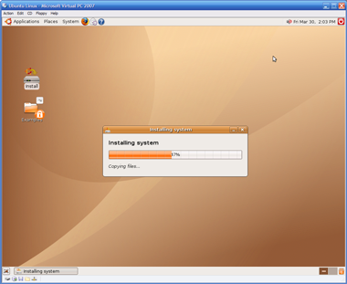
At any rate, tempting fate again, I decided to give Ubuntu a try, as folks were raving about Ubuntu 'dapper' (6.06).

I downloaded Ubuntu 6.10 ('edgy') and fired the ISO up in Virtual PC 2007, but found that I only got to a scrambled screen when trying to do anything with it.

Not to fear... The fix:

  • At the boot screen, press F4 and select something reasonable that ISN'T in 24-bit color. I chose 800x600x16. I selected "Safe Graphics Mode" as well.
  • Let Ubuntu boot up from the ISO. You still will end up with a thoroughly scrambled X screen...
  • But don't panic, and don't try clicking on anything or letting the VPC session capture the mouse, you will be easily able to get a console session by pressing CTRL-ALT-F1. You should now see a console session with a prompt: ubuntu@ubuntu~$
  • Enter sudo nano /etc/X11/xorg.conf - this will open the X configuration in a text editor.
  • Scroll or page down untill you get to the "screen" section. You will see the default depth is set to 24 - change DefaultDepth to 16
  • Enter Ctrl-O to save, answer y to save the changes, and then enter Ctrl-X to exit the text editor. This should put you back at the shell prompt.
  • Enter sudo telinit 1 and wait for it to process and return to a shell prompt: root@ubuntu.
  • Enter telinit 5 and the X session will return, and voila, beatiful and without being scrambled. You should be able to click on Install and go on your merry way from here on out.
  • So now what? Where do I get those great Linux GIS goodies? Right from the get-go you should be able to go to Applications->Add/Remove and add in Quantum GIS (qgis).

  • For more apps, you can use the Synaptics Package Manager. Go into System->Administration->Synaptics Package Manager and add some of the repositories back in and hit "Reload" and then try searching. So far, I have been playing with desktop tools - GRASS, Thuban and QGIS. All quite painless to load using the package manager.

I am certainly no Linux guru, but was nonetheless able to get this environment up and running in Virtual PC in about an hour and a half. If you're mainly a Windows guy like me, you now no longer have much of an excuse to not try these out.

Rwanda

Posted by Dave Smith On 3/24/2007 12:29:00 AM 2 comments

Limited resources have caused some administrative delays in approaching the Engineers Without Borders projects - chances are now that we will not be able to pursue much until mid-June.

In the interim, I have been looking at some projects in Rwanda as well. Similar needs, water and wastewater, here set in Rwanda, near Lake Kivu and Gisenyi on the Congolese Border.

There are a number of Rwandan projects that EWB is currently looking at: EWB Rwanda Projects

Here, I have taken a similar approach, with SRTMs for elevations, to derive contours, hillshading, watersheds and other topography - I also imported NGA gazetteer data, and items from a few other disparate sources, such as WHO and others which were helpful for examining Cameroon. Am still waiting for access to a few remaining datasets and sources. Rwanda appears to have a ministry of the environment, which may have GIS data as well.

ESRI Developer Summit?

Posted by Dave Smith On 3/22/2007 08:56:00 PM 0 comments

No, I was not able to attend... Getting the occasional bits and pieces of information from the DevSummit.

For those folks who are attending, say hi to Xiuzhu Yang, a good friend of mine and very talented developer that I have been working with for the last year on EPA projects.

Another very talented guy that I cross paths with, also at the DevSummit this year is Vincent Zhuang from SAIC, author of Programming ASP.NET for ArcGIS Server.

HostGIS Linux

Posted by Dave Smith On 3/20/2007 02:13:00 PM 1 comments

I just discovered a great Linux distribution called HostGIS - it comes ready to run MapServer and a whole suite of other goodies, right out of the box.

I went to the HostGIS site, and within about 20 minutes, had downloaded it, loaded it up on MS VirtualPC, and had it up and running:


It comes complete with OpenLayers and TileCache from our friends at MetaCarta, MySQL, PostgreSQL, and a few other add-ons and goodies that I am not as familiar with, such as Map-Fu.

While I am usually spoiled with plenty of ESRI tools, this certainly provides a refreshing alternative for projects without an ESRI budget...

Search