Surveying, Mapping and GIS

Exploring all aspects of mapping and geography, from field data collection, to mapping and analysis, to integration, applications development and enterprise architecture...

  • Geospatial Technology, End to End...

    Exploring all aspects of mapping and geography, from field data collection, to mapping and analysis, to integration, applications development, enterprise architecture and policy

Research Triangle Institute

Posted by Dave Smith On 4/29/2007 08:18:00 PM 0 comments

Toward the end of this week I had the pleasure of spending two days with the folks at Research Triangle Institute. RTI is a 501(c) operated by Duke University, UNC Chapel Hill, North Carolina State University, and North Carolina Central University and was formed in 1958 as one of the charter members of North Carolina's Research Triangle.

I had been bumping into a number of their people over the last couple of years, and it always seemed that we had many mutual interests. At any rate, we may well be forming some more solid alliances with RTI moving forward, to pursue geospatial applications development and environmental science. I was impressed with their capabilities, their ethic and many other aspects of how they operate.

They have many interesting things going on, such as a bioinformatics division, which is doing such things as modeling avian influenza on synthetic populations using a Linux supercomputing cluster, as well as much work for USEPA Office of Research and Development. Excellent breadth and depth in environmental and life sciences.

I could do a lot with an organization like this behind me - May this be a long and happy relationship...

Robillard at Penn State

Posted by Dave Smith On 4/24/2007 10:12:00 AM 0 comments

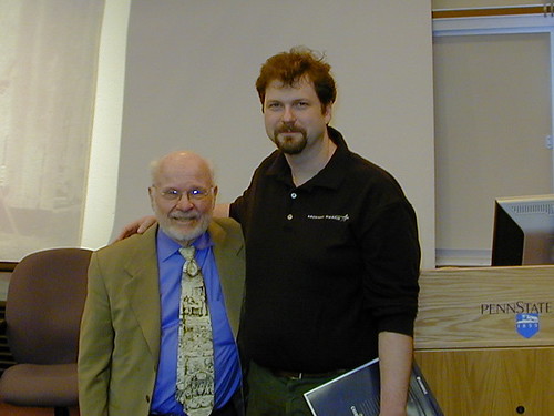
I had a most enjoyable evening last night - several of us met up at TGI Fridays last night, Walter Robillard, Chuck Ghilani and his wife, several folks from PSLS Pocono Chapter - Harry and Bill Schoenagel and Steve Lesher.
DGS_Robillard
After some great conversation over dinner, we went down to Penn State Wilkes-Barre and Mr. Robillard gave a spirited presentation covering quite a few interesting cases, involving evidence, case law, PLSS versus metes-and-bounds, and touched on many issues that drive the need for surveyors, attorneys and other professionals dealing with boundaries need to be aware of and deal with. It really drove home the message of doing due dilligence and for forging partnerships with our fellow professionals in the legal profession. With a good 30 to 40 people in attendance, including the Penn State student surveying constituent, it was a great turnout.

FGDC Metadata Rant Du Jour

Posted by Dave Smith On 4/23/2007 10:06:00 AM 1 comments

I have been doing some work developing metadata records and automated processes for generating and updating metadata as part of data refresh and ETL processes lately. In the course of doing this, we are trying to develop means of providing very rich and well-documented, FGDC and Agency-profile metadata.

However, when it comes to attributes... Seems FGDC and ESRI both have put some disincentives in the way of capturing attribute data and documenting them painlessly.

http://www.fgdc.gov/metadata/csdgm/05.html

One could take the easy way out, and just put in an overview description and citation, and completely ignore any detailed description of the individual attributes.

Or, one could use ArcCatalog and extract a quick listing of attributes as <attr> elements - but.... ArcCatalog only captures and stores the <attrlabl> elements within this. In the infinite wisdom of the folks at FGDC and the folks that developed MetaParser, they then further require attribute domain <attrdomv> (and in my experience, 99.99% of most attribute data is either never validated against a domain, or validated outside of the GIS system, in the database, data capture or ETL process) and attribute value accuracy description <attrvai><attrvae> which I agree is valuable where applicable, but in many instances is not applicable, such as feature name, FID or other types of fields.

It tends to make providing detailed attribute information a disincentive, and steers folks toward taking the cop-out approach of just providing the overview description. Seems like an opportunity lost.

USEPA GIS Workgroup

Posted by Dave Smith On 4/22/2007 04:47:00 PM 0 comments

I am looking forward to attending the EPA GIS Workgroup meeting coming up in Boston. This time around, the spring meeting will be in Boston, at the Omni Parker House Hotel, May 15th to 18th.

It will be good to refresh some contacts and make some new ones. We are hoping to make some further inroads in the EPA GIS community, combining our present USEPA geospatial expertise and SDVOSB status to reach out and support USEPA regions and other USEPA program offices. For me, it's also another opportunity to go and visit with my relatives in Massachusetts.

MetaCarta Public Sector Users Group

Posted by Dave Smith On 4/22/2007 08:28:00 AM 0 comments

MetaCarta will be having their third annual Public Sector Users Group meeting again in Tysons Corner on May 23rd.

Time and circumstances permitting, I am definitely going to try to attend again this year - Last year at their Users Group, we presented MetaCarta technology integrated with EPA mapping capabilities in EnviroMapper, specifically Window to My Environment.

It's always great to see how folks are geo-enabling and spatially mining their assets using technologies like MetaCarta. Last year, they also demonstrated quite a few other interesting emergent things from their labs - some of their innovations, such as OpenLayers and TileCache have been catching on like wildfire.

For details and registration info: http://www.metacarta.com/PublicSectorUG2007/ - and tell John Henry that I said hello...

Earth Day 2007

Posted by Dave Smith On 4/21/2007 06:00:00 PM 0 comments

Tomorrow, Sunday 22nd, 2007 marks the annual celebration of Earth Day.

I regard this as an excellent opportunity to give homage and thanks to our planet for all that it has provided us, particularly this rich life that we enjoy.

Regardless of any controversy over Climate Change, certain truths are self-evident. We should, we must be good stewards of our planet. We must accept responsibility for our impact on this planet. We must live our lives in a sustainable fashion. No political argument, no economic argument will ever remove the moral and ethical responsibility to minimize and mitigate our adverse impacts on our environment.

Toward these aims, we must promote good science and technology - we must continue to pursue cleaner, more efficient technologies. We must continue to pursue clean, sustainable energy sources. We must continue to find ways to conserve resources. We must find a proper balance in our existence, to reduce suburban sprawl development, reduce the number of vehicle miles traveled, to preserve forests and farmland, to restore watersheds, and improve air quality.

Will we leave this planet as we found it, in worse, or better condition?

We owe it to this planet, which gave us life and which has sustained us, to in return preserve her life and sustain her.

Agency Metadata Editor

Posted by Dave Smith On 4/19/2007 09:14:00 PM 1 comments

Over the last few days I have been working with a great newly released metadata editor tool developed by our good friends over at Innovate!

It's based on the Coeur d'Alene Tribe "3-Tab" editor, and provides a customized environment which is database-driven and customizable for an Agency's needs, as well as highlighting some elements which are not mandatory for FGDC CSDGM compliance, but which are mandatory for Agency profile compliance above and beyond FGDC requirements.

The tool integrates seamlessly with ArcCatalog and also provides a validation tool, to ensure compliance with the Agency profile.

Tab 1: Basic Dataset Information

Tab 2: Quality, Coordinate System and Attribute Information

Tab 3: Distribution & Metadata Information


In just a matter of minutes, it's fairly easy to generate a complete, compliant metadata record, which passes validation in metaparser (mp).

Lockheed Martin Completes GPS Block III Design Review

Posted by Dave Smith On 4/14/2007 08:05:00 PM 0 comments

Lockheed Martin has posted some news on one of their GPS Block III milestones:

http://www.lockheedmartin.com/wms/findPage.do?dsp=fec&ci=18298&rsbci=0&fti=111&ti=0&sc=400
LOCKHEED MARTIN TEAM COMPLETES GPS III SYSTEM DESIGN REVIEW ON SCHEDULE

KING OF PRUSSIA, Pa., April 5, 2007 -- Lockheed Martin [NYSE: LMT] announced today that it has successfully completed on-schedule a system design review of the U.S. Air Force's next generation Global Positioning System Space Segment program, known as GPS Block III.

More than 100 representatives from the Defense Department, including members of the U.S. Air Force Space and Missile Systems Center, Space Command and Strategic Command, as well as the Department of Transportation and Federal Aviation Administration, recently attended a five-day system design review (SDR) at Lockheed Martin in Valley Forge, Pa.

The review, which represented a significant interim milestone under a $49 million contract awarded in Nov. 2006, validated the detailed design of the GPS Block III system to ensure it meets military and civil user requirements. The Air Force is expected to award a multi-billion dollar development contract to a single contractor team in late 2007.

"The team executed on schedule an outstanding design review, demonstrating our technological, systems engineering and integration strengths for achieving mission success on this critical initiative," said Joanne Maguire, executive vice president of Lockheed Martin Space Systems. "We are extremely pleased with the government participation and the successful outcome of this important review and stand ready to proceed with the next development phase of the GPS III program."

GPS Block III will enhance space-based navigation and performance and set a new world standard for positioning and timing services. The program will address the challenging military transformational and civil needs across the globe, including advanced anti-jam capabilities and improved system security, accuracy and reliability.

During the review, the team reviewed in detail its planned architecture and design approach for the system and summarized results of risk reduction efforts and the team's experience on the government's Block IIR and IIR-M programs. A highlight of the review was an extensive exhibit hall that featured demonstrations of key technologies and displays summarizing performance, mission scenarios, and user benefits.

For GPS III, the team of Lockheed Martin, ITT and General Dynamics is building on its proven record of providing progressively advanced spacecraft for the GPS constellation. The team designed and built 21 Block IIR satellites for the Global Positioning Systems Wing, Space and Missile Systems Center, Los Angeles Air Force Base, Calif. Eight of the spacecraft, designated Block IIR-M, were successfully modernized and delivered to the customer to enhance operations and navigation signal performance for military and civilian GPS users around the globe.

Headquartered in Bethesda, Md., Lockheed Martin employs about 140,000 people worldwide and is principally engaged in the research, design, development, manufacture, integration and sustainment of advanced technology systems, products and services. The corporation reported 2006 sales of $39.6 billion.

Robillard at Penn State

Posted by Dave Smith On 4/12/2007 06:15:00 PM 1 comments

I recently got word via Chuck Ghilani that surveyor, attorney, forester and author Walter G. Robillard will be speaking on Monday, April 23rd at 6 PM in T101 of the Penn State Wilkes-Barre Campus.

Mr. Robillard is a well-known authority on boundaries and legal issues in surveying. I am hoping to attend, and am currently digging through some of his many books as a refresher. I have
to which Mr. Robillard has contributed, particularly on legal aspects.
This event is free, but donations to benefit the Penn State Surveying Honor Society and to defray the cost of bringing Mr. Robillard are greatly appreciated.

Google Earth layers for Darfur

Posted by Dave Smith On 4/11/2007 04:40:00 PM 0 comments

To follow up, the full details of the Google Earth Darfur layers are available at the Holocaust Museum: http://www.ushmm.org/googleearth/

Google Earth exposes violence in Darfur

Posted by Dave Smith On 4/11/2007 03:37:00 PM 0 comments

It warms my heart to see that a headline story today is in how Google Earth has been working to expose the violence and bloodshed in Darfur.

This part of Sudan has been suffering horrendously in the midst of conflict, with denial from the Sudanese government - and thanks to the efforts of the folks at Google, the violence has been put front and center, with imagery depicting destroyed villages and lives, people displaced, and worse.

From one of the news articles,


Using high-resolution imagery, users can zoom into Darfur to view more than 1,600 damaged or destroyed villages, providing what the Holocaust Museum says is evidence of the genocide. Sudan's government denies that genocide is taking place.

In addition, the remnants of more than 100,000 homes, schools, mosques and other structures destroyed by janjaweed militia in Darfur, Sudanese forces and others are visible.

"
When it comes to responding to genocide, the world's record is terrible. We hope this important initiative with Google will make it that much harder for the world to ignore those who need us the most," said Holocaust Museum director Sara Bloomfield in a statement.

Ogle Earth carries some of the details: http://www.ogleearth.com/2007/04/darfur_webcast.html

As we saw with Rwanda, we cannot afford to sit by idly and do nothing.

From Reuters: http://www.reuters.com/article/internetNews/idUSN1043905220070410

From Associated Press: http://www.siliconvalley.com/latestheadlines/ci_5635344

PC Magazine: http://blogs.pcworld.com/staffblog/archives/004070.html

TechNewsWorld: http://www.technewsworld.com/story/56827.html


As an aside, as Google Earth has also been in the hot seat in the news of late, I recently was contacted by Kenneth Wong of Cadalyst Magazine "GIS Tech News" regarding the recent Google Earth controversy on Katrina.


I will certainly be one to defend Google Earth. As a federal contractor doing GIS work for Katrina response, we were long aware of their dedicated Katrina site, and to them I give kudos for providing infrastructure and imagery for the relief effort. Congressional inquiry? Not appropriate, and I certainly hope Google is spared this. However while I said "much to do about nothing" I also soundly will echo Adena Schutzberg's comment that it all the more points up the need for metadata for live data services and online mapping.

Head Rush Ajax

Posted by Dave Smith On 4/09/2007 08:35:00 PM 3 comments

As I mentioned a few days ago, I was just finishing reading one of the books in the "Head First" series that Kathy Sierra developed, namely Head Rush Ajax by Brett McLaughlin.

This is a fun read. It really makes Ajax very easy and accessible, with a fun dialogue, irreverent and entertaining style, and plenty of practical examples and online code to work with. I have been playing with Ajax code since around November of 2005, but largely just hacked my way through most of it, brute-force-style, without any coherent source of information, other than the school of hard knocks.

As such, I figured there might be a few areas where I might grumble through the but given there were a lot of things that I already knew, but on the other hand I still learned quite a few nuances and new things while reading this book.

The book presents Ajax in a good, progressive way, with bite-sized yet savory nuggets, which all contribute to a soundly filled tummy full of Ajax. Unlike many of the technical tomes I digest routinely, this one didn't put me to sleep. It was deceptively simple in how the book followed a linear progression, with each piece building upon the one before it - it's not at all written "reference-style" with disconnected globs of information as so many other technical tomes tend to be.

True, some parts of the book were still perhaps overly "nØØb"-oriented (for me at least) and overly rich with "greasy kid stuff" but that's not necessarily a bad thing. The way that the book tackled otherwise sticky topics, such as navigating and managing the DOM was nice, as were the ways in which a request is sent, processed and received. All in all, the presentation was quite robust, with no meaningful detail omitted.

The only downsides: 1. The emphasis on JSON toward the end. I have expressed my bias and concern regarding JSON before, mainly as I still cling to the paradigm of not only server-to-client communication via XML, but also server-to-server communication. 2. It had a PHP focus - I don't deal much with PHP, mainly .NET and Java.

As an aside, two things I'd like to see some objective study someday on:

  • How truly bloated is XML, compared to JSON? Seems JSON can suffer from its share of bloat as well.
  • How much is JSON supported on the server side. Not just libraries for generating JSON, but also libraries for parsing and processing JSON? What languages? Seems to me that generating JSON might be the easy part, even doable through XSLT transforms - but parsing?
But I digress... I'd definitely recommend the book for anyone just beginning to dip their toe into Ajax - all you really need is the most basic understanding of JavaScript and perhaps some CSS and HTML. Head First Labs supplies the pizza ;^) Well done, Mr. McLaughlin.
Paperback: 446 pages
Publisher: O'Reilly Media, Inc.
(March 28, 2006)
Language: English
ISBN-10: 0596102259
ISBN-13:
978-0596102258
Product Dimensions: 9.2 x 8 x 1.1 inches

Happy Easter

Posted by Dave Smith On 4/08/2007 09:56:00 PM 1 comments


No matter your faith, it is a universal and ancient truth that, with the Vernal Equinox comes a celebration of rebirth, renewal and new growth.

With my son, I recently planted seeds for tomatoes, peppers, and a variety of herbs and vegetables which are beginning to sprout. So too are the seeds of many new ideas and business relationships beginning to sprout. I am looking forward to the coming summer, for growth and a bountiful harvest.

I wish a very happy Easter to all.

Kathy Sierra and Codes of Conduct

Posted by Dave Smith On 4/02/2007 07:33:00 PM 0 comments

I have been monitoring a number of posts of varying perspectives in my usual RSS feeds regarding the Kathy Sierra controversy, and while there is still much "he-said/she-said" swirling about, it is abundantly clear that there was unacceptable and intolerable behavior on the part of some, who made vile, threatening and misogynistic posts - referred to as cyberbullying.

In response, Tim O'Reilly has made a call for a "Bloggers Code of Conduct", and other Codes of Conduct have been pointed to as well. Certainly there are some good words of advice in these - I will only touch on the high-level points, as Tim O'Reilly has more detailed discussion on each of these on his site:

  1. Take responsibility not just for your own words, but for the comments you allow on your blog.
  2. Label your tolerance level for abusive comments.
  3. Consider eliminating anonymous comments.
  4. Ignore the trolls.
  5. Take the conversation offline, and talk directly, or find an intermediary who can do so.
  6. If you know someone who is behaving badly, tell them so.
  7. Don't say anything online that you wouldn't say in person.
However, the deeper thought not expressed in O'Reilly's call is that this whole controversy unfolded in the technology blogosphere... Presumably populated by developers, enterprise architects, analysts, IT pros and other technology professionals. Perhaps I presume too much.

Professionals.

Even beyond behaving as humans, which means treating each other with basic dignity and respect - treating others the same as we ourselves would expect to be treated by others, the community also should behave like adults and professionals, as this type of vicious, misogynistic behavior gives the entire technology sector a black eye.

While I too may occasionally not agree with everything Kathy Sierra, Scoble, O'Reilly or others have to say, I for one nonetheless value them deeply as professionals, for their input and contribution to the professional community, for their experience and insight, and so on, and as such, would treat them with the respect they deserve. I am finishing reading one of the Head Rush books even as we speak. I am one who will defend freedom of speech to the last, even for those with whom I would disagree, and as such have little tolerance for anyone who would use threats of violence toward silencing others.

In our work, in our capabilities, in our words, we are to be humans, adults, and professionals first and foremost. In any professional environment, gender is irrelevant, and violence and cyberbullying is completely unacceptable. It is a sad commentary that the community even needs Codes of Conduct.

Portuguese Discovery of Australia?

Posted by Dave Smith On 4/02/2007 09:49:00 AM 2 comments

The Map Room blog has an interesting article discussing a reinterpretation of an old portolan chart found in a Los Angeles library vault, by author Peter Trickett. In his book Beyond Capricorn, Trickett argues the case for Portuguese discovery of Australia, long prior to the British or Dutch. According to Trickett, Portuguese explorer Christopher de Mendonca led a small fleet into Botany Bay in 1522, more than 200 years ahead of Captain Cook, and ahead of Dutch explorers as well.

Is it another Gavin Menzies adventure? The argument is rather compelling in some ways - obviously the chart describes a massive landmass, which does align well with parts of the Australian coast.

According to this MSNBC article, the map describes features one might expect in that region of Australia, however the coastline had some inconsistencies. It's argued that these inconsistencies may be either intentional and/or miscopied, including a 90° rotation along the coastline.

The Google Earth Hacks blog has a download, which overlays the map graphic (respliced with the 90° fix) atop the Australian landmass, so you can see this for yourself:


Search