After combating on proposals for a few recent projects, I am getting a bit frustrated with the preponderance of IT generalist firms chasing after the same work we do. Seems there is still a notion out there that information technology is the solution to everything. Problem is, the reality is that IT in and of itself is not and will be a driver to compare with the actual business. And if the actual business requires understanding of geospatial analysis, or of geodesy and high-accuracy locational data, or of environmental science, or of transportation and congestion, then these are still the primary drivers.
Sure, you can hire some button pushers cheap... but will they really serve the need? Maybe, but most likely not. Will they display any thought leadership or vision? Definitely not. Is any of it meaningful to the IT generalists? No. Just butts in seats, generating revenue, quantity versus quality. Whatever happened to qualifications, domain expertise and past performance?
IT Generalists
News from the MAPPS Lawsuit?

Technorati tags:aerial photography, architecture, business, cadastral, cadastre, cartography, contracting, contracts, engineering, federal, geo, geodesy, geodetic, Geospatial, GIS, law, lawsuits, legal issues, licencing, licensure, map, mapping, maps, news, opinion, photogrammetry, policy, procurement, professional, professional practice, remote sensing, spatial, surveying
MAPPS Lawsuit this Friday

For me, fortunately this is no problem, as not only am I a GIS practitioner in the Federal arena, I am also a Licensed Professional Land Surveyor and Licensed Professional Engineer. I can also say I know of quite a few firms doing GIS work, which have similarly licensed professionals on staff. However, I also know of quite a few firms which do not have licensed professionals on staff. In some instances, they have managed to skirt state laws and the Brooks Act by virtue of the work being generally unrelated to land surveying, however in instances such as topographic mapping, the lines become more blurred, and in the instance of cadastral mapping, quite often are crossed outright.
 As such, AAG and others have teamed up to file an Amicus Brief and are acting to stop this lawsuit.
I can certainly understand the concern of the GIS practitioners and the organizations listed. However, many of the organizations represented only have a very limited number of members who actually do federal contracting. And of these members, many do have licensed staff in-house. Those that don't, certainly could consider retaining licensed professionals as well, if so much is actually at stake. But I certainly don't agree with the "end of the world" characterizations that have been raised.
What I do, however, find disturbing is the marginalization of professional licensure during the course of this. Essentially, statements have been made, that licensure doesn't really protect the public, or that licensure doesn't ensure perfection. No, it doesn't, and nobody ever claimed it did - in fact, licensure is the mark of minimal competency to take responsible charge of a project. In essence, the starting point upon which a true professional is built.
It isn't perfect, and that is why we have investigations, enforcement, E&O insurance, and other safeguards and remedies in the professions - as opposed to the complete lack of similar infrastructure which exists in the unlicensed community.
Oddly, these same statements marginalizing licensure and professional status would also tend to undermine GISCI and other efforts toward promoting professionalism in the unlicensed GIS community.
Further, it has been stated that it would be impossible to devise an examination to ensure the competency of GIS professionals as they do in Engineering and Land Surveying. Thoroughly untrue.
This demonstrates fundamental misunderstandings of professional licensure. Professional licensure is similar to a three-legged stool - the key elements are not just an examination, but also educational requirements and experience requirements. No single one of these can ensure an adequate yardstick. The stool does not begin to have balance without all three.
And with regard to examinations, certainly not every aspect of engineering or land surveying is adequately covered by their respective examinations, either - the exams present a microcosm of the universe of each profession, intended to gauge basic breadth and depth of understanding. The same most certainly can be done for GIS or Computer Science. I say this from experience, as one who straddles all of these.
I do have mixed feelings on this entire lawsuit - I have concerns about Land Surveyors being thrust into new areas of practice beyond their familiarity, in which they are not competent to practice, and yet at the same time, see the need to curb some of what amounts to unlicensed practice in the GIS community, particularly with regard to cadastral and other issues.
Another issue is that state laws governing what does and doesn't constitute land surveying vary from state to state - and in many it is not just boundary surveying. Certainly states do not intend to give up their sovereignty to Federal Government, so there is some interplay to be realized here as well.
Fortunately, I can cast stones in either direction, and do not have to pick sides... My only hope is that some clarity will emerge from all of this.
Technorati tags:
aerial photography, architecture, business, cadastral, cadastre, cartography, contracting, contracts, engineering, federal, geo, geodesy, geodetic, Geospatial, GIS, law, lawsuits, legal issues, licencing, licensure, map, mapping, maps, news, opinion, photogrammetry, policy, procurement, professional, professional practice, remote sensing, spatial, surveying
Brooks Act Trial has been postponed
The MAPPS lawsuit, to clarify provisions of the Brooks act, as they pertain to geospatial, mapping and surveying activities has been postponed from this Friday to 2/9, per Adena Shutzberg at Directions Magazine - it will be interesting to see how this all pans out.
Technorati tags:
aerial photography, architecture, business, cadastral, cadastre, cartography, contracting, contracts, engineering, federal, geo, geodesy, geodetic, Geospatial, GIS, law, lawsuits, legal issues, licencing, licensure, map, mapping, maps, news, opinion, photogrammetry, policy, procurement, professional, professional practice, remote sensing, spatial, surveying
Geospatial versus Surveying

A battle is imminent, with several professional societies challenging the Federal Government on whether the Brooks Act should apply to geospatial contracting efforts.
A trial is scheduled for February 2nd, Private Photogrammetric Surveyors (MAPPS), American Society of Civil Engineers (ASCE), National Society of Professional Engineers (NSPE) and Council on Federal Procurement of Architectural and Engineering Services (COFPAES) v. United States of America - to provide definition and clarity and to look toward Qualifications-Based Selection (QBS) in mapping procurements.
Directions Magazine provides their perspective on the issue, and drew my attention. MAPPS provides a page discussing the background and legal history.
The outcome should prove interesting - many issues have been simmering with regard to state and federal definitions of surveying and mapping, particularly as technologies have continued to evolve. I have my own unique perspective, as a geospatial practitioner, as a licensed professional, and as a member of a state licensing board - and these perspectives are in some ways in great harmony, largely in support of Qualifications-based Selection, however also in some ways in dissonance with QBS, as mere fact of licensure may not qualify one to perform the work. As a regulatory body, the State Registration Boards' duty is to ensure protection of the public - and in many ways, lack of adherence to the Brooks Act has skirted this. However, many state laws are similarly overbroad, and/or antiquated.
Technorati tags:
aerial photography, architecture, business, cadastral, cadastre, cartography, contracting, contracts, engineering, federal, geo, geodesy, geodetic, Geospatial, GIS, law, lawsuits, legal issues, licencing, licensure, map, mapping, maps, news, opinion, photogrammetry, policy, procurement, professional, professional practice, remote sensing, spatial, surveying
ESRI FedUC Wednesday...
Just got back from the reception at the Organization of American States - many great conversations, and overall a very productive day for me.
 I sat in on a few of the Homeland Security and Emergency Response sessions - we are having an ever expanding role in that arena. Prominent was IRRIS, from our business partners and fellow Pennsylvania firm, GeoDecisions. We are currently looking at some possibilities for bringing data from mobile sensor platforms directly into IRRIS, as well as dynamic search and discovery possibilities for sensor data - will be interesting to see how it all unfolds.
Other Homeland Security / Emergency Response sessions touched on EMMA, as a good model for statewide emergency management with wide stakeholder support.

There was a good session on NIMS, as it moves forward. The pieces are rapidly falling into place for broader integration and use of incident data, the vision of local-state-federal finally becoming more of a reality. Within NIMS, they mentioned the NOAA plume modeling facility, which is continually run for known sites, utilizing current weather conditions. My wonder is in how well this is or can be tied into available facility data for all of the applicable EPA FRS sites. The NIMS document is currently being revisited for updating, presenting many new opportunities to harmonize incident management efforts across agencies.
It makes a great deal of sense to get ever more stakeholders put together, not just for simple data sharing, but also for lessons learned, sharing of SOPs, models, types of analyses performed, and so on. One report cited as an excellent resource is the 2007 National Academy of Sciences Report, Successful Response Starts with a Map: Improving Geospatial Support for Disaster Management, which cites a number of areas for improvement - for example that data standards do not yet meet emergency response needs, and that training and exercises for responders need geospatial intelligence built into them.
While we didn't have a booth at this event, I saw at least one fellow SDVOSB exhibitor, Penobscot Bay Media - they are doing work in LIDAR scanning mounted on a robotic platform. We talked VETS GWAC a bit... My friends at the EPA booth saw some very brisk business, although they didn't manage to draw Jack Dangermond in. We did catch up with Jack later (will post the picture another time, as it was not my digital camera...)
I got a few minutes to chat with Adena Schutzberg, of Directions Magazine, All Points Blog, and many other good things - she was my Teaching Assistant way back when, at Penn State for Spatial Analysis with Dr. Peter Gould. A few encouraging words from her on my blog and the many diverse things I manage to get my fingers into...
The final sessions I got to sit in on - I had a few meetings here and there, which punctuated the day, and unfortunately ended up missing the GeoLoB discussion, but caught the tail end of the Geospatial One Stop presentation by Rob Dollison of USGS. He discussed a number of things coming down the pike in the next few months, as build 2.1 gets pushed to production in the next month or so, 2.2 in March-June timeframe, followed by 2.3 - many interesting enhancements, such as search relevance, search booleans, viewing results as a bounding box, a fast base map, 3D viewing, and so on. Exciting stuff. On our end, we are looking for ways to tie our GPT instance at EPA, the GeoData Gateway, into GOS, through the EPA firewall, and using integrated security. We are lucky there to have Marten Hogeweg and the same ESRI team working with us that developed GOS.
One thing that had me wondering on the implementation was "authoritative data sources". Here, the intent would be to present "authoritative data sources" in the search results near the top. Will this be another field in the metadata record? Is it determined by virtue of its' publisher?
At any rate, it was an enjoyable day, saw many friends, had a lot of exciting and productive discussion, and I am looking forward to more of the same tomorrow. But now, I'm ready for bed...
Geo Web Services and Reliability
 In a recent blog post, Matthew Perry (PerryGeo) lashed out, reaffirming his reluctance to rely on spatial web services such as WMS. Given that the NASA JPL WMS server was evidently down, many users and applications which consume the JPL WMS services also had issues and outages.
Yes, certainly any distributed system can face issues with downtime, or worse yet, with services going away altogether. How to remedy this?
As a service provider, one of the things that providers can work toward is providing the users with some information with which the users can make informed decisions. Essentially, manage their expectations. In some arenas, particularly where commercial services are offered, this should be in the form of a formalized Service Level Agreement (SLA), as part of the contract.
Here, the provider can outline the parameters of the content itself (such as FGDC-compliant metadata, including accuracy, source, et cetera), and beyond each iterative data snapshot, provide information on data latency (how current is the data?) and how often will it be refreshed? From an infrastructure standpoint, some hosting parameters should also be set forth, such as availability and reliability - to set the ground rules on what kind of downtime is acceptable or unacceptable, what kind of data throughput can be expected, and so on.
This becomes a bit more of a challenge in other arenas, such as agencies where external budgetary, legislative and other pressures may impact how well an organization can support published services.
But nonetheless, if an agency is forthcoming and up-front with these constraints at the outset, it can allow its' users and stakeholders to plan and prepare accordingly - by writing their code to handle outages appropriately, by utilizing alternative services, and so on. It also can lead toward consolidation, augmentation, replication of valued services as external users and stakeholders lobby for support (via legislative initiative and budget) for these services. An agency might not be able to provide formalized parameters as a commercial service would be expected to, however providing users with some basic insight will go a long way.
As organizations gradually move more and more toward Service Oriented Architecture, and as variegated Web Services appear right and left, and increasingly become available lights-out, via a simple URL, it becomes increasingly easy to connect to and consume these services - however that ease of access and use is ultimately bound to cause some disappointment, when things change down the road. I suggest and recommend SLAs and service metadata toward managing expectations.
Technorati tags:
.net, arcgis, arcgis desktop, asp.net, carbon project, developer, dotnet, esri, esri developer network, extensions, gaia, geo, geography, geospatial, gis, gml, interoperability, licencing, map, mapping, maps, microsoft, msdn, ogc, oracle, programming, web services, wfs, xml, XSLT
VETS GWAC

I am quite happy to report that our firm was on a winning team for the GSA VETS GWAC, which was established as a contract vehicle for federal agencies whereby Service Disabled Veteran Owned Small Businesses can compete on federal contracts.
Per GSA:
This is a great win for us, and hopefully it will open a few more doors toward pursuing additional opportunities in the federal geospatial world.
The Veterans Technology Services (VETS) Governmentwide Acquisition Contract (GWAC) is a proposed competitive multiple award, indefinite-delivery indefinite-quantity contract designed to provide worldwide information technology solutions to federal agencies while strengthening opportunities in federal contracting for service-disabled veteran-owned small businesses.
Technorati tags:
applications, business, contracting, contracts, design, developer, e-government, ea, emergency response, engineering, enterprise architecture, federal, geo, Geospatial, GIS, GSA, GWAC, homeland security, internet, interoperability, mapping, metadata, modeling, news, procurement, service-oriented architecture, spatial, veterans, vets
US Navy Seaport-E

 I'm pleased to report that my company was just accepted as a prime contractor on the US Navy Seaport Enhanced contract. We had previously been a subcontractor to several other primes on Seaport, but now we can go full throttle in exploring the Seaport vehicle for opportunities in our core competencies of Environmental, Transportation, and Geospatial technology and information systems engineering.
Geospatial Line of Business Debrief
A few people have been asking me for a debrief on the Geospatial Line of Business meeting yesterday at the JW Marriott in DC. Mixed feelings on the event. With regard to Agency people, there were a few of the regular movers and shakers, and a considerable number of Agency geospatial figures completely absent - and of the ones I spoke to, I got a mixed response. Some were unconcerned and coolly interested, some very nervous, others very skeptical. There was an odd industry turnout - several of the key players that I often work with in the rarified air were there, but others conspicuously absent. Their response was similarly mixed. Sure, lots of "what's in it for us?" But many doubts and trepidations.
My own key concern is that Geospatial business is horizontal, as opposed to vertical. I also had some not insubstantial doubt that the task at hand and its full ramifications was fully grasped by those responsible for this endeavor.
With regard to the meeting itself, I unfortunately missed part of the first section - I unfortunately got in a minor collision on I-270 on the way down. Two cars behind, a driver failed to notice the slowdown in morning rush hour traffic and rammed an Acura RSX into the backend of my workhorse Subaru. Fortunately nobody hurt, I was able to get cool heads to prevail over the definite rage potential, and everyone was able to get the information they needed to deal with this another way, on another day.
Fortunately I didn't miss much of the meeting. The initial presentation mainly was a rehash of the PowerPoint that I presented in my last post. This was followed by Q&A session. There were many questions, but only sketchy answers. There were several questions on what the resultant direction would be - a samping:
- Whether a Center of Excellence approach would be taken - the answer to this one was that they had looked at this, and it held some good low-hanging fruit, but that it was not entirely satisfactory and wouldn't strictly be emulated
- What kind of approach or form of acquisition would be taken, such as a specific contract vehicle - no decision yet
- Minority business participation, et cetera - will be a factor
- Sponsorship - sustainability would be key
Ultimately they were trying to stress goals of business process re-engineering, standardization, sharing, and culture change. Lofty goals. But little in terms of approach - which is the purpose of the RFI. Interoperability was indicated to be a key driver.
There were also some questions submitted, but unanswered -
- What exactly do you mean by "geospatial" - traditional GIS or anything with a geo-component, such as address databases, lat/long values in a database, or locational references...?
They did recognize the need for many areas of Agency geobusiness to continue in place even with consolidation. They also indicated that the results will show up in the President's Budget submission for 2008 - keep your eyes peeled next February.
They do promise to post the questions and answers online. The formal Q/A period goes until 4/21/06. Following this, read the RFI closely, read closely the Vision, Goals, and Objectives section, and provide a best response. There will be limited ability to assess a huge volume of responses, so if possible try to consolidate responses with others, such as helping the agencies, industry/nonprofit organizations or joint responses by the major private sector players. I had already intended to respond and have already been contacted by a couple of key people... I may have parts of my response feeding into others' response.
They are providing a template and some guidance - they are allowing an additional 20 pages to be submitted, to bring the total to 30 pages, not including cover and TOC. Submittal of current best practices is encouraged, with Agency approval.
The current point for dissemination of information is here: http://www.whitehouse.gov/omb/egov/c-6-8-glob.html
Whether or not this comes to fruition, this is definitely still a very big deal... And it IS most definitely about consolidation and budget cuts. "No further expenditures on existing business will be made."
Technorati tags:
business, cio, collaboration, community, e-government, ea, enterprise architecture, events, fea, federal, geo, Geospatial, gis, gsa, interoperability, mapping, metadata, news, ogc, OMB, opinion, policy, service-oriented architecture, SOA, spatial
DIPEx Image Processing and Exploitation
 Yesterday I got to see a live demo of a remarkable product, DIPEx, which was developed by DataStar, which is one of our teammates on the USEPA ITS-ESE contract. DIPEx leverages NASA's ELAS software for image processing by adding web-enabled Java GUIs and also by making the entire application accessible and extensible via OGC Web Services, complete with WSDLs for easy integration. The whole system is built on Open Source technology, running on Apache, with PostGIS on the backend.
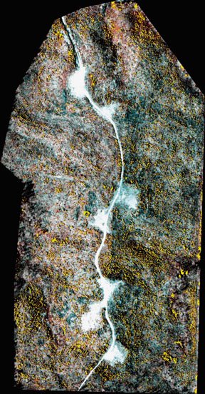
 In the demo, they showed a number of features and functions, such as a full-featured web-based frontend to rival any ArcIMS-based application I have seen, with transactional WFS capabilities to edit vector data, then used the newly created vector to in turn initiate a workflow to modify an aerial image in raster and bring it back into the web view, with the multiple OGC-based vector and raster map services in various different map projections and other things going on.
Particularly given that their strength is in remote sensing imagery processing, these guys have some great things going on, and somehow have managed to fly under the radar with it. I'm hoping we can bring in their technology and capabilities to leverage some of what we are doing in our enterprise efforts...
Technorati tags:
aerial photography, analysis, applications, arcims, developer, earth observation, environment, esri, esri developer network, extensions, geo, geodetic, Geospatial, gis, gml, imagery, internet, interoperability, Java, mapping, NASA, ogc, open source, photogrammetry, programming, raster, RDBMS, remote sensing, satellite, service-oriented architecture, SOA, software, spatial, SQL, tools, web services, wfs, xml
Galileo versus NAVSTAR Redux
![]() While I've generally discounted a lot of the Galileo hype, The Space Review today has a very insightful article discussing a different angle on the "arms race" between Galileo and NAVSTAR GPS- the chronograph battle. Essentially their take on it is about the efforts of the Galileo team to build their technology on clocks based on hydrogen masers (Microwave Amplification by Stimulated Emission of Radiation), which yield sub-nanosecond time accuracy, as opposed to the older cesium and rubidium atomic clocks used by the US NAVSTAR GPS effort.
While I've generally discounted a lot of the Galileo hype, The Space Review today has a very insightful article discussing a different angle on the "arms race" between Galileo and NAVSTAR GPS- the chronograph battle. Essentially their take on it is about the efforts of the Galileo team to build their technology on clocks based on hydrogen masers (Microwave Amplification by Stimulated Emission of Radiation), which yield sub-nanosecond time accuracy, as opposed to the older cesium and rubidium atomic clocks used by the US NAVSTAR GPS effort.
The article mentions that the cost of maser-based technology would add $250,000 to the cost, however USAF and the Interagency GPS Executive Board had apparently rejected masers as too costly. I expect that mass of the units and infrastructure to support the varying technologies may also have some more impact on things as well.
Currently Symmetricom has the contract for the next-generation NAVSTAR birds, to use proprietary "optically pumped cesium beam technology", as opposed to the passive hydrogen maser to be used by Galileo.
Will there be an "chronometric arms war"? I'm still not sure there will. Currently NAVSTAR GPS is adequate for most navigation tasks, and the surveying community has developed solutions like CORS to allow millimeter-level processing of points. Ultimately there may be single-receiver solutions that allow realtime millimeter-level accuracy, but I'm not sure that Galileo alone is the solution or enough of a push.
Technorati tags:
eu, Galileo, geo, geodesy, geodetic, Geospatial, gps, location-based, mapping, navigation, news, satellite, science, space, surveying , time
ESRI Federal User Conference

I'm thinking about going to the ESRI Federal Users Conference in Washington, DC, January 31-February 2 2006.
Hopefully I will actually be able to attend for a reasonable part of it, but my schedule might be tough- just prior to it is the EPA's Hurricane Katrina: Lessons Learned session down in Research Triangle Park- I am probably going to attend that event as part of the work we have ongoing with EPA's Geospatial Enterprise Architecture along with the work we did in support of Katrina for the EPA Emergency Operations Center, as well as Geodata services and the Enviromapper for Katrina deployments our team rolled out.
I tend to find that trade shows can come with mixed blessings, as they tend to be everyone selling to everyone else. I have presented at a few shows, and usually that results in getting a lot of people coming up who want to give me their business card, telling me about how wonderful their own company is- "buy our products and services"... Oh, yay. Yet when I ask a technical question about the product or services they are selling, often not much more than a glazed look in return. The more technical types of conferences are the ones I like far better, where the techies can meet and talk- that and ones where they are internal to the agency, typically invitation-only.
I guess the upshot will be, as always, seeing a few old friends (I see Metacarta and a few other familiar faces will be manning booths), perhaps an interesting presentation or two, and some new contacts made. And finally, worst case, what better opportunity to remind some of these agency people and large prime contractors of Public Law 106-50, and subsequently Executive Order 13360, requiring that 3% of Federal contracting dollars to go to Service Disabled Veteran Owned Small Businesses, and that there are indeed qualified, competent and capable SDVOSB firms that do geospatial - like ours :).
Technorati tags:
business, esri, events, federal, geo, Geospatial, gis, mapping, metacarta, procurement, sdvosb, trade shows, veterans, vets
India eyes up satellite payloads as a new market...
This article in India's Central Chronicle discusses possible lifting of technology sanctions by the US and a booming market in India for deploying satellite payloads, particularly for remote sensing. Aside from general success marketing to a broad satellite clientele in the EU, the article highlights remote sensing applications via a leading Indian firm, Antrix, which has been marketing India's IRS imagery in conjunction with Space Imaging. Additionally, mention is made of Antrix securing a contract with Singapore to launch it's X-sat remote sensing vehicle.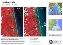
On a related note, India's New Kerala reports that India's IRS-1C satellite is celebrating a decade in service, having been launched on December 28, 1995. Above is imagery from the IRS-series, which was used, among other things, for assessing damage after last year's deadly tsunami.
Technorati tags:
business, eu, geo, Geography, Geospatial, gis, India, mapping, news, photogrammetry, remote sensing, satellite, science, Singapore, space, tsunami
Is GML a format?
I came across a post on a blog called Geoweb- the site appears to have a lot of discussion of Geography Markup Language (GML) and OGC standards. Of interest was a particular discussion about if GML is a "format". There were a number of philosophical points and comments by others, some of which were to the point of "GML is not a format" and "convert from GML and convert from GML is meaningless".
This post was very interesting, and I had a number of mixed reactions to it, mainly from the standpoint of having actually developed an OGC-compliant Web Feature Service (WFS) service from the ground up earlier this year. What we found was that there were a lot of people talking about GML and WFS, with no lack of detailed technical and philosophical discussions, but where the rubber meets the road, in terms of actual applications, they were precious few. A lot of vaporware abounded, so it seems. It also gave me a lot of appreciation for all of the hard work that people at OGC, The Carbon Project, Juan Chu Chow at Safe Software, and others had been putting in on making GML and WFS a reality.
In terms of our own reality, we rapidly came to the conclusion that a subset of GML, containing the essential data we were conveying was adequate and appropriate. The full GML schemas tend to include a lot of items that, while great to consider, aren't always appropriate for all data, and the schemas were complex, with multiple hierarchical and interlinked subschemas, to the extent of even arriving at one unified schema became difficult using the tools we had. So ultimately we took the dataset elements that we had and mapped them to a new unified schema that mapped as a subset to the full GML schemas. So in a sense we did "convert to GML". But WHAT GML? This again is where it becomes essential to have a schema...
From here it becomes a much simpler matter- making this GML data available to the client, and enter Web Feature Service (WFS). A basic (nontransactional) Web Feature Service has three basic methods: GetCapabilities, which provides the client with basic information about the service- in our instance we were performing a dynamic query of an Oracle database and presenting the matching feature services as WFS "layers", which would then be listed for selection by the user within the client. Next comes a call to the DescribeFeatureType method, which simply presents the schema to the client for validation. Finally, we have the query itself, the GetFeature method, which accepts the query parameters and returns the GML for the matching features. The proof of concept for our WFS, believe it or not, was coded, along with two test harnesses in one morning in .NET...
Initially we didn't have access to any existing tools for testing this service- we quickly latched on to the Carbon Project tools: CarbonViewer and Gaia... Here we began to notice that WFS and GML implementations were a little different, even between CarbonViewer and Gaia. The primary enterprise GIS tool in this instance was ESRI - ArcGIS and ArcIMS, and a few, myself included, felt that with all the buzz about GML and interoperability, getting the GML into ArcGIS would be no problem. Well, yes and no... The first snag was that Data Interoperability Extension is not, by default, included in the ESRI Enterprise License Agreement- partly due to their internal arrangements with Safe Software, who provides the engine that Data Interoperability Extension runs on. But ultimately this too was resolved, bringing us to the the next issue- subtleties between how FME and Data Interop Extension handle GML and WFS, and nested tags within the GML, as compared to the Carbon products. This also was ultimately resolved, the temporary but surprisingly effective quick fix being an XSLT transform on the fly within the service.
So ultimately, IS GML a format, or is it not? Even having been there, I would still say, yes and no. GML ultimately will probably never be a form for native storage of data, but will continue to exist as a format for transmission and interoperability of data, and in doing so, data does take the shape of GML- however as we are still finding that GML vaporware still outnumbers the small, but increasing number of real-world solutions, it may be that people will at least for a little while consider it to be more of just a specification or guideline, subject to interpretation. I however think its a good and workable start. There are hurdles, but it is very real and very workable.
At the recent EPA Environmental Symposium in Las Vegas I had occasion to bump into Sam Bacharach from OGC to report to him that the project was a success- I had last seen Sam in the spring at the Pennsylvania Digital Government Summit, prior to beginning the project- we had also opportunity to use the fruits of our labor to help out with Hurricane Katrina recovery efforts, as our WFS service allowed some measure of dynamic drilldown, not otherwise available in the available map services.
The limitations that we did encounter were unfortunately beyond our control, limitations in the Oracle database backend structure, which created too much spatial granularity (we couldn't query large geographic areas effectively), and on the other hand not enough granularity to allow drilldowns to very specific facility types, such as querying by NAICS/SIC codes.
In the end, we were pleased and honored to have been able to do our part for Hurricane Katrina relief in terms of applications support, along with our GIS analysts serving in the EPA Emergency Operations Center in Washington, DC to provide maps for presidential and congressional briefings and support for development of the Enviromapper for 2005 Hurricanes application. We still have that database backend redesign slated, and at some point would like to discuss the possibility of OGC certification. Currently our partner on this contract, Lockheed-Martin is listed as an OGC partner, and Sam Bacharach tells me OGC has been working very closely with LM of late.
Technorati tags:
.net, arcgis, arcgis desktop, asp.net, carbon project, developer, dotnet, esri, esri developer network, extensions, gaia, geo, geography, geospatial, gis, gml, interoperability, licencing, map, mapping, maps, microsoft, msdn, ogc, oracle, programming, web services, wfs, xml, XSLT
VETS GWAC
Much to our dismay, we received notice that we did not make the cut for the VETS GWAC contract. Surprisingly, their rationale was on a completely inconsequential technical detail- the spreadsheet that we submitted rates on. There were two spreadsheets on this to complete, both essentially the same, listing contract line item position categories and hourly rates, which are then carried from year to year with escalators.
The first spreadsheet covered the base years, the second additional years. For the first we were asked to submit an escalator, to cover price increases year-to-year. The second, for subsequent years, would follow the same rationale and methodology. The issue evidently was that we filled in the escalator for the second sheet. GSA says they were going to fill that in for us.
A.) The same escalator was used by us and
B.) There was absolutely nothing precluding GSA from entering any escalator they like, as they would have anyways.
As a result of this inconsequential nonsense, we along with a consortium of over a dozen other Service Disabled Veteran Owned Small Businesses are going to lose out on potential opportunities, not to mention the tremendous investment of time that we put in on the effort to prepare our proposal.
Needless to say, we are going to protest. It seems the fine ladies and gentlemen at GSA have missed the point of this exercise, which was to help small businesses, and to help the disabled vets who sacrificed for their country, as opposed to limit and restrict them with nonsense. Particularly after they allowed a number of other businesses to submit their proposals after the solicitation had already closed. I would think that missing the submittal deadline would be a far more substantial breach than this.
Technorati tags:
business, community, contracting, contracts, e-government, federal, gsa, gwac, procurement, sdvosb, veterans, vets
USGS Cartographic Service Contracts
 We have been invited to participate in a solicitation for a USGS Cartographic Service Contract. It's great, as a small business, to be recognized for your capabilities and to be included in an opportunity to compete with the "big boys"- typically the ENR 200 firms.
We do plan to respond- we (and I would imagine many other firms) can easily address most aspects of the work, however one component still is the ability to provide imagery- it's not every company that is capable of deploying the aerial or spaceborne platforms and sensors for aerial imagery or other remote sensing imagery... We do have a few tricks up our sleeves, with a network of regional firms that have these conventional capabilities, as well as some advanced technology from some of our friends who do military contracting.
http://erg.usgs.gov/isb/pubs/factsheets/fs06603.html
Teaming: 8(a), SDVOSB and HUBZone Firms
Synergist Technology Group, Inc. is a Service Disabled Veteran Owned Small Business (SDVOSB), and we are looking for teaming partners who are either also small businesses certified as 8(a), SDVOSB, or HUBZone around the country which could complement our skills in surveying, mapping, GIS and environmental information.
We are also looking to forge partnerships with other small and large businesses with specialized skills and equipment, such as firms with LIDAR, Remote Sensing, and other means of airborne and space-based imaging.
Please contact David G. Smith PE PLS, we would be glad to talk.
Chemist Position in Las Vegas

If you are a Chemist, and are interested in working in Las Vegas, contact me: dsmith@synergist-tech.com
Requisition Number: 615910
Date Posted: 10/27/2005
Job Title: Chemist Sr
Job Class: Scientist
Job Designation: EXPERIENCED PROFESSIONAL
Specific Description
Required Skills: BS degree in chemistry or equivalent scientific field plus a minimum of 8 years "hands on" organic compound GC/MS experience (emphaisis upon VOC analysis) using EPA methods (CLP and/or SW-846) and the preparation of data packages or analytical reports. Instrument maintenance, troubleshooting and minor repair skills/expertise are required. Problem solving skills and the ability to work relatively independenty are also required; the candidate must be capable of periodically working extended early morning, evening and weekend hours in a sometimes stressful mobile lab environment. Clear verbal and written communication skills are required as well as the ability to prepare, review and revise analytical methods or SOPs. Must be able to effectively interact in a professional manner with EPA, state and local authorities and the general public in performing field analysis duties. Experience/expertise using field portable instrumentation and/or performing organic compound field analyses in a mobile lab is highly desirable. Experience or familiarity with environmental analysis applications of MS/MS or MS/MS/MS technology is a major plus. OSHA hazardous waste site worker training and emergency response experience are very desirable. Familarity or expertise/experience with air monitoring and sampling procedures and equipment/instrumentation is also desirable. Project management experience/expertise is also desirable. This is a "hands on" senior organic analysis field chemist for a high profile contract with sophisticated mobile labs in Las Vegas, NV and Edison, NJ. The canididate will maintain, calibrate, troubleshoot and perform minor repair to keep field portable instrumentation and mobile lab equipment and instrumentation in a "road ready" state for time critical use during routine air monitoring projects and emergency response situations. The candidate will primarily perform onsite analysis of air samples for VOCs using a field portable GC/MS system and/or a GC/MS system in a sophisticated mobile lab. The candidate's work activities may also involve the maintenance, operation and use of a triple quadrupole MS/MS/MS system to perform real time monitoring of ambient or indoor air for selected VOCs or inorganic analytes such as chlorine or chlorine dioxide. The candiate will prepare detailed data packages and analytical reports for field analyes or monitoring. The candidate may perform analytical method deveolpment/evaluation and prepare and revise field analysis SOPs. The candidate will be periodically be required to perform project management functions and serve as a task leader for routine field analysis projects or emergency responses. Periodic travel throughout the United States is required, sometimes with little advance notice. The candidate may periodically need to work extended early morning, evening and weekend hours in a sometimes stressful mobile lab environment. Successful completion of 40-hour OSHA hazardous waste site worker training is required.
General Position Description
Conducts exploratory research to produce new knowledge and potential products; conceives, organizes, promotes, and executes ideas and plans to increase chemistry's role in and contribution to the discovery and chemical approaches to meet exploratory objectives in product discovery. Develops research proposals to provide a technically and economically sound basis for developing and evaluating new or improved products, processes, and analytical and physical testing techniques. Reports progress of research work and significance of the results. Recommends utilization of the results or changes in the scope of work or termination of projects.
Typical Minimums
Bachelors degree from an accredited college in a related discipline, or equivalent experience/combined education, with 5 years of professional experience; or 3 years of professional experience with a related Masters degree. Considered career, or journey, level.
Work Location: Las Vegas, NV
Clearance Required: NONE
US Citizen or US Permanent Resident status required


