Surveying, Mapping and GIS

Exploring all aspects of mapping and geography, from field data collection, to mapping and analysis, to integration, applications development and enterprise architecture...

  • Geospatial Technology, End to End...

    Exploring all aspects of mapping and geography, from field data collection, to mapping and analysis, to integration, applications development, enterprise architecture and policy
Showing posts with label federal. Show all posts

Federal Geospatial Platform

Posted by Dave Smith On 6/25/2010 01:31:00 PM 0 comments


"In 2010 and 2011, Federal data managers for geospatial data will move to a portfolio management approach, creating a Geospatial Platform to support Geospatial One-Stop, place-based initiatives, and other potential future programs. This transformation will be facilitated by improving the governance framework to address the requirements of State, local and tribal agencies, Administration policy, and agency mission objectives. Investments will be prioritized based on business needs. The Geospatial Platform will explore opportunities for increased collaboration with Data.gov, with an emphasis on reuse of architectural standards and technology, ultimately increasing access to geospatial data."
- President’s Budget, Fiscal Year 2011
Earlier this week, I had the opportunity to attend one day of the multi-day National Geospatial Advisory Committee (NGAC) meeting in Shepherdstown, WV - Though I had attended a few of their meetings previously, the thing that I was most interested in for this particular meeting is discussion of the emergent Geospatial Platform.  As the NGAC is a FACA committee, non-member involvement and participation is limited, though was able to get to get a sense of things...   The intent has a lot of potentialities, such as being able to provide more robust visualization and geospatial tool capabilities such as geocoding services, to augment ongoing Data.Gov efforts, as well as support ongoing FGDC initiatives.

The sense I got is that thre are many pieces still undefined, many things not yet prioritized, and so on, and discussion of options and alternatives was a big focus of the discussion that I sat in on - and one big challenge yet ahead is refinement of governance structure - as to how its' strategic vision and board of directors would be structured and at what level of government, where its' managing partner and operational/tactical component would reside.  These things are being discussed in iterative fashion, as they develop their roadmap.

Some interesting thoughts and ideas, not new, but again being raised - of the need for a strategic ownership stake in geospatial data at the White House level, e.g. a Federal GIO to reside within OMB, who would have the authority and teeth to centrally direct and manage geospatial policy in executive agencies at the federal level.  Another question, at the operations level, of commoditized geospatial technology platforms which could be shared across all federal agencies - a federal geocoding service, for example, or a geospatial data services hosting platform where individual stewards in agencies which might not have their own robust geospatial infrastructure could upload data and register it, apply symbologies, et cetera to be served as fed-wide robust, shared OGC web services, and so on.

What shape this will take is yet to be determined, and it sounds like the plan is to firm up the roadmap internally within the NGAC and then circulate it more broadly when v3 of the Roadmap is completed.

More about the Geospatial Platform:


Other coverage, items and discussion:

Live Blogging from FedUC, Day 1 (er... not really)

Posted by Dave Smith On 2/17/2010 06:51:00 PM 2 comments

This will be as close as I get to live blogging from the ESRI Federal User Conference, Day 1.


Problem is, I missed it.

Unfortunately, as my day went, I was tied up in a meeting in Baltimore and didn't get back to DC until the tail end of the reception.

So that should make this the shortest wrapup of FedUC Day 1.

I heard there was some tasty sushi at the reception, but by the time I arrived, it was already gone... However, having not had anything to eat since morning, I did inhale a handful of various hors d'ouvres and a Heineken...

To catch up, I did monitor a few assorted tidbits via Twitter throughout the day- some of these struck me:
  • Buzzword: VGI. Volunteered Geographic Information. a/k/a crowdsourcing. All pointing to the OpenStreetMap paradigm- Given the phenomenal success of OpenStreetMap in supporting base mapping for humanitarian efforts in Haiti, along with the fluid and adaptable nature of its key/value pair model, which was utilized for tagging crisis-related features, such as landslides, collapsed buildings, road obstacles, refugee camps and so on - how can one NOT talk about OpenStreetMap? Great to hear about OpenStreetMap being used in ArcGIS. But... the pundit in me asks, how transparent is this? Is it "importing OSM data"? That's great for many applications. But what of emergency response applications? Given the dynamic nature of OpenStreetMap, "import" might not cut it. How about direct, native OSM support? That I need to investigate further. But then, comes the other, far more important piece of VGI - the participatory piece? Can/will ArcGIS 10 support direct editing of OSM? And outside of OSM, how much robust ArcGIS 10 capability for participatory GIS exists right out of the box?

  • Offshoot: Citizen-centric science. I understand Audubon demonstrated eBird - interesting - a year ago, I contributed a proof-of-concept to the eBio conference in London, demonstrating harnessing social media such as Twitter to allow citizen science participation to allow folks to record observations of various species in the wild, toward such ends as assessing biodiversity, invasive species, and so on. I tied this in with web services such as GBIF's lookup services to, for example, translate between common names and scientific name, and so on. This, in turn, tied in to other sources such as Flickr, and combined, wherever possible, with available geographic information, for providing feeds and display in, for example Bing Maps or other platforms. Great to see this coming along... I'd be interested in looking at the Audubon effort more closely, along with further exploring the model for vetting and validating inputs.

  • The Cloud... Evidently a big focus on cloud hosting, the new partnership between ESRI and Amazon, and "rent ArcGIS Server by the hour". I think this is an interesting model and have been harping on this for years. Geodata services hosting at this point is nothing esoteric, and could/should essentially be commoditized *cough* GeoServer *cough*. But... where the less-well-charted and more-interesting territory still lies is not in just serving up data. ArcGIS Server is frankly often too much tool to waste on just serving up map layers and tiles. Where I see the opportunity for ArcGIS server is in true ANALYSIS, MODELING and so on. Web-based geoanalytical services and geoprocessing services. We need a good model, and some good strategic thinking in the community of how the long-range picture of all of that will look.

  • ArcGIS for iPhone... That was another feature of ArcGIS 10 noted by some who attended the Plenary... Sounds great, but... I want to know more about how it operates, and more importantly, how customizable, configurable, how many features and functionalities it supports. Hopefully someone can shed some light there...
Even for showing up at the last minute, I briefly ran into @jfrancica, @donatsafe, @MikeHardy and @sturich from Pen Bay Media and got to say hi to them, as well as various other friends - I know there are plenty more friends, tweeple and geobloggers in town this week - I also did see @pbissett and @cageyjames from afar - on locating the @weogeo booth, it still had a few people milling about, so I unfortunately didn't get to chat...

More to follow... Tomorrow, my luck should be better, and I plan to be able to stay for the whole day - and for #geoglobaldomination afterward. Hopefully others will be posting their recaps, observations and scuttlebutt as well... At this point, the handful of hors d'oevres and beer in my otherwise empty tummy are looking for company.

ESRI Federal User Conference 2010

Posted by Dave Smith On 2/15/2010 09:15:00 AM 0 comments

I am looking forward to spending this week in Washington DC, despite any further threats of snow (1"-3" expected tonight)... Living in Northeastern Pennsylvania, 1 to 3 inches of snow is no big thing. But the 30+ that hit the Washington area last week are astounding. Hopefully, much of the prior accumulation is now under control.


Despite the snow, I laugh in the face of the snow and am still anticipating a decent turnout at the 2010 ESRI Federal User Conference (FedUC). At present, it sounds like a lot of my own federal colleagues are still planning on attending, as are various friends, geobloggers, geotweeple and so on... It has rapidly become the east-coast version of the San Diego ESRI International User Conference, with solid attendance not just by feds, but by a wide variety of others as well. The agenda, again a mix of technical GIS topics and where GIS is being used in a wide variety of business domains, along with a collection of special interest group meetings. I will generally be following an environmental science track, along with a few excursions into other areas.

It is being held once again at the Walter E. Washington Convention Center in Washington, DC, February 17-19th, although I will be arriving today, for various meetings around Washington today and tomorrow, and a few throughout the FedUC as well. Free for feds to attend, relatively cheap for others...

I hope to be able to post here and there from the FedUC, depending on connectivity and power availability (my workhorse laptop no longer holds a charge as it used to) - as well as the periodic blips from Twitter...

And if you are in the DC area, but are NOT attending the ESRI Federal User Conference, then here's a definite to keep an eye out for: #geoglobaldomination - essentially, just an ad-hoc, twitter-organized, vendor-neutral, platform-agnostic gathering of geospatial folks getting together over a few beers to discuss esoterics and idiosyncrasies of the geospatial business...

It will be fun!

ESRI Federal User Conference Highlights

My recently-retired EPA friend and colleague Dave Wolf was the recipient of the "Making a Difference" award. Dave was involved in pioneering efforts in web mapping at EPA, with EnviroMapper and other efforts.

I unfortunately arrived a bit late, and missed the discussion of ArcGIS Explorer Build 900 - fortunately Jithen Singh has a good overview of it here: http://mandown.co.nz/esri/arcgis-explorer-build-900-showcased-at-the-esri-federal-user-conference-2009/

As I arrived, I noted that there was a big focus being put on integration between ArcGIS and remote sensing imagery capability, specifically with ENVI and IDL: http://www.ittvis.com/ProductServices/ENVI.aspx. Dan Zimble led into presentations showing some of this capability, particularly integration of IDL scripts with ModelBuilder

Other highlights and demos:

  • Time Layer Animation
  • Keyless License Manager capability
  • Microsoft Virtual Earth data as a subscription service
  • APIs: Demonstration of ArcGIS Server Flex API via Solar Boston map: http://gis.cityofboston.gov/solarboston/
In general, there seemed to be a big focus on themes mirroring very topical and current issues, particularly stimulus and infrastructure investment - in the case of Solar Boston, energy - another demonstrated "smart routing" for alternative-fuel vehicles, based on availability of CNG fuel.

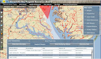
Relating to water issues, another demonstration featuring the Flex API was for the Chesapeake Bay Program: http://wdcb10.esri.com/cbprl/

This showed use of federated assets, such as USGS stream gauges, USEPA STORET water quality data, and so on, and provides many tools for assessment, management and best practices for improving water quality for the Chesapeake Bay.

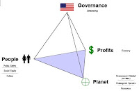
Colonel Alex Dornstauder of the US Army Corps of Engineers gave a good presentation on what USACE is doing relating to watersheds and water quality, using an approach of "3D decision space" and cross-agency "lenses". The approach utilized several different datasets and attributes with ModelBuilder to get a baseline assessment, which can then be utilized to in the target, with a collaborative vision to triage risk and prioritize investments to water quality.

(3d Decision Space image gleaned from a related presentation by Col. Dornstauder: http://gis.esri.com/library/userconf/ieug08/papers/watershed_dornstauder.pdf)

The Colonel closed with an excellent quote from George Washington, "Let us raise a standard to which the wise and honest can repair"

There was also discussion and demos of
  • Situational Awareness tools built on the Flex API in the code gallery (http://resources.esri.com)
  • ArcGIS Mobile SDK, with a demonstration, showing field data collection, domains, subtypes, dropdown list support.
  • 3D and network analysis - modeling of movement within a building in 3d (pedestrian egress via stairs, et cetera) - 3D proximity analysis
  • There was discussion of food safety, with a case study of the Hawaii Food Safety Center
  • Economic security and urban growth
  • Demonstration of ordinary least squares analysis vs. geographically weighted regression


Maryland Governor Martin O'Malley gave an excellent discussion, hitting many excellent notes - with many things that resonated: "can you show me my house" - which he tied in well in how "show me my house" repeatedly resonated in context of geography with the many case studies he presented. Other highlights "Maryland is ESRI Customer #008" -
He discussed trying to remedy many of the issues facing Baltimore, "hopeless & vacant hearts" and how CityStat http://www.baltimorecity.gov/government/citistat/ and iMap http://maps.baltimorecity.gov/imap/ have provided far more performance-oriented approaches - he touched on how previously, information had been collected in such a way as to not make it to management in any meaningful way, with emphasis on measurement of inputs, but not of outputs and outcomes - and the new paradigm of viewing outcomes against the map, tells where challenges lie. These types of geospatial approaches allow relentless followup and assessment, and drive the effort to move the graphs in right direction, with improvements in city services, reductions in shootings and homicides, improved response times - cleaning out and boarding of vacant houses, mapping service problems and opportunities for daily review. "The map does not care if neighborhood is white/black, rich/poor, republican/democrat"

As Governor now, he has taken this mapping-oriented and performance-oriented approach to the next level on a statewide level, with StateStat http://www.statestat.maryland.gov/ and BayStat http://www.baystat.maryland.gov/, and GreenPrint, which provides an ecological assessment of every single parcel in Maryland, along with ecological measures being put in force: http://www.greenprint.maryland.gov/ - and tie-in of stakeholders at all levels - "if it's not about the relationship, it's not about anything".

Governor O'Malley left the audience with a Native American proverb, "how we treat one another is reflected in how we treat the earth"

I did visit the EXPO floor and looked at some of the maps - the floor was definitely quite crowded. By one account, there were 2800 registrants this year for the ESRI Federal User Conference.

Some of the ESRI schwag:


(I don't think the DevSummit attendees will be getting ESRI umbrellas to go with their weather...)

As posted previously, I will try to live tweet more coverage tomorrow, using hashtag #feduc

If you are also attending and want to meet up, by all means, drop a line - dsmith (at) synergist-tech.com - while I have a few meetings, both inside, during FedUC, and a few outside meetings in the DC area next week, I will generally try to make FedUC my base of operations and will blog wherever conditions permit (if conference WiFi is available and/or my AT&T 3G service cooperates).

Also, I will try to post updates from my phone and laptop via Twitter - http://twitter.com/DruidSmith using the hashtag #feduc - if others are attending, I'd suggest using #feduc as well, tools such as TweetGrid will be helpful for tracking twitter traffic in realtime - here's a sample 1x1 TweetGrid already set up for tracking #feduc: http://tweetgrid.com/grid?l=0&q1=%23feduc

NSDI for Democracy

Posted by Dave Smith On 2/07/2009 03:13:00 PM 0 comments

With news of Vivek Kundra joining the Obama administration to serve the Office of Management and Budget (OMB) as their top IT visionary, it brings me great encouragement. Vivek Kundra has been serving as the District of Columbia’s Chief Technology Officer, and he recently created some excitement through his Apps for Democracy initiative, where he pursued development of an “Open Data Catalog” containing over 250 data assets of various flavors (e.g. XML, Text/CSV, KML, ATOM/GeoRSS and ESRI Shapefile formats), and then promoted a contest wrapped around the Open Data Catalog, for development of innovative mashup-oriented applications. In just a short amount of time, 47 excellent applications were submitted, dealing with a broad range of topics and providing many innovative solutions, a great success.

So what is OMB all about – and what might Kundra’s joining OMB mean?
From Wikipedia, http://en.wikipedia.org/wiki/Office_of_management_and_budget

The Office of Management and Budget (OMB) is a Cabinet-level office, and is the largest office within the Executive Office of the President of the United States (EOP). It is an important conduit by which the White House oversees the activities of federal agencies. OMB is tasked with giving expert advice to senior White House officials on a range of topics relating to federal policy, management, legislative, regulatory, and budgetary issues. The bulk of OMB's 500 employees are charged with monitoring the adherence of their assigned federal programs to presidential policies. OMB performs its coordination role by gathering, filtering, and promulgating the President's annual budget request, by issuing bulletins, memoranda and circulars dictating agency management practices, by overseeing the "President's Management Agenda", and by reviewing agency regulations.

Executive oversight of federal agencies – via expert advice on federal policy, management, legislative, regulatory, and budgetary issues, to be implemented and monitored for adherence via the President’s Management Agenda. That’s quite powerful. And under the Bush administration, OMB has already begun engaging in some basic monitoring activities relating to geospatial technology and investments, under the Geospatial Line of Business (GeoLoB).

So where do we go from here? And what does Kundra’s selection mean in this mix? Only Kundra really has the answer to this, at present - however I do believe that we can make some informed guesses as to what may be on his mind, based on his past track record and accomplishments. District of Columbia’s Open Data Catalog? Think in terms of doing this across all of Federal government. Strengthen and bolster the existing OMB A-16 mandate, and drive publishing of open data. That certainly forms some excellent pieces of the National Spatial Data Infrastructure.

Foster partnership-building and collaboration, ala the Apps for Democracy effort. Perhaps, on a cross-government level, we should also be looking at approaches such as Forge.mil, where agencies can collaborate and share GOTS technology investments, and work together to enhance and expand technology and capability, as opposed to continually reinventing the wheel.

Other things for Kundra to look at? Alignment of efforts across government. Currently USGS and EPA collaborate on efforts to build and densify hydrology data, as the National Hydrology Dataset (NHD), and are working with states to get this to a 1:4,800 level. Meanwhile, FEMA is developing DFIRMs for flood mapping, based on county and other types of data for stream centerlines. How do we align such things as linear referencing between USGS stream gauges and FEMA for looking at flooding issues? Coordinate between NOAA and NWS for realtime storm tracking, and have models available, using all best-possible data, toward stream flood prediction? What if a truck tumbles off of a bridge and ends up in a river, releasing hazardous waste into the river – is the information flow adequate to deal with hazardous waste cleanup even where that river crosses the border into the next state downstream? Pieces and parts of these types of things are starting to happen, but where they do, it is typically only in an ad-hoc, reactive fashion, with very limited coordination or common framework. Where does one thing end and the next begin? What are the gaps? Overlaps?

Or, consider a military convoy, heading across multiple states to an exercise. Due to an emergency bridge closure, they are diverted off of the main highway and onto local roads. They may be carrying sensitive and/or high value goods, such as weapons systems. Who knows? Who SHOULD know? Perhaps local bridge weight restrictions restrict their travel even further. How do we handle this in any coordinated fashion? Who’s doing what, and who’s able to supply what data to smoothly deal with these types of situations? Federal government places some mandates on states to collect roadway data, but again, is there any mechanism for establishing data capture, transparent access and flow? What’s covered, and what isn’t? State-to-state, if there is a serious roadway closure issue just inside one state’s border, will the adjacent state know this and be able to notify motorists via VMS boards and other means?

Although there are a few exceptions here and there, more often than not, the answer to these types of questions and scenarios is “no/had no idea/what am I supposed to do about it” accompanied by shrugs. Streams do not care about political boundaries, they only understand watersheds. Roads are networks. Cars and trucks do not just reach the Edge of the Knowne Worlde and drift off into space when they cross the state line. Information access and flows must be able to bridge these gaps.

It’s pretty much a given that 90% of most business processes in Federal government touch on or deal with location in some form or fashion. Where are assets, where are people, who’s being served, and so on. Through implementation of best practices and through making data access and exchange more timely, transparent, and complete, through better alignment of technology investments and reduction of gaps and overlaps, these *shrug* moments start to vanish, and the *AHA* moments start to happen. I am hoping that Mr. Kundra is thinking the same way. If what lies ahead of us is anything like his efforts to date, we indeed have a bright future ahead of us.

National Spatial Data Infrastructure 2.0

Posted by Dave Smith On 1/28/2009 03:02:00 PM 2 comments

Recently there has been a great deal of discussion about "NSDI 2.0" - and yet it seems there is much confusion about what it is or isn't - and what we should do, or whether we should bother discussing it at all.

History
To step backward in time, it primarily deals with National Spatial Data Infrastructure from a federal perspective, as enacted through the Office of Management and Budget Circular A-16.

This document was originally issued in 1990, followed by Presidential Executive Order 12906, and then subsequently updated in 2002 (which incorporated EO 12906).

OMB Circular A-16 (as revised 2002)

In its present form, the NSDI (if you were to consider it NSDI 1.0) consists of:

  • Defined data themes (geodetic control, orthoimagery, elevation, transportation, hydrography, governmental units, and cadastral information)
  • Metadata (FGDC Metadata Format)
  • The National Spatial Data Clearinghouse (Geospatial One-Stop)
  • Standards (developed only when no existing voluntary standards exist, in accordance with OMB Circular A-119)
  • Partnerships
Within the NSDI, oversight is provided by the Federal Geographic Data Committee (FGDC)

Additionally, A-16 pursues the following:
  • Privacy and Security of raw and processed citizens' personal data and accuracy of statistical data
  • Access to these data, subject to OMB Circular A-130
  • Protection of proprietary interests to these data 
  • Interoperability between various federal agencies' information systems within these data
The NSDI supports the advancement for a Global Spatial Data Infrastructure that coincides with National Security interests. Any Federal system that develops international data in accordance with these systems must follow international voluntary standards as outlined by Circular A-119.

The Current Situation
With the FGDC and OMB mandate, this prior effort more than anything, establishes a framework.  This framework, in turn, is something that individual agencies and data stewards can build to.  Similarly, the recent Office of Management and Budget (OMB) Geospatial Line of Business (GeoLoB) and other initiatives, such as the Federal CIO Council's Federal Enterprise Architecture (FEA) Geospatial Profile 1.1 provide guidance toward harmonizing investment, technology and architecture.  Further, the recently-formed National Geospatial Advisory Committee (NGAC) has been formed under the Federal Advisory Committee Act to provide advice, from a community cross-section, to FGDC.

Here nonetheless remains the challenge of populating this framework.  Many diverse efforts are ongoing, which align with these efforts, such as Imagery For The Nation, such as EPA's Exchange Network, however some of these efforts still lack adequate resources for completion, may have issues with stovepipes, lack of interoperability, lack of access, and so on.

The drivers for completing this work are manifold - such as providing adequate tools for planning, to better allow informed decision-making for such things as roadways and transportation, for analysis of demographics toward broadband investments, for homeland security, for planning improvements to municipal sewers, for protecting natural and archaeological heritage and biodiversity, and so on.   As such, with discussion of massive stimulus and the H.R. 1 bill geared toward many of these things, it is imperative that decisions and investments be made in an informed fashion.

Currently multiple documents of relevance and proposals toward populating this framework and advancing the various initiatives are currently circulating within the GIS community:
All of these speak to the need for populating the NSDI framework.  The questions and differences only remain in approaches.    Many elements are crucial to success, such as:
  • Satisfying clear mandates, requirements and drivers for geospatial data
  • Delivering data in an accessible, vendor-neutral, platform-agnostic and interoperable fashion
  • Leveraging and dovetailing into existing initiatives and investments
  • Partnerships:  Federal/State/Local/Tribal/Academia/NGO/Industry
  • And many more...  These need to be considered carefully.
The hope is that the community can have an open, informed discussion of these elements and proposals, along with all of the key context, history and background.  And hopefully adequate open forums will become available for doing so.

Farm Bill Prevents Sharing of Geospatial Data?

Posted by Dave Smith On 9/28/2008 12:16:00 PM 5 comments

I just came across this bit of disturbing information - a colleague was seeking historic aerial photographs from USDA, and was greeted with the following response:

"Please refer to Title 1, Subtitle F, Section 1619 titled "Information Gathering" on pages 256-259. This will give you the precise language of the 2008 Farm Bill which prevents FSA from providing geospatial information."

The bill is available here: http://www.usda.gov/documents/Bill_6124.pdf

The pertinent language is below:

SEC. 1619. INFORMATION GATHERING.

(a) GEOSPATIAL SYSTEMS.—The Secretary shall ensure that all the geospatial data of the agencies of the Department of Agriculture are portable and standardized.

(b) LIMITATION ON DISCLOSURES.—

(1) DEFINITION OF AGRICULTURAL OPERATION.—In this subsection, the term ‘‘agricultural operation’’ includes the production and marketing of agricultural commodities and livestock.

(2) PROHIBITION.—Except as provided in paragraphs (3) and (4), the Secretary, any officer or employee of the Department of Agriculture, or any contractor or cooperator of the Department, shall not disclose—
(A) information provided by an agricultural producer or owner of agricultural land concerning the agricultural operation, farming or conservation practices, or the land itself, in order to participate in programs of the Department; or
(B) geospatial information otherwise maintained by the Secretary about agricultural land or operations for which information described in subparagraph (A) is provided.

(3) AUTHORIZED DISCLOSURES.—
(A) LIMITED RELEASE OF INFORMATION.—If the Secretary determines that the information described in paragraph (2) will not be subsequently disclosed except in accordance with paragraph (4), the Secretary may release or disclose the information to a person or Federal, State, local, or tribal agency working in cooperation with the Secretary in any Department program—
(i) when providing technical or financial assistance with respect to the agricultural operation, agricultural land, or farming or conservation practices; or
(ii) when responding to a disease or pest threat to agricultural operations, if the Secretary determines that a threat to agricultural operations exists and the disclosure of information to a person or cooperating government entity is necessary to assist the Secretary in responding to the disease or pest threat as authorized by law.

(4) EXCEPTIONS.—Nothing in this subsection affects—
(A) the disclosure of payment information (including payment information and the names and addresses of recipients of payments) under any Department program that is otherwise authorized by law;
(B) the disclosure of information described in paragraph (2) if the information has been transformed into a statistical or aggregate form without naming any—
(i) individual owner, operator, or producer; or
(ii) specific data gathering site; or
(C) the disclosure of information described in paragraph (2) pursuant to the consent of the agricultural producer or owner of agricultural land.

(5) CONDITION OF OTHER PROGRAMS.—The participation of the agricultural producer or owner of agricultural land in, or receipt of any benefit under, any program administered by the Secretary may not be conditioned on the consent of the agricultural producer or owner of agricultural land under paragraph (4)(C).

(6) WAIVER OF PRIVILEGE OR PROTECTION.—
The disclosure of information under paragraph (2) shall not constitute a waiver of any applicable privilege or protection under Federal law, including trade secret protection.

ESRI FedUC - February 20-22 2008

Posted by Dave Smith On 2/11/2008 09:31:00 PM 0 comments


One event coming up that I do plan on attending - the 2008 ESRI Federal User Conference: http://www.esri.com/events/feduc/index.html

Looking forward to attending it again, a lot of my friends in the federal sector and federal contracting will be attending. I also like the size, kind of like a mini San Diego.

Haven't yet heard if anyone's organizing a geoblogger meetup in any formal fashion... but I did create a Facebook event for it - http://www.facebook.com/event.php?eid=8865086825

February 20-22, 2008
Washington DC Convention Center,
801 Mount Vernon Place NW
Washington, DC

USEPA Geospatial Information Officer Selected

Posted by Dave Smith On 7/02/2007 11:04:00 AM 0 comments

From a memo circulated by USEPA CIO and AA for USEPA's Office of Environmental Information (OEI), Molly O'Neill:

I am very pleased to announce and welcome Jerry L. Johnston, Ph.D as the new Geospatial Information Officer (GIO) for EPA. Jerry has many years of geospatial experience in a variety of public and private sector positions. Most recently, he was a manager in the Environmental Fate and Effects Division in the EPA Office of Pesticide Programs where he successfully integrated geospatial analysis into the regulatory assessment processes of OPPTS. Prior to joining EPA, Jerry was in private industry where he held numerous roles including that of a Chief Technology Officer.

Over the course of his distinguished career, Jerry has demonstrated an exceptional ability to apply geospatial technology to help solve complex environmental problems. His understanding of information technology, policy development, geospatial data, and the business processes of EPA will be invaluable as we develop new approaches for managing and using environmental information.

I have mentioned to several people that I believe our geospatial work is just beginning and there are great opportunities ahead. Jerry's experience, energy, and fresh perspective will be important to leading this effort and I am confident that he will work collaboratively with the entire GIS community at EPA to make huge strides.

Jerry will be joining us full-time in mid-July. Please join me in welcoming Jerry to OEI!
Congratulations to Mr. Johnston. This will be a challenging, key role in the agency moving forward, for governance, best practices, data stewardship, enterprise architecture, SOA, OMB GeoLoB and so on.

Emergency Response and GIS

Posted by Dave Smith On 6/14/2007 07:23:00 AM 0 comments

One of the other events which will be happening concurrent to the ESRI Conference is the SONS 07 event - "Spill Of National Significance", which will replicate a major catastrophic event - to include simulated release of oil, hazardous material, and/or other associated threats to health and safety. This year's event will take place in the midwest, replicating an earthquake along the New Madrid fault zone.

Through our work with USEPA, we will be among the participants in this event, as we did for Hurricane Katrina, supporting the effort through our own GIS staff at the USEPA Emergency Operations Center. The two main stakeholders and participants on the environmental side are USEPA and USCG, along with FEMA, state, regional and private sector participants to support the response as appropriate.

It's good to see these events take place, and it no doubt will give us many more new lessons learned and opportunities to refine response. The bottom line still comes to being proactive, in terms of GIS preparedness, as opposed to reactive. With regard to availability of information on impacted facilities, we will no doubt be in better condition than we were for Katrina, but many of the other pieces are still lacking. Specifically, there is still little transparency or availability of realtime or near-realtime data, when it comes to assessing response capacity and many other pieces.

Here, we should go back to HSPD-5 which deals with communications and interoperability, and examine how well our GIS assets work together, and how well they support standards, how well-documented they are to allow users to make informed decisions regarding the data.

Closely affiliated and associated with this is HSPD-8 for preparedness - which comes along with a host of other questions - how current, scalable, flexible and robust is your GIS data, and does it address the need? For example, how many burn units are immediately available in a 100-mile radius right now, how many pieces of fire apparatus are available right now - with the right now being key. In looking at a dozen or so counties nearby, I see almost 500 fire stations, almost 200 law enforcement offices, and nearly 200 emergency medical providers. Yes, they participate in surveys and report in data, but how timely is it? Now consider that Pennsylvania has 67 counties, and the scale of the problem magnifies greatly. Say your EOC is impacted, loss of power, loss of communications, otherwise rendered inoperable. Can you cascade your operations over to a COOP site and continue seamlessly?

Here in Pennsylvania, we have many gaps, overlaps and stovepipes for data and communications flow, and many points of failure, from local to local, local to county, county to county, local to state, county to state, between state agencies, local to fed, county to fed, state to fed, and fed to fed. I can't think of any one of these which genuinely works seamlessly with the next. This is what we have been referring to as the gap of pain, and something for which we have a concept and team already up and running to address.
The February 2007 snowstorm, which caused widespread damage and notoriously left hundreds of motorists trapped on Interstate 78 for 20 hours, still remains a major fiasco here in Pennsylvania, with solutions still thoroughly unadressed politically, fiscally and bureaucratically. On the other hand, technologically, we can address the data, communications and preparedness issues. This is something that we have been looking at quite closely ever since 9/11, investing a lot of time and thought into, and something I will be running through again, considering the SONS exercise. It's time to act and become proactive, and to break through the stovepipes and fiefdoms.

USEPA GIS Workgroup

Posted by Dave Smith On 4/22/2007 04:47:00 PM 0 comments

I am looking forward to attending the EPA GIS Workgroup meeting coming up in Boston. This time around, the spring meeting will be in Boston, at the Omni Parker House Hotel, May 15th to 18th.

It will be good to refresh some contacts and make some new ones. We are hoping to make some further inroads in the EPA GIS community, combining our present USEPA geospatial expertise and SDVOSB status to reach out and support USEPA regions and other USEPA program offices. For me, it's also another opportunity to go and visit with my relatives in Massachusetts.

Agency Metadata Editor

Posted by Dave Smith On 4/19/2007 09:14:00 PM 1 comments

Over the last few days I have been working with a great newly released metadata editor tool developed by our good friends over at Innovate!

It's based on the Coeur d'Alene Tribe "3-Tab" editor, and provides a customized environment which is database-driven and customizable for an Agency's needs, as well as highlighting some elements which are not mandatory for FGDC CSDGM compliance, but which are mandatory for Agency profile compliance above and beyond FGDC requirements.

The tool integrates seamlessly with ArcCatalog and also provides a validation tool, to ensure compliance with the Agency profile.

Tab 1: Basic Dataset Information

Tab 2: Quality, Coordinate System and Attribute Information

Tab 3: Distribution & Metadata Information


In just a matter of minutes, it's fairly easy to generate a complete, compliant metadata record, which passes validation in metaparser (mp).

NGS 10-Year Plan: Call for Comments

Posted by Dave Smith On 2/23/2007 07:17:00 PM 0 comments

The National Geodetic Survey, in keeping with quite a few innovations and revelations to coincide with their 100th anniversary, has unveiled a copy of their 10-year plan, and are soliciting comment:

During the last year, NGS has spent considerable effort refining its mission, vision and strategy for the future. The result of this effort is the NGS 10 year plan. Because any plans for the future will affect the NGS stakeholders and the general public, NGS is releasing this plan in draft form for a public comment period lasting until March 31, 2007. NGS is interested in hearing all feedback on the proposed plan over the next few weeks. NGS will also discuss and take comments on the 10 year plan at the ACSM conference in St. Louis. This will take place during the first half (8:30 a.m. - Noon) of the "National Geodetic Survey and Partners" meeting on Sunday, March 11.

Please note that this document is in draft form. At this time NGS is seeking comments on the content of the plan. Once those comments have been received and incorporated into the plan the document will undergo a professional editorial review to address administrative (spelling, punctuation, etc.)
issues. Following the public comment period, NGS will consolidate all feedback and issue a final copy of the 10 year plan some time in April 2007.

Click here to download the draft of the NGS 10 year plan.
Click here to go to the comment template for providing feedback on the plan.Comments will be mailed to the NGS 10 year plan working group.


I am currently reviewing the document, it's around 42 pages. Some interesting touchpoints within the document:

"...the geodetic latitude, longitude and height of points used in defining the NSRS should have an absolute accuracy of 1 millimeter at any time."

"...the gravimetric geoid used in defining the NSRS should have an absolute accuracy less than 1 centimeter anyplace at any time."

"NGS will publish all coordinates of defining points of the NSRS with an epoch tag and will furthermore publish velocities relative to that epoch-tagged set of coordinates."

"NGS will therefore publish all coordinates and velocities of NSRS defining points in both the most recent official U.S. Datums and the most recent realization of the International Terrestrial Reference Frame (ITRF). Furthermore, NGS will provide simple transformation tools between all historic and current datums and reference frames used by NGS, in 4 dimensions if possible."

and...

"NGS will validate local capacity for accurate positioning through direct interaction with a county geospatial representative and evaluation of that county’s access to the NSRS."

Thanks to John Halleck for pointing some of these out, to pique everyone's interest. Some very lofty goals indeed...

News from the MAPPS Lawsuit?

Posted by Dave Smith On 2/09/2007 06:34:00 PM 0 comments


On the lawsuit by MAPPS et al. v. United States of America, to pursue an interpretation of the Brooks Act as it pertains to mapping and geospatial activities, with the trial date to have been today, little news of what may or may not have transpired today has been reported.
Elsewhere in the geospatial community, Adena at All Points Blog relays some information that a settlement was being pursued, presumably prior to litigation.

She also provides a link to GIS Monitor, which has an excellent rundown on the issue from the MAPPS side, based on a conversation with John Palatiello, executive director of MAPPS.

Additionally, as of late yesterday, GeoCommunity Spatial News posted a position statement by the URISA Board of Directors, one of the parties wishing to block the MAPPS litigation via an Amicus (Friends of the Court) Brief.

I will, in the meanwhile, pursue a few other avenues to see if I can gain some insight on this.

NAD83 (NSRS2007) is now online!

Posted by Dave Smith On 2/09/2007 06:01:00 PM 0 comments


Exciting news: In keeping with their aims for big ways to commemorate their 200th anniversary, the National Geodetic Survey has just put the new National Readjustment of NAD83 online.


Some PowerPoint presentations on the adjustment are provided here:
Data is downloadable in "Re-Adjustment Data Format" here: http://www.ngs.noaa.gov/NationalReadjustment/rdf.html

Many thanks to NGS and all the good people who put a lot of time and effort into this - it will be great to have all of these stations tied to a consistent, seamless adjustment instead of many independent regional adjustments, as well as having NAD83 tied to CORS for concurrence.

MAPPS Lawsuit this Friday

Posted by Dave Smith On 2/07/2007 09:51:00 PM 0 comments


The battle is coming to a head. MAPPS versus the Federal Government on what the Brooks Act means, with regard to definitions of surveying and mapping, and to what extent federal contracting activities must be Qualifications-Based Selection (specifically meaning, with the implication the work will be performed under the responsible charge of a licensed professional).

For me, fortunately this is no problem, as not only am I a GIS practitioner in the Federal arena, I am also a Licensed Professional Land Surveyor and Licensed Professional Engineer. I can also say I know of quite a few firms doing GIS work, which have similarly licensed professionals on staff. However, I also know of quite a few firms which do not have licensed professionals on staff. In some instances, they have managed to skirt state laws and the Brooks Act by virtue of the work being generally unrelated to land surveying, however in instances such as topographic mapping, the lines become more blurred, and in the instance of cadastral mapping, quite often are crossed outright.

As such, AAG and others have teamed up to file an Amicus Brief and are acting to stop this lawsuit.

I can certainly understand the concern of the GIS practitioners and the organizations listed. However, many of the organizations represented only have a very limited number of members who actually do federal contracting. And of these members, many do have licensed staff in-house. Those that don't, certainly could consider retaining licensed professionals as well, if so much is actually at stake. But I certainly don't agree with the "end of the world" characterizations that have been raised.

What I do, however, find disturbing is the marginalization of professional licensure during the course of this. Essentially, statements have been made, that licensure doesn't really protect the public, or that licensure doesn't ensure perfection. No, it doesn't, and nobody ever claimed it did - in fact, licensure is the mark of minimal competency to take responsible charge of a project. In essence, the starting point upon which a true professional is built.

It isn't perfect, and that is why we have investigations, enforcement, E&O insurance, and other safeguards and remedies in the professions - as opposed to the complete lack of similar infrastructure which exists in the unlicensed community.

Oddly, these same statements marginalizing licensure and professional status would also tend to undermine GISCI and other efforts toward promoting professionalism in the unlicensed GIS community.

Further, it has been stated that it would be impossible to devise an examination to ensure the competency of GIS professionals as they do in Engineering and Land Surveying. Thoroughly untrue.

This demonstrates fundamental misunderstandings of professional licensure. Professional licensure is similar to a three-legged stool - the key elements are not just an examination, but also educational requirements and experience requirements. No single one of these can ensure an adequate yardstick. The stool does not begin to have balance without all three.

And with regard to examinations, certainly not every aspect of engineering or land surveying is adequately covered by their respective examinations, either - the exams present a microcosm of the universe of each profession, intended to gauge basic breadth and depth of understanding. The same most certainly can be done for GIS or Computer Science. I say this from experience, as one who straddles all of these.

I do have mixed feelings on this entire lawsuit - I have concerns about Land Surveyors being thrust into new areas of practice beyond their familiarity, in which they are not competent to practice, and yet at the same time, see the need to curb some of what amounts to unlicensed practice in the GIS community, particularly with regard to cadastral and other issues.

Another issue is that state laws governing what does and doesn't constitute land surveying vary from state to state - and in many it is not just boundary surveying. Certainly states do not intend to give up their sovereignty to Federal Government, so there is some interplay to be realized here as well.

Fortunately, I can cast stones in either direction, and do not have to pick sides... My only hope is that some clarity will emerge from all of this.


Technorati tags:
, , , , , , , , , , , , , , , , , , , , , , , , , , , , , , , ,


Geospatial Liaison Positions at USGS

Posted by Dave Smith On 2/07/2007 02:56:00 PM 0 comments


I just received the following announcement from a colleague - several GIS-oriented positions are currently open at USGS:


Today the U.S. Geological Survey published vacancy announcements for the Geospatial Liaisons for Washington, Oregon, and several other states.
Information on the announcements is below. These jobs are open to all qualified applicants and are not restricted to current USGS or Federal government employees. Questions on the application process can be answered by Nina Fralick (nfralick@usgs.gov).

Here's the information and links to the announcements:

Applicants qualified for either the Physical Scientist or
Cartographer series are being sought for the following locations. These
positions are open simultaneously with equivalent ones in Maine, Georgia, West
Virginia, and Nebraska, and all announcements are accessible at the OARS website
(http://www.usgs.gov/ohr/oars/) and
on USAJobs ( http://www.usajobs.gov/).

A late picture from ESRI FedUC 2007

Posted by Dave Smith On 2/02/2007 11:14:00 AM 0 comments

I was delinquent in posting this pic from the 2007 ESRI FedUC...

DSC_0032

A group of colleagues from the USEPA contracting world - From left to right: Myself, Jessica Zichichi (Innovate!), Jack Dangermond, Claudia Benesch (CSC - Agency Central Support) and Catherine Harness (CSC - GeoData Gateway Lead)

This was the reception at the Organization of American States - and yes, that is a map on my necktie...


Technorati tags:, , , , , , , , , , , , , , , , , , , , , , , ,

Brooks Act Trial has been postponed

Posted by Dave Smith On 2/01/2007 09:38:00 AM 0 comments

The MAPPS lawsuit, to clarify provisions of the Brooks act, as they pertain to geospatial, mapping and surveying activities has been postponed from this Friday to 2/9, per Adena Shutzberg at Directions Magazine - it will be interesting to see how this all pans out.


Technorati tags:
, , , , , , , , , , , , , , , , , , , , , , , , , , , , , , , ,


NGS 200th Anniversary and NAD83(NSRS 2007)

Posted by Dave Smith On 1/28/2007 07:07:00 PM 0 comments


The 200th Anniversary of the National Geodetic Survey is coming up - from origins as the Survey of the Coast, signed into existence by Thomas Jefferson, on February 10th, 1807 to the present, a legacy of much excellent work. NOAA and NGS have many events planned in celebration of their 200-year legacy of success.

With this, also comes the unveiling of the National Readjustment of NAD83 - NAD83(NSRS 2007). A key benefit of this will be in that this adjustment will be performed using all data in the National Spatial Reference System (NSRS), as opposed to the previous efforts, which were statewide and regional. The first, NAD83(1986) was performed on states, multi-state regions and so on.
Later on, with improved GPS capability came NAD83(HARN), referencing the High-Accuracy Reference Network. This exposed positional issues in the previous NAD83(1986) adjustment, and again, the HARN adjustments were performed on a state or regional basis.

As time progressed, we saw the emergence of the national Continuously-Operating Reference Stations (CORS) system - and with this, we gained a national network of GPS coordinates, which however exposed inconsistencies with the state and regional networks.
Now, with NAD83(NSRS 2007), 70,000 GPS points nationwide have been put into the mix, in a massive effort to place all of these on a common reference system, to eliminate the longstanding inconsistencies from adjustment to adjustment, network to network. With the excellent leadership of people at NGS like Dave Doyle, this release will be a boon to survey-grade, geodetic projects nationwide.


Technorati tags:
, , , , , , , , , , , , , , , , , , ,

Search