Surveying, Mapping and GIS

Exploring all aspects of mapping and geography, from field data collection, to mapping and analysis, to integration, applications development and enterprise architecture...

  • Geospatial Technology, End to End...

    Exploring all aspects of mapping and geography, from field data collection, to mapping and analysis, to integration, applications development, enterprise architecture and policy

MetaCarta Public Sector User Group Meeting

Posted by Dave Smith On 9/30/2008 08:59:00 PM 0 comments

MetaCarta is holding a users group meeting next week, October 8th - from their site:


MetaCarta Public Sector User Group Meeting 

How often can you hear key geospatial analysis findings from defense, intelligence, federal civilian, and industry analysts under one roof, in one day?

On Wednesday, October 8, 2008, MetaCarta invites you to join us for the 4th Annual MetaCarta Public Sector User Group Meeting as intelligence officers, industry analysts, and other senior executives share their geospatial technology experiences.

This is a perfect way to decompress from the Fiscal Year end, and come away with proven geospatial technology examples to employ within your own agency or organization.

Don't miss your chance to gain insight from industry experts including:

  • Jeff Vining, Research VP, Homeland Security and Law Enforcement, Gartner Research
  • Terry Busch, Senior Intelligence Officer, Defense Intelligence Agency
  • Dave Sonnen, Senior Consultant, Spatial Information Management, IDC Research
  • Dr. Jerry Johnston, Geospatial Information Officer, EPA / OEI

Collaborate with partners and colleagues to learn about best practices and take away critical knowledge about the latest uses and trends around geospatial intelligence, geosearch, and information retrieval. Hear about the “geoweb” and how MetaCarta exposes intelligence that would have been impossible to find any other way.


Highlights:


  • Share experiences and uses of MetaCarta technology
  • See the convergence of open source content and analysis
  • View in-depth customer presentations
  • See the updated 2008 / 2009 product roadmaps
  • Learn custom integration tips & tricks 
http://www.metacarta.com/geo-overview.htm


Farm Bill Prevents Sharing of Geospatial Data?

Posted by Dave Smith On 9/28/2008 12:16:00 PM 5 comments

I just came across this bit of disturbing information - a colleague was seeking historic aerial photographs from USDA, and was greeted with the following response:

"Please refer to Title 1, Subtitle F, Section 1619 titled "Information Gathering" on pages 256-259. This will give you the precise language of the 2008 Farm Bill which prevents FSA from providing geospatial information."

The bill is available here: http://www.usda.gov/documents/Bill_6124.pdf

The pertinent language is below:

SEC. 1619. INFORMATION GATHERING.

(a) GEOSPATIAL SYSTEMS.—The Secretary shall ensure that all the geospatial data of the agencies of the Department of Agriculture are portable and standardized.

(b) LIMITATION ON DISCLOSURES.—

(1) DEFINITION OF AGRICULTURAL OPERATION.—In this subsection, the term ‘‘agricultural operation’’ includes the production and marketing of agricultural commodities and livestock.

(2) PROHIBITION.—Except as provided in paragraphs (3) and (4), the Secretary, any officer or employee of the Department of Agriculture, or any contractor or cooperator of the Department, shall not disclose—
(A) information provided by an agricultural producer or owner of agricultural land concerning the agricultural operation, farming or conservation practices, or the land itself, in order to participate in programs of the Department; or
(B) geospatial information otherwise maintained by the Secretary about agricultural land or operations for which information described in subparagraph (A) is provided.

(3) AUTHORIZED DISCLOSURES.—
(A) LIMITED RELEASE OF INFORMATION.—If the Secretary determines that the information described in paragraph (2) will not be subsequently disclosed except in accordance with paragraph (4), the Secretary may release or disclose the information to a person or Federal, State, local, or tribal agency working in cooperation with the Secretary in any Department program—
(i) when providing technical or financial assistance with respect to the agricultural operation, agricultural land, or farming or conservation practices; or
(ii) when responding to a disease or pest threat to agricultural operations, if the Secretary determines that a threat to agricultural operations exists and the disclosure of information to a person or cooperating government entity is necessary to assist the Secretary in responding to the disease or pest threat as authorized by law.

(4) EXCEPTIONS.—Nothing in this subsection affects—
(A) the disclosure of payment information (including payment information and the names and addresses of recipients of payments) under any Department program that is otherwise authorized by law;
(B) the disclosure of information described in paragraph (2) if the information has been transformed into a statistical or aggregate form without naming any—
(i) individual owner, operator, or producer; or
(ii) specific data gathering site; or
(C) the disclosure of information described in paragraph (2) pursuant to the consent of the agricultural producer or owner of agricultural land.

(5) CONDITION OF OTHER PROGRAMS.—The participation of the agricultural producer or owner of agricultural land in, or receipt of any benefit under, any program administered by the Secretary may not be conditioned on the consent of the agricultural producer or owner of agricultural land under paragraph (4)(C).

(6) WAIVER OF PRIVILEGE OR PROTECTION.—
The disclosure of information under paragraph (2) shall not constitute a waiver of any applicable privilege or protection under Federal law, including trade secret protection.

Pentagon 9/11 Memorial

Posted by Dave Smith On 9/12/2008 11:01:00 AM 0 comments

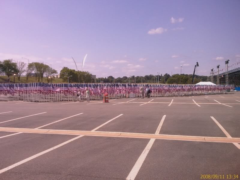
I was in Crystal City for some business yesterday, and afterward went over to the Pentagon.

Adjoining the dedication area, a sea of flags...


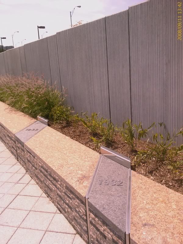
Each step in the wall, representing the age of one of the victims...


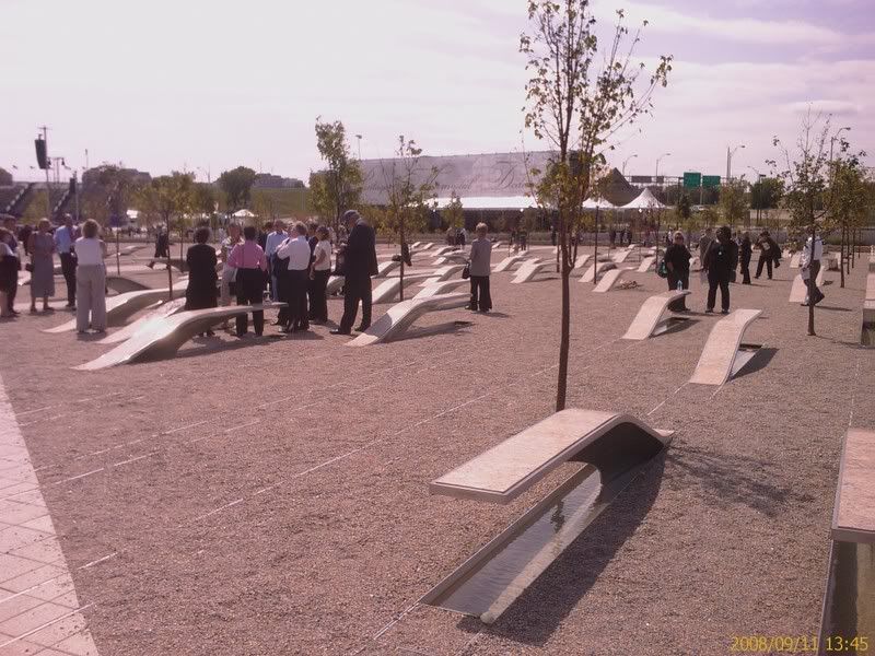
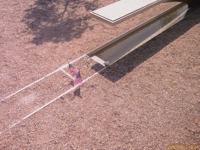
Each bench, representing one of those 184 who died here that day...


to the youngest of the young, a mere 3 years old...


The bell that tolled when the names were read out...


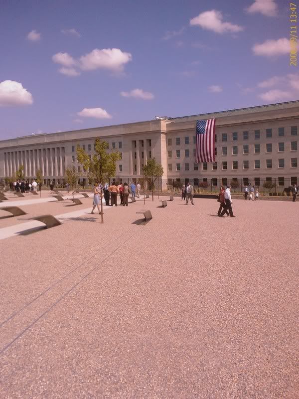
A flag draped where the plane impacted...

I prayed for all those who lost their lives on 9/11

I prayed for all those who have lost their lives since

I prayed for the surviving friends, family and colleagues

I prayed for our children, for our nation, and for our future

The Lost Maps of Nagaland

Posted by Dave Smith On 9/10/2008 06:58:00 PM 0 comments


The Times of India brings a story, speaking to the necessity of preserving maps and records dealing with boundaries - apparently the official maps depicting the boundary of the Indian state of Nagaland have gone completely missing.

Nagaland is a hill state in the foothills of the Himalayas, located in the far northeast of India, adjoining the Indian states of Assam, Arunachal Pradesh and Manipur, and bordering Myanmar (formerly Burma) to the east.

From the article,


The government has lost all "original documents" — comprising details of boundaries — of Nagaland, in a glaring instance of callous handling of vital public documents.

The Union home ministry and the Assam government, which originally kept the records of Nagaland, do not even have the valid "map" of the state which ironically is in the throes of violence sparked by the demand to carve out Greater Nagaland by extending the existing boundaries of the state.

The matter came as a shock to home ministry officials when it was brought to light for the first time by Nagaland during its submission before the Local Commission on the Assam-Nagaland Border here last week.

In response to the commission's direction to submit before it the original documents of the state to settle boundary disputes, Nagaland said it was not in a position to give the written statement unless "its original documents which were purportedly lost by Assam" were returned.
At present, it looks like some of the details of the boundary will have to be recreated from surveys and whatever remaining documentation can be salvaged. The region has not been without its share of historic boundary disputes.

Search