I posted about HostGIS for Linux server-based GIS the other day... Nice canned distribution, but if you want flexibility or desktop apps, you may want to try some other goodies. I am still working my way up to the whole tilecache/OpenLayers thing... I have my own AJAX WMS client that I wrote, but want to look at doing some interesting things with tile servers and some open-source backend stacks.
At any rate, tempting fate again, I decided to give Ubuntu a try, as folks were raving about Ubuntu 'dapper' (6.06).
I downloaded Ubuntu 6.10 ('edgy') and fired the ISO up in Virtual PC 2007, but found that I only got to a scrambled screen when trying to do anything with it.
Not to fear... The fix:
- At the boot screen, press F4 and select something reasonable that ISN'T in 24-bit color. I chose 800x600x16. I selected "Safe Graphics Mode" as well.
- Let Ubuntu boot up from the ISO. You still will end up with a thoroughly scrambled X screen...

- But don't panic, and don't try clicking on anything or letting the VPC session capture the mouse, you will be easily able to get a console session by pressing CTRL-ALT-F1. You should now see a console session with a prompt: ubuntu@ubuntu~$
- Enter sudo nano /etc/X11/xorg.conf - this will open the X configuration in a text editor.
- Scroll or page down untill you get to the "screen" section. You will see the default depth is set to 24 - change DefaultDepth to 16
- Enter Ctrl-O to save, answer y to save the changes, and then enter Ctrl-X to exit the text editor. This should put you back at the shell prompt.
- Enter sudo telinit 1 and wait for it to process and return to a shell prompt: root@ubuntu.
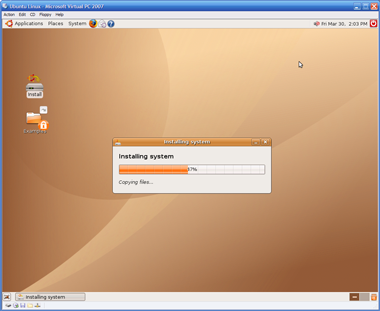
- Enter telinit 5 and the X session will return, and voila, beatiful and without being scrambled. You should be able to click on Install and go on your merry way from here on out.
- So now what? Where do I get those great Linux GIS goodies? Right from the get-go you should be able to go to Applications->Add/Remove and add in Quantum GIS (qgis).
- For more apps, you can use the Synaptics Package Manager. Go into System->Administration->Synaptics Package Manager and add some of the repositories back in and hit "Reload" and then try searching. So far, I have been playing with desktop tools - GRASS, Thuban and QGIS. All quite painless to load using the package manager.

I am certainly no Linux guru, but was nonetheless able to get this environment up and running in Virtual PC in about an hour and a half. If you're mainly a Windows guy like me, you now no longer have much of an excuse to not try these out.


Nice! I will certainly give it a try. I was just messing around with the QEMU virtual machine and all sorts of Linux distros with GIS apps. QEMU works fine and so does Virtualbox, but I am having trouble finding a way to share folders between the virtual hard drive and the real drive of my PC. I think Virtual PC does just that and I will investigate more on the subject.
By the way, I've had success lately running Knoppix 5.1.1 on the CD and install Grass 6.2 and QGIS 0.8 via Synaptic. Before rebooting your PC, you create a persistent HOME directory on the harddrive so you will be able to recall the installed apps. And if you save your configuration on the hardrive, you can recall the apps installed via the KLIK system (http://klik.atekon.de/). They have GRASS 6.0 and QGIS 0.6. And if you don't like running Linux on the CD, you can install it on a pendrive (http://www.pendrivelinux.com/), wich is handy if your PC can boot on a USB port. Also, Knoppix 5.1.1 has the latest JAVA version that allows you to install GIS apps like "OpenJump", "Udig" or "Landserf". That is one way to use pendrive, another one would be to install a virtual machine on it. Hoping this adds perspectives to the discussion.
Works Great with Mint !!!
Thanks a lot
Bastel
You can also try this ready to use GIS Virtal Machine: www.gisvm.com
Ricardo