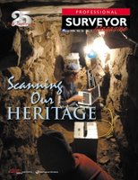
 Catching up on a backlog of mail and other things that have been sitting around - I just read my March '06 edition of Professional Surveyor, and enjoyed a couple of articles - their theme in this edition, "Scanning our Heritage" combines a couple of things that I enjoy - surveying and archaeology.
 Laser Scanning and Archaeology: One article highlights the application of laser scanning in creating detailed records and models of archaeological sites. I think this is a wonderful application of the technology, as it's still an unfortunate truth that once sites are discovered, even after hundreds and thousands of years of protection by simply being lost, they tend to rapidly deteriorate due to intentional vandalism and looting, or even wear and tear due to well-intentioned tourism.
Additionally, it allows subterranean features to be move effectively mapped, and allows modeling and analysis to try and better understand ancient cultures. Furthermore, the point clouds and photographic values that are collected with modern laser scanning solutions allow three-dimensional virtual models to be created, allowing greater options for allowing virtual visitors to do a walkthrough of the site without any harm to the actual site.
Surveyors and Metadata: There was also an article in this issue discussing metadata, with contrasting opinions from a surveyor's viewpoint versus a GIS professional's perspective. The surveyor's opinion is that the typical surveyor's plat contains the metadata up front, in the title block and notes. On the other hand, he makes issue of the GIS not having this metadata up-front. Yes, but... While the surveyor's boundary may have known accuracy in terms of closure, this is many times not disclosed specifically, and many times coordinate system is likewise not disclosed. Surveyors tend to be very adverse to publishing coordinates. Additionally, while the surveyor may be comfortable with the metadata aspects that he does describe in his title block and other notes and disclosures, he must defer to the constraints of other data that he may incorporate into his plat, such as FEMA flood zones (as opposed to physically determined flood zones), NWI wetlands (as opposed to physically located wetlands), soils or other data which is typically overlaid (with no indication of accuracy estimation).
From my more recent perspective working in large federal enterprises with many autonomous components, metadata is certainly a huge issue. In many instances the metadata itself may not exist for many datasets, or the metadata that does exist may be of poor quality. Finding metadata can be an issue if it does exist. Sometimes datasets are dynamic, with continuous updates which may not be reflected in the metadata (such as collection date, method of collection and collection accuracy), which may undermine the data. Or, in an example given about emergency response, data may give false negatives or false positives, which may lead to loss of life and/or property.
At any rate, data should be better than no data, and data or metadata or lack thereof should never be a complete substitute for domain expertise and common sense. In emergency response operations, metadata should serve to allow decisionmakers to make informed decisions about usefulness of data (for example avoidance or second-guessing of the outdated dataset). If properly documented, datasets can be evaluated and prioritized for use. From the surveying world to the GIS world, things get a little more complicated. Certainly surveyors understand the potential shortcomings of data if it does not meet locational criteria. And I think the upshot is that surveyors DO in a sense use metadata in their product as pointed out in the article, and for them to be able to convey their metadata along with their data into GIS and LIS systems (which are ultimately collaborative) will serve to provide continuous quality improvements.
Technorati tags:
3d, 911, applications, archaeology, collaboration, community, emergency response, exploration, federal, geo, gis, history, imagery, laser scanning, lidar, mapping, metadata, modeling, news, opinion, preservation, rescue, stewardship, surveying , technology, visualization


I would recommend checking out Cyark at www.cyark.org to see some excellent examples of laser archaeology in action, by a nonprofit dedicated to cultrual heritage documentation.
What I like in this article is about the laser scanning technology that archeologists use. Based on various reports, many lost cities had been easily mapped by archeologists through the use of the latest 3D laser scanning devices. As of this time, I am looking for Faro arm for sale as well as dependable laser scanning equipment for my design projects. I am inspired to delve more on the development of laser scanning technology.