Surveying, Mapping and GIS

Exploring all aspects of mapping and geography, from field data collection, to mapping and analysis, to integration, applications development and enterprise architecture...

  • Geospatial Technology, End to End...

    Exploring all aspects of mapping and geography, from field data collection, to mapping and analysis, to integration, applications development, enterprise architecture and policy

Extreme GPS

Posted by Dave Smith On 4/28/2006 03:14:00 PM 2 comments

I came across this great photo of an Antarctic GPS base station, posted by a blogger and Ph.D. student from the University of Kansas doing research on the Western Antarctic Ice Sheet... note the oddly tall setup complete with guy wires... Elsewhere there were some photos showing snowdrifts burying equipment- I can only speculate...


He also mentions he is doing work with Synthetic Aperture Radar and other imaging... This is the kind of work I would have liked to have been involved in at least once, in my younger days... I find I'm now getting older and wiser.

Our knowledge of this barren and remote world is becoming better and better, thanks to adventurous and intrepid souls like this...


Technorati tags:
, , , , , , , , , , , , , , , , ,

DGN support pulled from AutoCAD 2005 products?

Posted by Dave Smith On 4/27/2006 07:48:00 PM 0 comments

Angel Espinoza of KETIV posts that the Autodesk 2005 products are no longer going to be supported, due to legal issues surrounding support for MicroStation V8 DGNs. This involves licensing for a component that Autodesk doesn't own. Autodesk 2004 products are unaffected, and Autodesk 2006 products contain the component on a separate disk in the distribution. Evidently with 2007 forward, Autodesk will have their own component in place to provide this functionality. Both excellent products, each with its own strengths and weaknesses, however I have so, so many times in the past needed that crucial interoperability between them. For this I always turned to the Intergraph/Bentley products to do a push to Autodesk, as opposed to importing, and it appears I will have to continue to do so for another few years more.

Microstation v8 introduced excellent Autodesk support, including georeferenced images, font conversion and other great functionalities and features, and there has historically been a strong rivalry between these two giants... I suspect there may be more to this story...

On another level, it also brings to mind the ESRI/Data Interoperability Extension third party component issue...


Thanks go to R.K. McSwain of CAD Panacea who pointed Angel Espinoza's article out... he posts lots of great tips for the CAD community and has been a great resource over the years...


Technorati tags:
, , , , , , , , , , , , , , , , ,

Please Don't Eat The Daisies

Posted by Dave Smith On 4/27/2006 11:58:00 AM 1 comments


Have been getting our house ready to put it on the market this past month... I still have mixed feelings about it.

A few stories on the history of the house- This house is the house that author, playwright and songwriter Jean Collins Kerr (1923- 2003) grew up in. Kerr was the author of the acclaimed collection of stories "Please Don't Eat the Daisies", which later became a hit feature film of 1960 starring Doris Day and David Niven, and later also became a sitcom of the same name in the 1960s.
Additionally, Kerr authored the hit play "Mary, Mary", which was one of the longest-running Broadway comedies, with such stars as Debbie Reynolds, running with over 1500 performances. Bridget Jean Collins, by her birthname, was married to longtime New York critic Walter Kerr.


Technorati tags:
, , , , , , , , , , , , , , , , ,

Geospatial Portal Toolkit 3.0 coming soon...

Posted by Dave Smith On 4/21/2006 09:51:00 PM 0 comments

In a meeting yesterday, I heard word from some of the ESRI Portal folks that ESRI's Geospatial Portal Toolkit version 3.0 is going to be released on Monday...

Am looking forward to it.


Technorati tags:
, , , , , , , , , , , , , , , , , , , , , , , , , , , , ,

Geospatial Line of Business Debrief

Posted by Dave Smith On 4/19/2006 10:02:00 PM 2 comments

A few people have been asking me for a debrief on the Geospatial Line of Business meeting yesterday at the JW Marriott in DC. Mixed feelings on the event. With regard to Agency people, there were a few of the regular movers and shakers, and a considerable number of Agency geospatial figures completely absent - and of the ones I spoke to, I got a mixed response. Some were unconcerned and coolly interested, some very nervous, others very skeptical. There was an odd industry turnout - several of the key players that I often work with in the rarified air were there, but others conspicuously absent. Their response was similarly mixed. Sure, lots of "what's in it for us?" But many doubts and trepidations.

My own key concern is that Geospatial business is horizontal, as opposed to vertical. I also had some not insubstantial doubt that the task at hand and its full ramifications was fully grasped by those responsible for this endeavor.

With regard to the meeting itself, I unfortunately missed part of the first section - I unfortunately got in a minor collision on I-270 on the way down. Two cars behind, a driver failed to notice the slowdown in morning rush hour traffic and rammed an Acura RSX into the backend of my workhorse Subaru. Fortunately nobody hurt, I was able to get cool heads to prevail over the definite rage potential, and everyone was able to get the information they needed to deal with this another way, on another day.

Fortunately I didn't miss much of the meeting. The initial presentation mainly was a rehash of the PowerPoint that I presented in my last post. This was followed by Q&A session. There were many questions, but only sketchy answers. There were several questions on what the resultant direction would be - a samping:

  • Whether a Center of Excellence approach would be taken - the answer to this one was that they had looked at this, and it held some good low-hanging fruit, but that it was not entirely satisfactory and wouldn't strictly be emulated
  • What kind of approach or form of acquisition would be taken, such as a specific contract vehicle - no decision yet
  • Minority business participation, et cetera - will be a factor
  • Sponsorship - sustainability would be key

Ultimately they were trying to stress goals of business process re-engineering, standardization, sharing, and culture change. Lofty goals. But little in terms of approach - which is the purpose of the RFI. Interoperability was indicated to be a key driver.

There were also some questions submitted, but unanswered -

  • What exactly do you mean by "geospatial" - traditional GIS or anything with a geo-component, such as address databases, lat/long values in a database, or locational references...?

They did recognize the need for many areas of Agency geobusiness to continue in place even with consolidation. They also indicated that the results will show up in the President's Budget submission for 2008 - keep your eyes peeled next February.

They do promise to post the questions and answers online. The formal Q/A period goes until 4/21/06. Following this, read the RFI closely, read closely the Vision, Goals, and Objectives section, and provide a best response. There will be limited ability to assess a huge volume of responses, so if possible try to consolidate responses with others, such as helping the agencies, industry/nonprofit organizations or joint responses by the major private sector players. I had already intended to respond and have already been contacted by a couple of key people... I may have parts of my response feeding into others' response.

They are providing a template and some guidance - they are allowing an additional 20 pages to be submitted, to bring the total to 30 pages, not including cover and TOC. Submittal of current best practices is encouraged, with Agency approval.

The current point for dissemination of information is here: http://www.whitehouse.gov/omb/egov/c-6-8-glob.html

Whether or not this comes to fruition, this is definitely still a very big deal... And it IS most definitely about consolidation and budget cuts. "No further expenditures on existing business will be made."


Technorati tags:
, , , , , , , , , , , , , , , , , , , , , , , ,

Geospatial Line of Business

Posted by Dave Smith On 4/17/2006 09:58:00 AM 0 comments


Tomorrow I'm going to try and attend the Geospatial Line of Business session in DC. This is rapidly approaching and rapidly becoming a huge issue with many of the folks I work with in the Agencies. Truly, this could be one of the biggest shakeups in Geobusiness currently going on in Federal governments. Essentially, the intent and implication is consolidation of Geospatial activities across agencies. Agencies which are inefficient or ineffective at supporting an identified Line of Business may find themselves no longer engaged in that Line of Business, to have that work subsumed by a more capable Agency. What is a Line of Business? In most instances, it is a vertical sector of the Agency's business. However, in some instances, it is a horizontal sector, such as Geospatial business.

The intent is in improving efficiency and effectiveness, and in raising the bar to provide geospatial centers of excellence in government. The potential upside of this is improved interoperability and a breaking down of historical stovepipes. The potential downside is that it may rip the guts out of some agencies and introduce a new layer of bureaucratic abstraction.

Care must be taken...

The FBO notification can be found here: http://www2.fbo.gov/spg/GSA/V/VC/GSV06PD00089/listing.html

Some additional supporting documents and items of interest can be found here:

I'm hoping to get together with other movers and shakers there... I am definitely interested in tracking this, working on it and providing input wherever possible, particularly as I have already been engaged in Agency-wide Geospatial segment and Enterprise Architecture work since last June. I have a good idea of what opportunities and pitfalls may be encountered.


Technorati tags:
, , , , , , , , , , , , , , , , , , , , , , , ,

Happy Easter

Posted by Dave Smith On 4/16/2006 08:30:00 AM 0 comments


A Happy Easter and A Happy Passover!


Live Local Streetscapes

Posted by Dave Smith On 4/13/2006 07:16:00 PM 1 comments

As I have been playing around with Virtual Earth / Live Local and its APIs recently, I came across this interesting technology preview: http://preview.local.live.com/ - what this site presents is street-level photos corresponding with a given location in Live Local, taken from a roving camera van outfitted with an array of cameras and GPS.

The idea isn't entirely new- here in Pennsylvania our DOT has an online VideoLog that is linked to a web-based GIS application: http://www.dot7.state.pa.us/ividlog/video_locate.asp - it provides front, rightward and leftward photos. What amazes me with the Live Local implementation is that they have significantly more density with respect to the distance interval between photos.

Personally, I could do without the cutesey race car cockpit thing the Live Local team has going on... but the navigation and ability to turn and look to the side is interesting.

On another note, Rick Hallihan reveals a peek, caught in a picture window, of the roving van hard at work for Microsoft on his blog:


If you see an odd-looking van running around in your neighborhood, say CHEESE... You definitely won't miss PennDOT's van:


Technorati tags:
, , , , , , , , , , , , , , , ,

Geospatial One Stop Wins Award

Posted by Dave Smith On 4/13/2006 05:14:00 PM 0 comments

GeoCommunity Spatial News reports that the Geospatial One Stop won an award via Excellence.Gov. Cited was support for Katrina and Rita. Some of you will lavish your praise and congratulations on GOS and ESRI, while I know others of you may have mileage that varies...

I do congratulate ESRI and the GOS team - but while I think GOS is going in the right direction, and has become a vital piece of infrastructure, I'm not sure it's quite there yet.


Technorati tags:
, , , , , , , , , , , , , , , , , , , , ,

Microsoft and Spatial Databases?

Posted by Dave Smith On 4/10/2006 05:18:00 PM 0 comments

Some signs that Microsoft is trying to catch up and seeing the importance of geospatial support- Paul Flessner, Microsoft senior Vice President of Data and Storage Platforms touched on it in CRN recently - From the CRN article:

Flessner expanded on the company's data-and-storage vision, saying that the data store of the future must handle sound and graphical data types as well as the more standard relational and non-relational text information.

"We've got to go past words and numbers and get to sounds and sights," he told CRN in an interview Thursday.

One problem is that "pattern matching is not there yet," Flessner said.

Microsoft's plan for a unified store to handle all these data types is still on, but timing is unclear. He expects more and more data--including satellite information-- to flow into stores from sensors and that will enable creation of richer applications.

"You will see an investment in spatial indexing, geometry libraries. I want to do a good job supporting ESRI and other geo-spatial guys and make a good
library available so if you can't afford those packages do good spatial analysis without them," Flessner said.

(
ESRI is a leading maker of geographic information systems and mapping software.)

When will that happen? The next four to six years, although he'd like to get more done "sooner rather than later."

At PDC last year, Microsoft Chairman Bill Gates said that the "unified store" vision, already promised and late, would come with the next SQL Server or "Katmai" release wave.


We shall see... They have a lot of catching up to do to get up to effectively compete with Oracle Spatial and PostGIS...


Technorati tags:
, , , , , , , , , , , , , , , , , , , , , , , ,

Nepal, Redux

Posted by Dave Smith On 4/10/2006 12:43:00 AM 2 comments

Following up on my previous post, there has been an unfortunate escalation in hostilities and tensions in Nepal... I had loosely been following the issues with Maoist rebels for a few years... clampdown on government and democracy by King Gyanendra a year ago, but now the resultant backlash of pro-democracy activists has fractured Nepal in yet another direction.


A number of articles are reporting that several protesters have been killed in clashes with government forces, and as many as 800 have been jailed over the past few days.

Truly unfortunate and disturbing... I'm hoping that an all-out civil war can be avoided. Certainly Gyanendra has a lot at stake, however much government reaction appears to have been ill-coordinated and heavy-handed.


Technorati tags:
, , , , ,

Virtual Earth...

Posted by Dave Smith On 4/09/2006 11:35:00 PM 3 comments

I spent part of the weekend toying with Virtual Earth and the somewhat underdocumented VE API. I'm currently looking for a good way to develop a way to replace an existing map interface that, while it's slick-looking and features interactive Flash, the base map is basically a static image- no scale dependent renderers, fixed text height and symbology, and the like. Add to this the current map has been decoupled from any meaningful coordinate system. Having not found any solid Flash-based alternatives that I can put my hands on, and though I like SVG, it introduces the issue of plugin support. Finally, I had been looking at the big three AJAX-oriented offerings.

I see that Schuyler Erle has also been evaluating these as well- with his Google Maps Hacks background, it's interesting to see his perspective. The things that I am still grappling with most are basic - I'd like to overlay my own polygon layer, and have the polygon symbology linked to a dynamic web service that updates once a minute.

Now I have seen some interesting things on the Google side - VGMap is one attempt to accomplish it, but the map behavior and quirks are still kind of rough...

But by far the most interesting thing I've come across is the Virtual Earth Shapefile Reader - it appears to use a web service that converts the .shp and sends it out as XML. The application can then call the web service and bring in the ESRI shapefile on the fly. It's close, but not quite, to what I need. But the feel of the map ends up quite nice.

If I'm missing any other offerings out there, or if anyone has suggestions, definitely drop me a line.


Technorati tags:
, , , , , , , , , , , , , , , , , , , , , , , , , , , , ,

Himalayan Surveying and Mapping

Posted by Dave Smith On 4/07/2006 09:40:00 PM 1 comments

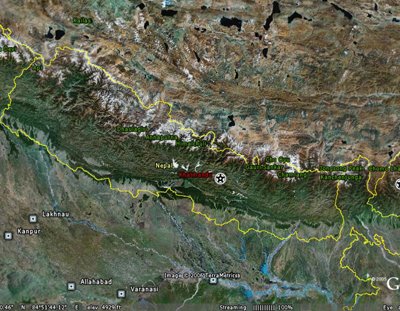
I found an interesting article on 'Zee News', which describes a forthcoming effort to remap the border between Nepal and Tibet. The 1,400 km border runs along the ruggedest parts of the Himalayas, from the area of Mount Everest and Kanchenjunga toward the Mountain Kingdom of Bhutan the east, through Annapurna and on toward Nanda Devi to the West in India.


The survey will be a joint effort, between the Chinese government and the Nepalese government. The Surveying and Mapping Bureau of Shaanxi Province will be leading the Chinese effort, with additional Tibetan assets based out of Lhasa, and counterparts from Nepal will join them to form five survey teams. They plan to retrace the boundary using GPS, and to check and maintain the 98 boundary pillars and 79 markers that were placed by previous teams. The border was initially set by treaty in 1961, was first demarcated in 1963, and has been resurveyed in 1979 and 1988. The GPS data will be processed and GIS mapping will be developed from the data.

New Kerala further reports that the Chinese team left Lhasa a few days ago to meet up with the Nepalese contingent in Xigaze in Southern Tibet to begin work. Truly some of the world's most beautiful yet rugged territory. My prayers go out to them on this endeavor.


Technorati tags:
, , , , , , , , , , , , , , , ,

Interesting Find in Google Earth

Posted by Dave Smith On 4/01/2006 09:49:00 PM 0 comments

As a site that's getting some serious mileage on digg.com, Kevin Jarnot's blog reports an interesting find today on Google Earth...

On loading his kmz file, it takes me to that mysterious and secretive site in Nevada, otherwise known as Area 51, Dreamland, et cetera... This one is annotated 'We Have Visitors..."

We see a number of aircraft, including some unusual ones - note the circular one on the tarmac to the northeast of the F16s...

April Fools, and enjoy the cookout!

Search