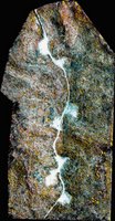
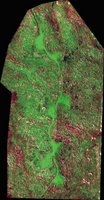
 Yesterday I got to see a live demo of a remarkable product, DIPEx, which was developed by DataStar, which is one of our teammates on the USEPA ITS-ESE contract. DIPEx leverages NASA's ELAS software for image processing by adding web-enabled Java GUIs and also by making the entire application accessible and extensible via OGC Web Services, complete with WSDLs for easy integration. The whole system is built on Open Source technology, running on Apache, with PostGIS on the backend.
 In the demo, they showed a number of features and functions, such as a full-featured web-based frontend to rival any ArcIMS-based application I have seen, with transactional WFS capabilities to edit vector data, then used the newly created vector to in turn initiate a workflow to modify an aerial image in raster and bring it back into the web view, with the multiple OGC-based vector and raster map services in various different map projections and other things going on.
Particularly given that their strength is in remote sensing imagery processing, these guys have some great things going on, and somehow have managed to fly under the radar with it. I'm hoping we can bring in their technology and capabilities to leverage some of what we are doing in our enterprise efforts...
Technorati tags:
aerial photography, analysis, applications, arcims, developer, earth observation, environment, esri, esri developer network, extensions, geo, geodetic, Geospatial, gis, gml, imagery, internet, interoperability, Java, mapping, NASA, ogc, open source, photogrammetry, programming, raster, RDBMS, remote sensing, satellite, service-oriented architecture, SOA, software, spatial, SQL, tools, web services, wfs, xml


0 Response for the " DIPEx Image Processing and Exploitation "
Post a Comment