Surveying, Mapping and GIS

Exploring all aspects of mapping and geography, from field data collection, to mapping and analysis, to integration, applications development and enterprise architecture...

  • Geospatial Technology, End to End...

    Exploring all aspects of mapping and geography, from field data collection, to mapping and analysis, to integration, applications development, enterprise architecture and policy

NGS to publish data in feet

Posted by Dave Smith On 2/26/2006 07:16:00 PM 0 comments

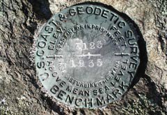
I will relay this message recently posted on the POB message board from Dave Doyle, Chief Geodetic Surveyor of the National Geodetic Survey


I was able to convince NGS management to approve a new policy concerning the publication of State Plane Coordinates in feet on both the conventional NGS data sheet, and the OPUS extended output. As soon as software changes can be made, NGS will begin providing feet in addition to meters for the 18 states that have NAD 83 legislation which specifically defines the conversion to either U.S. Survey Feet, or International Feet. These are: Arizona(I), Connecticut(US), Delaware(US), Florida(US), Georgia(US), Illinois(US), Indiana(US), Louisiana(US), Mississippi(US), Montana(I), New Hampshire(US), New York(US), North Dakota(I), Pennsylvania(US), Rhode Island(US), South Dakota(US), Virginia(US), Washington(US) and Wisconsin(US).

15 States currently have NAD 83 legislation, but it does not define a conversion to either U.S. Survey or International Feet. NGS will publish feet in these states if the following conditions are met:

1. An interested person, governmental agency or professional organization in the state/territory makes a request to publish a specific foot to the NGS Director.

2. The NGS Director assigns a technical coordinator to assist the requestor, to ensure appropriate state or territorial surveying, mapping and GIS agencies and organizations are contacted and are in consensus. These may include, but not be limited to:

a. Land Surveying Professional Association
b. Transportation Department
c. Office of Geographic Information
d. GIS professional association or consortium

3. An official written request is made to the NGS Director, signed by senior representatives of the requesting agencies and organizations as approved by the technical coordinator.

4. The technical coordinator drafts and publishes a Federal Register Notice (FRN) outlining the state or territory’s intent to publish SPCs in a specific foot. If no irresolvable comments are received within 30 days after the FRN publication, the technical coordinator will work with various NGS divisions (responsible for SPC publication) to ensure the conversion is implemented into appropriate NSRS products, services and tools.

These states are: Alaska, Idaho, Iowa, Kansas, Maine, Minnesota, Missouri, Nebraska, Nevada, New Jersey, Ohio, Utah, Vermont, West Virginia, and Wyoming. If anyone is interested in pursuing this issue an e-mail or telephone call to me will suffice for completion of Item 1 listed above.

The only states that do not have NAD 83 legislation are Alabama and Hawaii and NGS will publish meters only in those states until this legislation is adopted.
Overtaxed...

Posted by Dave Smith On 2/26/2006 07:13:00 PM 0 comments

Haven't posted in a bit - some health issues landed me in the hospital the week before last - fortunately nothing serious, probably just a bit overtaxed... Have been quite busy with a number of interesting projects, but I will have to pace myself a little better.

Galileo Blasted by British Drivers

Posted by Dave Smith On 2/12/2006 09:08:00 AM 0 comments

The Association of British Drivers has posted a scathing piece targeting Galileo, with ABD chairman Bryan Gregory saying "Galileo is not a light on the horizon, it is the entrance to an abyss."

While duly crediting some of the benefits of GPS and locational technology, the article looks upon Galileo in particular, as implemented by EU as yet another stealth tax, yet another way to have government monitoring where you go, who you go with, and so on.

The article states that Galileo is the primary mechanism planned for road tolling by the EU, with "car-hating" Britain to be first.

"The EU is already planning to use Galileo to enforce continental-wide road tolling, and the car-hating British government wants to be first. You won't be able to drive nywhere without the EU knowing where you are going, who you are travelling with, and what speed you are travelling at. They will be able to charge whatever they want. One journey, four lapses of concentration that take you slightly over the speed limit, and you'll be banned from driving."

The article further cites other "big brother" practices abroad, with Japanese law forbidding the sale of cellphones that aren't GPS-enabled from 2007 onward, and manufacturers being forced to fit all vehicles with GPS.

... And they were so concerned with liberating themselves from the "evil" yoke of US military - based GPS?


Technorati tags:
, , , , , , , , , , , , , ,

DIPEx Image Processing and Exploitation

Posted by Dave Smith On 2/11/2006 03:13:00 PM 0 comments

Yesterday I got to see a live demo of a remarkable product, DIPEx, which was developed by DataStar, which is one of our teammates on the USEPA ITS-ESE contract. DIPEx leverages NASA's ELAS software for image processing by adding web-enabled Java GUIs and also by making the entire application accessible and extensible via OGC Web Services, complete with WSDLs for easy integration. The whole system is built on Open Source technology, running on Apache, with PostGIS on the backend.

In the demo, they showed a number of features and functions, such as a full-featured web-based frontend to rival any ArcIMS-based application I have seen, with transactional WFS capabilities to edit vector data, then used the newly created vector to in turn initiate a workflow to modify an aerial image in raster and bring it back into the web view, with the multiple OGC-based vector and raster map services in various different map projections and other things going on.

Particularly given that their strength is in remote sensing imagery processing, these guys have some great things going on, and somehow have managed to fly under the radar with it. I'm hoping we can bring in their technology and capabilities to leverage some of what we are doing in our enterprise efforts...


Technorati tags:
, , , , , , , , , , , , , , , , , , , , , , , , , , , , , , , , , , , , ,

Architecture, MetaCarta and other stuff....

Posted by Dave Smith On 2/11/2006 08:57:00 AM 0 comments

Haven't posted in a few days, things have been very hectic. We serendipitously have synergy of many things coming together at once - an excellent opportunity to rearchitect a number of legacy GIS databases and applications for 2006, at the same time that new Federal Enterprise Architecture guidance and other technology items are arriving on the scene, such as enhanced support for OGC standards in the pipeline from Dr. Sharma and the Oracle Spatial team and from ESRI. I've been spending a lot of time over the last two weeks trying to go from high-level enterprise standpoint to solution architecture across over a dozen systems, identifying the gaps, overlaps, and opportunities for standardization, FEA realignment and reusability. This also ties in well with work I'm doing for the USEPA Geospatial Metadata/Data/Services Architecture project I've been involved in since the fall.

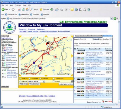
Apart from that, plenty of exposure on a few other things- the 2006 MetaCarta Public Sector User's Group meeting at Tyson's Corner on the 16th is going to highlight one of our recent successes in integrating MetaCarta technology into the USEPA "Window To My Environment" application. I'm hoping to attend for at least part of it.

For anyone interested in attending the 2006 MetaCarta Public Sector UG, I think they may still have some (very limited) space remaining... Details are available on the MetaCarta website, or you can contact my good friend John-Henry Gross, 703-629-0972. I note that one of the highlights is that John-Henry will be discussing the new GTS Analyst feature, as well as some enhancements in the GIS Connector and other additions and improvements.

This WME/MetaCarta application is also going to be featured at the upcoming USEPA Contractor Forum as well...


Technorati tags:
, , , , , , , , , , , , , , , , , , , , , , , , , , , , , , , ,

Virtual Campus session on FEMA tools

Posted by Dave Smith On 2/03/2006 11:01:00 PM 0 comments

Directions Magazine has an article about a free ESRI Virtual Campus session about FEMA's HAZUS tool for use in ArcGIS in disaster management and mitigation applications. I certainly plan to check it out- in light of some of the recent Lessons Learned sessions we have been going through with federal agencies on GIS support for Katrina and Rita, it will be good to see other tools and options for emergency response.

At the FedUC conference, I did sit in on the session put on by Matt Felton of Towson University on how they are working with the state of Maryland, discussing their MEGIN and EMMA tools - MEGIN provides a secure interagency (state, regional and local) portal for access to geospatial data and WebEOC, and EMMA is the GIS viewer component of this platform. Some of the issues encountered that we were aware of is that some tools like WebEOC couldn't peacefully coexist with secure firewalled networks, and robust identity management had been difficult to achieve in a large and distributed enterprise. There were a number of other sessions which I would have liked to have sat in on at FedUC.


Technorati tags:
, , , , , , , , , , , , , , , , , , , ,

Back from FedUC

Posted by Dave Smith On 2/02/2006 10:25:00 PM 0 comments

Just got home from Washington DC, but it was an extremely busy week with one meeting after another all around the beltway- Rumor is still circulating about us being asked to attend at the State of the Union address... Well, one sad truth is that I ultimately only got to spend about three hours at the ESRI FedUC conference yesterday afternoon. One business development opportunity after another this week - many interesting things brewing.

Got to see a bunch of familiar faces- my friends from the EPA geospatial world were present- Dave Wolf and Dave Catlin of the EPA Internet Geoservices team, Kevin Kirby, point man for the Locational Data Improvement and other initiatives, and Wendy Blake-Coleman, who I've been working with on next-generation architecture for EPA geospatial business. I understand GIO Brenda Smith was slated to speak this morning- unfortunately I was tied up in a meeting to discuss a couple of upcoming DOD projects.

My friends from the Metacarta crew had a nice hospitality room, they want me to get together with their marketing folks to promote our recent successess with integrating their products in EPA. They have a few new tools in the works for their DOD and Intel customers, including an analyst function that includes customizable alert features via e-mail and other notifications, as well as RSS feeds, to provide instant updates when a match of specific geographic and keyword parameters is made- they also have several other new things out and in the process of coming out.

There was a contingent of fellow Pennsylvanians present- PA GIS coordinator Jim Knudson and his deputy Stacy White were there- although I unfortunately didn't get to see Jim, I did say hello to Stacy. I also saw GeoDecisions had a booth- and found out later, over a few beers with a friend from Lockheed-Martin that we have some mutual friends and potential collaborative projects brewing between our company, Lockheed and GeoDecisions. PA firm Michael Baker was also present - who I did business with years back, though manned by the Virginia contingent. Here was Bob Austin, who has also recently been brought into our Integrated Project Team for the EPA Geospatial Data, Metadata and Services Architecture project I have been working on with Wendy Blake-Coleman. It's exciting to see so much synergy between different pieces of different projects, customers and agencies, and past and present partners of ours suddenly converging in many interesting ways.

Well, I've got much to catch up on and much to digest- was a very interesting week, even though most of it was outside of the FedUC context. Certainly there will be more bits and pieces to post as I get caught up tomorrow and over the weekend.

Search