I haven't posted in a few weeks - been busy, and that's a good thing in this instance...
 Gratefully, things are finally starting to sort themselves out on the move...
Currently I am gearing up to head south to the Savannah International Trade and Convention Center in Georgia, to attend the EPA Environmental Information Symposium from December 5th to December 7th. This afternoon, I just finished putting together a PowerPoint for a brief talk on ingestion, analysis and mapping of unstructured data during one of the sessions.
We are also hoping to put on a live demo - using MetaCarta web services integrated with ArcIMS and ASP-based Window to My Environment - we are also currently in the midst of a redesign for the infrastructure of Window to My Environment and EnviroMapper applications, to look at good stuff like integrating the application into the Oracle Portal environment, ESRI Geospatial Portal Toolkit, Service-Oriented Architecture, and Reusable Components.
Along the MetaCarta lines, there are a few other interesting tools emerging, with potential for geotagging - Aerotext, which I discussed previously, and SRA's NetOwl, developed for the CIA - which I may get an opportunity to see next week.
I had a great time in Las Vegas last time, so I am looking forward to this event as well...

The imponderable annoyance du jour: Verizon Online. So we moved across town in anticipation of our pending sale... everything has gone pretty smoothly so far, all things considered. On the 13th, we switched the phone line over to the other house. Same number, same town, just a couple of miles southeast.
Verizon says, 5-8 day wait time to switch the DSL over. What the.... I already have the DSL modem, the account is already set up, et cetera, et cetera, et cetera.... many reasons why this should be a very simple administrative thing for Verizon.
GRRR.... I tell them that the wait is unacceptable. "Um, sir, that's the ready date that comes up in the system." GRRR... "you can use Verizon Online via dial-up in the meantime for free".
Oh, gee.
Meanwhile, Verizon Online dial-up doesn't recognize my username and password.
Another call to Verizon tech support and they say "Mr. Smith, our records show you don't have dial-up". GRRRR. So they set me up with temporary access.
Temporary access doesn't work either.
Meanwhile, I hook the DSL modem up, and it detects DSL, 864kbps downstream, 150kbps upstream.
BUT, it's unable to logon.
Verizon Online dial-up folks tell me dial-up won't work if this is the case.
Well, anyways, in the meanwhile the Verizon Online DSL folks call and tell us that it won't be ready until the 27th. Yea, half a month. No explanation.... just going to take that long.
Add to this, all of the times I tried dialing up their customer service department and navigating their voice response system - to have it a.) not recognize what I was saying (particularly considering that with as much traveling as I have done, I have as close to a non-accent as is possible in American English), and b.) getting dropped after waiting 5 or more minutes on the call... AND of course, "can you give me the phone number you are calling about" AFTER their system has already confirmed this?
Well, the windows are fogged up from the steam escaping from my ears... Time to grab a cold beer and try to relax.
 Been hoisting furniture, packing, unpacking... 45, yes FORTY-FIVE boxes of books from my office alone - Surveying, Civil Engineering, Law, Philosophy, History, GIS, .NET, Java, XML, Web Services, Environmental Science, Stormwater, Wetlands, Limnology, Soil Science, Transportation, Geography... That's just the books. Add to this, an antique map table and a massive desk - old mahogany antiques on a grand scale that no longer exists... Several computers, servers, routers, hubs, monitors, et cetera...
Well, that about sums up one room of my house. Now scale that up by nearly 4,000 square feet. Living on leeched neighborhood broadband until my own gets restored, along with a lot of other seat-of-the-pants flying this week.
So... We do have a closing date on the Jean Kerr house... I don't want to curse myself by posting any more details, but it is a good thing.
Now I must sit and rest the aches...
 The folks at Safe Software have joined the GeoBlogging scene - They sent out the following:
Announcing Safe Software's Blog
We are pleased to inform
you that Safe Software now maintains a weblog (blog) at spatial-etl.blogspot.com.
We plan to use our blog to:
- keep you informed by posting breaking news about product updates
- share our insights into developments in our rapidly-evolving industry
- post information on upcoming Safe Software eventsdirect you to podcasts and
articles prepared by Safe staff- point to slide presentations from conferences and workshops
- surprise you every so often with a light-hearted posting, just to keep
things lively.We hope you'll visit our blog, and check back often.
They have been a good group of people to work with - they were very responsive and knowledgeable for us during Katrina for some of our ETL needs, particularly their wizard Juan Chu Chow.
We also hope to be working with them again on one of our EPA projects in the near future - after all, while there is no "true" ETL for spatial data yet, but.... the Safe folks have thus far come much closer than anyone, hands down.
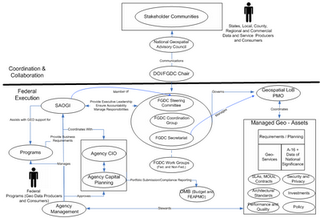
Geo term du jour: SAOGI 'say•yogi' - "Senior Agency Official for Geospatial Information". Per FGDC,
The SAOGI will oversee, coordinate, and facilitate the agency's implementation of the geospatial-related policies, directives, requirements, and activities.
Key Roles & Responsibilities
Though I have been playing with code for close to 30 of my 40 years, I have always considered myself far more of a hack than any kind of disciplined programmer with a formal background, as my focus has always been one of the science and engineering professional, oriented toward solving specific domain issues, such as surveying, hydrology, environmental issues, transportation, and the like - and most recently I have been thrust into Enterprise Architecture mainly due to my understanding of both the business and IT side of geobusiness - yet in terms of coding I have always managed to get some quick and often unique results in my forays into the programming world, and I am once again quite pleased tonight. One of the things I was ruminating on a few days ago is the possibility of using ASPMap as a web service, and calling the service via JavaScript and populating the view via AJAX. Better yet, extending ASPMap to serve WMS requests, but I am getting ahead of myself... Yesterday I sat down and managed to build a web service around ASPMap (MS Visual Studio 2005 ASP.NET and .NET Framework 2.0), and as its primary functionality, it currently accepts bounding box and image size as parameters - layers and other settings will be forthcoming. Essentially the service renders the image and then dumps it out as a file - I used a milliseconds function in JavaScript to provide the unique identifier (no cookies, no viewstate or other serverside issues - all these are managed by JavaScript in the browser)
I then tried Matteo Cassati's Soap Client for JavaScript and then used the DOM to insert the image (with the known URL) into the view. I still want to better understand what I can and can't do with the return types, but that will come...
I then built some JavaScript functions to pan, zoom, et cetera, as well as a one to resize the image (with a new call) whenever the browser is resized (note the views here are full-screen, although with the banner blurred out to protect potential customer). The map view will be dynamic, trying to maximize screen real-estate. I also want to do some nice AJAX magic with collapsing/resizable map controls and query panels (the navigation/toolbar shown in the upper right is already enabled in this fashion)... The next thought actually ties back to my original thought in a way... Having already built all the infrastructure, what would be involved in hitting an OGC WMS service and bringing in the image? Not much at all, just a little magic trying to navigate how JavaScript deals with ampersands in constructing strings. An hour and a half tonight, and my WMS client is also done - you see here a classic image from NASA JPL (MODIS Mosaic) - there is still much more tweaking and functionality to be developed, but for a mere weekend's work for a hack like me, I am quite pleased with the results.
Considering I managed to fit all of this in during a hectic weekend, in the midst of preparing for a move (with painting and carpeting the new house, boxing things up at the old house, et cetera) and driving 4 hours to Washington, DC tonight for meetings tomorrow, I am frankly amazed that I managed to get this done so quickly.
I am very much looking forward to what the next few months will bring. My intent is to build some very robust and reusable infrastructure. What I have started here will become universal throughout future applications, and the beauty of it is that I will be able to snap in whatever mapping infrastructure is available, whether ArcIMS or ArcGIS Server, ASPMap, WMS Servers, or anything else I can either build a Web Service wrapper around or convert to WMS outright.
 Haven't posted in a while - have had a number of projects keeping me busy. First and foremost is working on getting ready to move to our other house... some painting, carpeting, and other work going on... Add to this several other things that have been consuming bandwidth, such as some reorganizing at our office, a new computer (that still needs many things set up on it) and the upcoming elections...
But now the fun stuff - getting ready to embark on some upcoming web mapping projects.
Here, the dilemma was in how much of our project dollars we wanted to burn on mapping infrastructure. Customers were having a difficult time swallowing the 5-digit price tags and other baggage associated with ESRI products. As an alternative, a friend suggested ASPMap - which is a web mapping component that supports ASP and ASP.NET developed by VDS Technology.
I have been playing with the demo version, and am quite thrilled. At $449, it does quite a bit of what I want - multiple map layers, supporting ESRI Shapefiles, GeoTIFF, ECW; adjustable transparency of layers, scale-dependent renderers, thematic mapping, and ROUTING capability. My concern was in how robust the product is... I currently have a test application which has 6 layers and an ECW image, and the largest of the layers is 22MB, with a 19MB database file attached to it. Prior to loading, I generated a spatial index for the layer out of concern for speed, and after noting in the ASPMap documentation that it would use the indexes - the map images load up in milliseconds.
Great stuff... Now to see if I can also get some AJAX functionality working with the product. I am currently looking at msCross, which seeks to add Google-style AJAX functionality, along with WMS and WFS support to UMN Mapserver - can the same be done with ASPMap and other products?
 In a recent blog post, Matthew Perry (PerryGeo) lashed out, reaffirming his reluctance to rely on spatial web services such as WMS. Given that the NASA JPL WMS server was evidently down, many users and applications which consume the JPL WMS services also had issues and outages.
Yes, certainly any distributed system can face issues with downtime, or worse yet, with services going away altogether. How to remedy this?
As a service provider, one of the things that providers can work toward is providing the users with some information with which the users can make informed decisions. Essentially, manage their expectations. In some arenas, particularly where commercial services are offered, this should be in the form of a formalized Service Level Agreement (SLA), as part of the contract.
Here, the provider can outline the parameters of the content itself (such as FGDC-compliant metadata, including accuracy, source, et cetera), and beyond each iterative data snapshot, provide information on data latency (how current is the data?) and how often will it be refreshed? From an infrastructure standpoint, some hosting parameters should also be set forth, such as availability and reliability - to set the ground rules on what kind of downtime is acceptable or unacceptable, what kind of data throughput can be expected, and so on.
This becomes a bit more of a challenge in other arenas, such as agencies where external budgetary, legislative and other pressures may impact how well an organization can support published services.
But nonetheless, if an agency is forthcoming and up-front with these constraints at the outset, it can allow its' users and stakeholders to plan and prepare accordingly - by writing their code to handle outages appropriately, by utilizing alternative services, and so on. It also can lead toward consolidation, augmentation, replication of valued services as external users and stakeholders lobby for support (via legislative initiative and budget) for these services. An agency might not be able to provide formalized parameters as a commercial service would be expected to, however providing users with some basic insight will go a long way.
As organizations gradually move more and more toward Service Oriented Architecture, and as variegated Web Services appear right and left, and increasingly become available lights-out, via a simple URL, it becomes increasingly easy to connect to and consume these services - however that ease of access and use is ultimately bound to cause some disappointment, when things change down the road. I suggest and recommend SLAs and service metadata toward managing expectations.
 Scott Guthrie discusses the planned Microsoft AJAX roadmap, for providing improved "ATLAS" support for developers who want to pursue robust Asynchronous JavaScript and XML in their ASP.NET applications - it comes with multiple pieces, which have now been officially named:
 I am loving some of the new additions to ArcGIS Desktop 9.2, and as a longtime user of packages like AutoCAD, I was frankly wondering why some of these enhancements didn't come along much sooner. With this, I tend to draw parallels - for example, the measuring pallette, though with welcome enhancements, still fell slightly short for me - the "measure area" tool doesn't provide much feedback with regard to which polygon was just measured. If there are multiple overlapping layers, there is no highlight to show the selected polygon, and no output to the results panel where the resultant area is displayed. Either of those would be a great touch for the ArcGIS Desktop team to add. Being able to selectively render the output as acres, hectares, and other units - very cool.
Linear / Polygon measuring - being able to snap to features is great - but again, what are we snapping to? In AutoCAD, the user can define his OSNAPs - for example endpoint, midpoint, intersection, perpendicular to, et cetera... These would be another great enhancement to the tool. Some of this is already implemented and supported when editing, why not latch onto that same functionality and leverage it for other tools?
Hopefully the ArcGIS Desktop team is listening, and hopefully many of those little technical usability enhancements like these, that have been in the CAD world for years will begin to make it into the ESRI fold as well.
I downloaded a copy of Solaris 10 the other day - I usually just got the CD images, but this time I selected the DVD image. Download went fine... but my surprise:
90 minutes to reconstitute the .iso image on a 3GHz P4, due to the compression algorithm used by Sun?
Wow.
After the last post, where I was venting some frustrations as I was trying to get the trip underway, one might not know what to expect from me regarding the remainder of the trip. Aside from having very limited internet connectivity - I did manage to break away from the NCEES Annual Meeting to take in some of the excellent scenery - here the only issue was my digital camera, which is getting to be 6 years old, and through various travels is showing signs of wear. I can't complain at all, though - I managed to capture over 200 photos, most of which I was able to upload to Flickr.
Some highlights: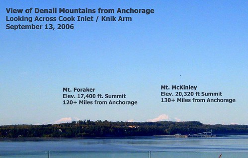
Actually being able to see Denali from Anchorage - over 130 miles away!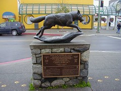
Iditarod monument in downtown Anchorage
Incredible fall colors in the Kenai Peninsula
Great wildlife... Bull Moose near Portage
Siberian Yupik dancers from the towns of Savoonga and Gambell, on St. Lawrence Island in the Bering Sea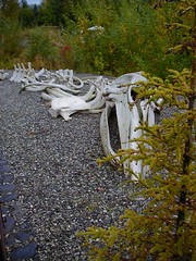
Juvenile Grey Whale Skeleton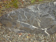
Alutiiq Petroglyphs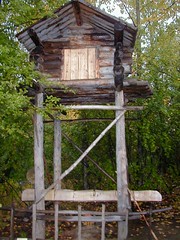
Athabaskan Food Store - this would be up on stilts, with the posts coated with bear grease to make it difficult for animals and other interlopers. The scent of bear grease would also keep the bear away.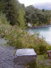
Campsite with tipi along Kenai Lake - near Cooper Landing
There are plenty more photos in my Alaska 2006 collection on Flickr - click here for my "Alaska 2006" photoset.
Some of the places I went - the Alaska Native Heritage Center, on the Glenn Highway north of Anchorage, the Alaska Wildlife Conservation Center, near Portage, Moose Pass, Sterling, Soldotna...
Some of the other highlights - the food was excellent - I had plenty of native halibut and salmon - grilled, smoked, and prepared many other ways, I did partake in the reindeer sausage and sampled many excellent local beers like Alaskan Amber. On the flight in, one of the bonuses was the incredible view of over a dozen glaciers along the coast, and on the flight out, we were presented with a spectacular view of the Northern Lights.
To anyone who ever has the opportunity to travel to Alaska, I highly recommend it. As with my last trip to Alaska, this one will have a lasting and rewarding memory. As the Inupiaq would do, to Alaska I say quyanaq!
Not quite the ordeal that Jeff Thurston had in travel, but some hiccups nonetheless…
Some frustrations of the flight – at the last minute they cancelled the first leg of my flight to message doesn’t provide any information on how to remedy things, just “SOL”.
Reasons cited: Weather. However, the weather in both Scranton and Philadelphia, are fine. So I check the airport site, and they still show it on schedule. I then check US Airways, and they show it cancelled… After calling them, I end up working my way through the automated system until I finally reach a human, and then end up getting transferred to someone else, because I’m beyond the contiguous 48 states – “International Flight”…
Anyways, I need to fly to Pittsburgh instead. The backstory here is that, although Wilkes-Barre/Scranton is called an “International” airport, the reality is that you still need to take a prop plane to a “real” airport like Pittsburgh…
Anyways, this seems sorted out. So I arrive at the airport well over an hour in advance – but have to wait quite a while at the check-in counter, for all the other folks who didn’t get the news about their Philly flight cancellation. Things go slooowly. Finally, I get to the counter, and my check-in process involves five minutes of tapping on the computer… thought that was already worked out.
So on to TSA. As a humorous note, I saw on the TSA website that while gels and liquids are prohibited, they say gel bras worn are OK. Must have had a few issues there, to get to the point… Anyways, I have some ornery jerk just ahead of me who refuses to take off his shoes… after some back-and-forth, they whisk him aside, he finally whips the shoes off for their X-ray machine. Slip-on penny loafers, no big deal. Meanwhile they are going over some 80-year-old woman and her 60-year-old daughter with Downs syndrome… Guys, I don’t think we have to worry about these two characters hijacking any planes.
Finally, by the time I get to the gate, they are already boarding. I don’t usually have delays anything like this. Who knew there could be such silly drama in little ole’ Scranton, PA.
Anyways, as I write this I am in Pittsburgh – finally some coffee, a bite to eat, and a little less grumpy. However, they don’t have WiFi… So now I am posting this from McCarran, Las Vegas.

I am looking forward to next week - I am traveling to Alaska for the week, to attend a conference as a Pennsylvania Delegate to the National Council of Examiners of Engineering and Surveying (NCEES).
This is their annual meeting - where among other things, the proposal of "B+30" for engineering licensure will be discussed. B+30 essentially describes an academic foundation of an accredited Bachelors' degree in Engineering, plus 30 additional credits or a Masters' degree. I am looking forward to the trip - it has been several years since I was last in Alaska, and I enjoyed it greatly last time.
Last time, I flew into Fairbanks, and traveled the length of the Parks Highway to Anchorage and back, went jetskiing on Nancy Lake, explored Denali, burning rolls of film capturing the National Geographic scenes of Grizzlies, Dall Sheep, Caribou and other flora and fauna... Also took an enjoyable riverboat trip on the Chena and Tanana rivers, (a memorable image is still the lazy swirling together of the white Tanana - with glacial silt from the Wrangell Mountains and Alaska Range to the north, next to the black Chena, stained from the peaty permafrost to the south)... I also got to meet Susan Butcher (Iditarod winner) at her homestead and see her dogs and quite a few other amazing things on that trip... This time, I will be staying in Anchorage and hope to see some of the sights, and perhaps get down into Kenai briefly.
Of course I plan to enjoy the local fare - in Fairbanks there was a salmon bake that I still remember quite fondly... 20 feet of massive salmon fillets, grilled outdoors over alder fires. And Alaska has some excellent local brews as well...
Though I am disappointed that the Fly By Night Club in Anchorage is closing... "Sleaziest Bar in Spenard" - They had an excellent blues band there last time - Maurice John Vaughn - and who could forget the various Spam delicacies and Budweiser surcharge.
Though it's partly a working trip, it will be fun, to say the least.
 The scrappad blog posts about a matrix of ArcWeb APIs that was recently published by ESRI - unfortunately the original link posted on scrappad is broken, but I was able to locate the document here:
http://support.esri.com/index.cfm?fa=knowledgebase.whitepapers.viewPaper&PID=20&MetaID=1183
The table lists functionalities, and if they are currently supported by SOAP, REST, OpenLS, J2ME, and JavaScript APIs. It is interesting to note that virtually everything is supported by SOAP, followed by JavaScript, with REST, OpenLS and J2ME bringing up the rear.
As things move forward, it will be interesting to see how these geospatial web services play with regard to BPEL, orchestration and other emerging SOA efforts.

I am quite happy to report that our firm was on a winning team for the GSA VETS GWAC, which was established as a contract vehicle for federal agencies whereby Service Disabled Veteran Owned Small Businesses can compete on federal contracts.
Per GSA:
This is a great win for us, and hopefully it will open a few more doors toward pursuing additional opportunities in the federal geospatial world.
The Veterans Technology Services (VETS) Governmentwide Acquisition Contract (GWAC) is a proposed competitive multiple award, indefinite-delivery indefinite-quantity contract designed to provide worldwide information technology solutions to federal agencies while strengthening opportunities in federal contracting for service-disabled veteran-owned small businesses.
 The New York Times reports on the results of Strong Angel III, which was an interagency exercise for emergency responders that just took place in San Diego. This training effort involved a mock virus outbreak, coupled with cyberterror attacks, which cut off phones, internet and power.
Initially, the ad-hoc wireless network that was established failed, due to overwhelmed circuits and overtaxed bandwidth however, through a systematic restarting of the network, segment by segment, the network was re-established.
One everything was finally up, data including imagery and mapping was able to be shared seamlessly, with participants using Google, Microsoft, ESRI, and Intergraph technologies. Apparently, one of the technologies utilized was Simple Sharing Extensions, which is standards-based, and built on RSS.
I am certain there will be many more take-homes from this exercise, which ultimately proved to be a success - I will certainly be one to check through their site: Strong Angel III.
 I hate to keep harping with my skepticism of Galileo's business model... The Space Review today echoes my own prior concerns about their business model, given the need to firewall behind encryption in order to succeed - and atop this, concerns about China pulling out as a Galileo partner and instead pursuing their own Compass project.
Where are things headed in technology? Harry Chen picked up on Gartner's updated Hype Cycle, which features their assessments and predictions for technology adoption. New to this year's chart are Ajax, folksonomies, and Wiki. Personally, I think standardizations, based on ISO, Marc, Dublin Core and other approaches beat the folksonomy, but it is interesting to see all of these technologies in a big picture, and to compare notes. I have some slightly differing opinions on some of these technologies. Further, it might be interesting to look at a similar diagram, as it pertains specifically to geospatial technologies, such as location-based services, temporal analysis, common operational picture, interoperability, wireless, web services, geoprocessing, BPEL and other areas...
In the diagrams, they show technologies passing through 5 major phases...
Tim Berners-Lee and Dan Connolly are posting about RDF and the Semantic Web - one of the particularly neat tools they are looking at is called Tabulator, which is a semantic web browser. Among the ways that data can be viewed, is as tables, calendars, or maps. In this instance, it looks that they are using a Google Maps interface, and it will be interesting to see how this project continues to unfold.
I have only played around with RDF, only scratching its' surface, but it seems that a whole new richness is being exposed, through RDF.
I ended up not bringing my regular digital cam for the trip, but nonetheless, did snap a handful pix with my digital camera... I uploaded them to a flickr photoset:
The flickr photoset is viewable here... I have a few others from around San Diego, which I might post to flickr later.
Still unwinding from the ESRI User Conference - I had meant to post during the conference but there just wasn't enough time, from the daily activities and parties after.
Now, I still have a few hours to kill in San Diego before my flight, and am finally taking it easy. The Conference was a lot of fun - Though being in that mode of hundreds of intense 5-minute conversations over the course of the day can tend to put one in an odd state of mind - by the end of that day, you can scarcely remember who you talked to, or about what... And too much going on, at a frenetic pace. I had to step out of quite a few sessions to support a few ongoing things with our federal customers, so it was definitely a working vacation...
At any rate, a lot of old friends, colleagues and adversaries at USDA, EPA, other agencies, as well as CSC, Perot Systems, Lockheed, Jim Knudson, my MetaCarta buddies, Chris Cappelli from ESRI and others from PA and elsewhere, as well as many excellent and interesting new contacts made, and as always a lot of excellent intel and takeaways - I did get a brief chance to talk to keynote speaker, Senator Bob Kerrey, now of the New School such as Kim Ollivier, who is the father of the New Zealand national Transverse Mercator grid, and some who I've known for years but never actually met, like Mike Binge - he and I have been on the same side, preaching the Surveying and GIS message for years, and often diametric opposites, busting each others' chops on political issues...
The biggest thing for me - some of my main customers were there... And though there's plenty of excellent showcasing and eyepopping demos, sometimes one has to put the brakes on and use a cautious and critical eye. We are currently in the midst of going from just ArcIMS in our shop to Geospatial Portal Toolkit and ArcGIS Server for Web development, (yay, great new toys!), but there are still some questions and concerns that linger, with regard to placing too much dependency on some of the more granular out-of-the-box ESRI pieces that these ship with, for map viewers, for instance - with developer ADFs not yet completely standardized and harmonized, not all versions of map viewers standardized, and the very distinct possibility in some instances of an ESRI update rollout breaking our apps where we have plugged them into our customizations.
The good news is that the new architecture I have been developing decouples components anyways, so I will be more able to plug in some robust ESRI pieces rather than reinvent the wheel, and this strategy also reduces potential breakage and/or makes the breaks much simpler to fix, and the second half-full glass is that a more standardized and harmonized ADF is coming coming, and not necessarily terribly far off. I think the ESRI team has come quite a ways.
So... on to ArcGIS Server...
 Tomorrow morning I'm boarding my flight to head out to San Diego for the 2006 ESRI User Conference - I am looking forward to getting away for a few days, and am looking forward to the conference. Quite a few friends and colleagues will be there once again... It will probably mostly be EPA-centric for me (you may find me helping out at their booth at several points), as a majority of my work is still focused on their projects. 85 people representing EPA, from program offices, to regions, to some of their contractors like CSC will be attending.
It's been a few years since I last went... I usually end up swamped with too many things on my plate, or with other competing events going on. So this time I end up hitting both FedUC and the regular UC in the same year. I am also expecting to see several of my other friends from MetaCarta and other companies and organizations there - and am also hoping to make some new friends and contacts.
Pennsylvania is currently in the process of pulling together its Geospatial Coordinating Council. This body will (hopefully) be modeled after some efforts that have been successful in North Carolina and other states with mature geospatial coordination efforts.
PRINTER'S NO. 4455
THE GENERAL ASSEMBLY OF PENNSYLVANIA
HOUSE BILL
No. 2871 Session of 2006
INTRODUCED BY FAIRCHILD, CAWLEY,
THOMAS, BELFANTI, CALTAGIRONE,
CAPPELLI, CLYMER, CREIGHTON, DeWEESE, MUSTIO,
MYERS, PALLONE,
PHILLIPS, RUBLEY, SATHER, SONNEY, STURLA, TIGUE
AND
YOUNGBLOOD, JUNE 30, 2006
REFERRED TO COMMITTEE ON INTERGOVERNMENTAL
AFFAIRS,
JUNE 30, 2006
AN ACT18 6405. Discretionary powers.
20060H2871B4455 - 1 -
1 6406. Reports.
2 6407. Creation and general powers of committees.
3 6408. Composition and duties of committees.
4 6409. Pennsylvania Mapping and Geospatial Technologies Fund.
5 § 6401. Short title of chapter.
6 This chapter shall be known and may be cited as the
7 Pennsylvania Geospatial Coordinating Council Act.
8 § 6402. Definitions.
9 The following words and phrases when used in this chapter
10 shall have the meanings given to them in this section unless the
11 context clearly indicates otherwise:
12 "Council." The Pennsylvania Geospatial Coordinating Council
13 established in section 6403 (relating to Pennsylvania Geospatial
14 Coordinating Council) as an agency independent of the executive
15 branch.
16 "Fund." The Pennsylvania Mapping and Geospatial Technologies
17 Fund established in section 6409 (relating to Pennsylvania
18 Mapping and Geospatial Technologies Fund).
19 § 6403. Pennsylvania Geospatial Coordinating Council.
20 (a) Establishment.--The Pennsylvania Geospatial Coordinating
21 Council is hereby established.
22 (b) Membership.--The council shall consist of up to 35
23 members who shall serve until the expiration of their terms,
24 membership or employment or until their successors are
25 appointed. The following persons shall serve on the council:
26 (1) The Secretary of Environmental Protection of the
27 Commonwealth.
28 (2) The Secretary of Conservation and Natural Resources
29 of the Commonwealth.
30 (3) The Secretary of Transportation of the Commonwealth.
20060H2871B4455 - 2 -
1 (4) The Director of the Pennsylvania Emergency
2 Management Agency.
3 (5) Three persons nominated by the Governor who shall be
4 appointed without the advice and consent of the Senate. The
5 persons nominated by the Governor shall be selected from
6 either the Governor's Office or other State agencies under
7 the Governor's jurisdiction and shall serve three-year terms.
8 (6) A designee of the President pro tempore of the
9 Senate who shall serve a three-year term.
10 (7) A designee of the Minority Leader of the Senate who
11 shall serve a three-year term.
12 (8) A designee of the Speaker of the House of
13 Representatives who shall serve a three-year term.
14 (9) A designee of the Minority Leader of the House of
15 Representatives who shall serve a three-year term.
16 (10) A designee of the Chief Justice of the Pennsylvania
17 Supreme Court who shall serve a three-year term.
18 (11) A designee of the Pennsylvania Historical and
19 Museum Commission who shall serve a three-year term.
20 (12) Six persons nominated by the County Commissioners
21 Association of Pennsylvania to serve three-year terms. The
22 nominees shall be appointed by the Governor without the
23 advice and consent of the Senate. At least four of the six
24 nominees shall be current or former county commissioners.
25 (13) A designee of the Statewide organization
26 representing school boards who shall be appointed by the
27 Governor without the advice and consent of the Senate. The
28 designee shall serve a three-year term.
29 (14) A designee of the Statewide organization
30 representing authorities who shall be appointed by the
20060H2871B4455 - 3 -
1 Governor without the advice and consent of the Senate. The
2 designee shall serve a three-year term.
3 (15) A designee of the Statewide organization
4 representing boroughs who shall be appointed by the Governor
5 without the advice and consent of the Senate. The designee
6 shall serve a three-year term.
7 (16) A designee of the Statewide organization
8 representing cities who shall be appointed by the Governor
9 without the advice and consent of the Senate. The designee
10 shall serve a three-year term.
11 (17) A designee of the Statewide organization
12 representing first class townships who shall be appointed by
13 the Governor without the advice and consent of the Senate.
14 The designee shall serve a three-year term.
15 (18) A designee of the Statewide organization
16 representing second class townships who shall be appointed by
17 the Governor without the advice and consent of the Senate.
18 The designee shall serve a three-year term.
19 (19) A designee of the Pennsylvania Society of Land
20 Surveyors who shall be appointed by the Governor without the
21 advice and consent of the Senate. The designee shall serve a
22 three-year term.
23 (20) A designee of the Pennsylvania Association of
24 Colleges and Universities who shall be appointed by the
25 Governor without the advice and consent of the Senate. The
26 designee shall serve a three-year term.
27 (21) A designee of the Pennsylvania Chamber of Business
28 and Industry who shall be appointed by the Governor without
29 the advice and consent of the Senate. The designee shall
30 serve a three-year term.
20060H2871B4455 - 4 -
1 (22) A designee of the Pennsylvania One Call System who
2 shall be appointed by the Governor without the advice and
3 consent of the Senate. The designee shall serve a three-year
4 term.
5 (23) A designee of a Federal agency with an office in
6 this Commonwealth from the Federal Geographic Data Commission
7 or its successor who shall be appointed by the Governor
8 without the advice and consent of the Senate. The designee
9 shall serve a three-year term.
10 (24) Up to five persons who shall be nominated by the
11 council and appointed by the Governor. The nominees shall be
12 appointed without the advice and consent of the Senate and
13 shall serve three-year terms. Members may be nominated from
14 State executive agencies or independent boards, commissions
15 or legislative service agencies not otherwise represented on
16 the council, State row offices, county or local governments,
17 regional counterterrorism task forces, local law enforcement,
18 professional organizations, the Pennsylvania Mapping and
19 Geographic Information Consortium or other interested private
20 citizens and groups.
21 (c) Executive director.--The Management and Operations
22 committee shall nominate an executive director to be approved by
23 the council. The executive director shall appoint staff to any
24 position created and funded by the council.
25 (d) Vacancies.--Vacancies on the council shall be filled by
26 the appointment of a successor in accordance with the procedures
27 set forth in this chapter.
28 (e) Meetings.--The council shall meet quarterly and at other
29 times at the call of the chair. The Secretary of Transportation
30 shall call the first organizational meeting of the council and
20060H2871B4455 - 5 -
1 preside until a chair is elected.
2 (f) Officers.--The council shall elect a chair and vice
3 chair from among its membership at the first organizational
4 meeting to serve until the first quarterly meeting of the
5 following year. Thereafter, the council shall elect a chair and
6 vice chair from its membership at the first quarterly meeting in
7 each calendar year to serve one-year terms. No person may serve
8 as chair for more than two consecutive terms or for more than a
9 total of four full one-year terms.
10 (g) Quorum and bylaws.--A simple majority of the members
11 appointed on the council shall constitute a quorum. The council
12 shall establish bylaws to govern its proceedings as required for
13 the council to take official action. The bylaws shall provide
14 for the duties of the executive director regarding personnel,
15 accounting, budgeting and other matters necessary to the
16 functioning of the council.
17 (h) Reimbursement for expenses.--Members of the council
18 shall serve without compensation and shall be reimbursed by the
19 council for reasonable expenses actually incurred in connection
20 with official duties of the council in accordance with this
21 chapter and the bylaws of the council.
22 (i) Organization.--The council shall be organized within the
23 Pennsylvania Historical and Museum Commission for
24 organizational, budgetary and administrative purposes.
25 § 6404. General powers of council.
26 (a) Cooperation.--The council shall encourage cooperation
27 and cost-sharing among Federal, State and local government
28 agencies, academic institutions and the private sector to
29 improve the quality, access, cost-effectiveness and utility of
30 Pennsylvania's geospatial information and to promote geospatial
20060H2871B4455 - 6 -
1 information and technology as a strategic resource in this
2 Commonwealth.
3 (b) Forum for policy and technology.--The council shall
4 serve as a forum on geospatial policy and technology issues
5 within this Commonwealth to enhance cooperation and coordination
6 among the governments, associations and organizations
7 represented on the council.
8 (c) Strategic planning.--The council shall engage in
9 strategic planning on geospatial issues and on the coordination
10 and sharing of geospatial data and technology across this
11 Commonwealth.
12 (d) Policy development.--The council shall develop and
13 propose policies concerning the substance, documentation,
14 standards and sharing of geographic data, geospatial technology
15 systems and other related technologies and advise elected
16 officials regarding needed directions, priorities,
17 responsibilities and funding of geospatial information and
18 technology in this Commonwealth.
19 (e) Technical assistance program.--The council shall
20 administer, within the limits of available resources, a
21 technical assistance program for political subdivisions,
22 authorities and regional planning agencies to develop geospatial
23 technology capabilities that are consistent with the council's
24 overall plan.
25 (f) Fundraising.--The council shall seek public and private
26 grants, donations, appropriations and contributions from its
27 members and from foundations and other external entities in
28 furtherance of the purposes of the council.
29 (g) Final approval.--The council shall have final approval
30 of all policy recommendations proposed by any committee and
20060H2871B4455 - 7 -
1 working group established by the council.
2 § 6405. Discretionary powers.
3 (a) Staff and administrative expenses.--The council may make
4 expenditures for staff and administrative expenses of the
5 council and for other council purposes from funds designated by
6 the council for such purposes.
7 (b) Contracting.--The council may enter into contracts to
8 purchase products and services required for council operations
9 and to further the purposes of the council.
10 (c) Study of specific topic.--The council may designate one
11 or more additional nonvoting, ex officio members of the council
12 on a temporary, ad hoc basis to assist with the council's study
13 or deliberation of a specific topic.
14 § 6406. Reports.
15 The council shall report at least annually to the Governor,
16 the President pro tempore of the Senate, the Speaker of the
17 House of Representatives and its membership on the status of
18 recommended improvements of geospatial technology in this
19 Commonwealth.
20 § 6407. Creation and general powers of committees.
21 (a) Duty of council.--The council shall oversee the standing
22 committees created in this subsection.
23 (b) Creation of committees.--The council may establish,
24 abolish and oversee working groups and additional standing
25 committees as needed with the exception of the Management and
26 Operations Committee.
27 (c) Bylaws.--The following committees are hereby created:
28 (1) State Government Committee.
29 (2) Local Government Committee.
30 (3) Federal Interagency Committee.
20060H2871B4455 - 8 -
1 (4) Statewide Mapping Advisory Committee.
2 (5) Statewide Geospatial Technology Advisory Committee.
3 (6) Management and Operations Committee.
4 Each standing committee shall adopt bylaws, subject to the
5 council's approval, to govern its proceedings.
6 § 6408. Composition and duties of committees.
7 (a) State Government Committee.--Membership shall consist of
8 representatives from all interested State government entities.
9 The committee shall annually elect one of its members serving
10 pursuant to section 6403(b)(1), (2), (3), (4), (5), (6), (7),
11 (8), (9), (10) and (11) (relating to Pennsylvania Geospatial
12 Coordinating Council) to serve as chair of the State Government
13 Committee and as its representative on the council.
14 (b) Local Government Committee.--Membership shall consist of
15 representatives from organizations and professional associations
16 that currently serve or represent local government geospatial
17 technology users and other groups. The committee shall annually
18 elect one of its members serving pursuant to section
19 6403(b)(12), (13), (14), (15), (16), (17) and (18) to serve as
20 chair of the Local Government Committee and as its
21 representative on the council.
22 (c) Federal Interagency Committee.--Membership shall consist
23 of representatives from all interested Federal agencies with an
24 office located in this Commonwealth. The appointed Federal
25 representative serving pursuant to section 6403(b)(23) shall
26 serve as the chair of the Federal Interagency Committee.
27 (d) Statewide Mapping Advisory Committee.--Membership shall
28 consist of interested members of the council and representatives
29 of other organizations and professional groups with an interest
30 in Statewide mapping issues. The committee shall consolidate
20060H2871B4455 - 9 -
1 Statewide mapping requirements and attempt to gain Statewide
2 support for financing cooperative programs. The committee shall
3 also advise the council on issues, problems and opportunities
4 relating to Federal, State and local government geospatial data
5 and technology programs. The committee shall annually elect one
6 of its members serving pursuant to section 6403(b) to serve as
7 chair of the Statewide Mapping Advisory Committee and as its
8 representative on the council.
9 (e) Statewide Geospatial Technology Advisory Committee.--
10 Membership shall consist of interested members of the council
11 and representatives of other organizations and professional
12 groups with an interest in Statewide issues concerning
13 geospatial technology. The committee shall advise and make
14 recommendations on the Statewide technical infrastructure for
15 geospatial technology and anticipate and respond to geospatial
16 technology technical opportunities and issues affecting State,
17 county and local governments in this Commonwealth. The committee
18 shall annually elect one of its members serving pursuant to
19 section 6403(b) to serve as chair of the Statewide Geospatial
20 Technology Advisory Committee and as its representative on the
21 council.
22 (f) Management and Operations Committee.--The Management and
23 Operations Committee shall consider management and operational
24 matters related to geospatial technology and other matters that
25 are formally requested by the council. The committee membership
26 shall consist of the chair of the council, the executive
27 director, the chair of each of the standing committees of the
28 council and other members of the council appointed by the chair
29 of the council and approved by the council.
30 § 6409. Pennsylvania Mapping and Geospatial Technologies Fund.
20060H2871B4455 - 10 -
1 (a) Establishment.--The Pennsylvania Mapping and Geospatial
2 Technologies Fund is hereby established in the Treasury
3 Department.
4 (b) Source of funds.--The fund shall be comprised of public
5 and private grants, donations, appropriations and contributions
6 from members of the council and from foundations and other
7 external entities.
8 (c) Purposes of fund.--Moneys from the fund shall be used
9 for administrative and personnel costs of the council and its
10 staff and in furtherance of the purposes of the council.
11 (d) Investment.--The State Treasurer shall invest money in
12 the fund not currently needed to meet the obligations of the
13 fund in the same manner as other public money may be invested.
14 Interest that accrues from these investments shall be deposited
15 in the fund.
16 (e) No lapsing of moneys.--Money remaining in the fund at
17 the end of each fiscal year shall remain in the fund and shall
18 not lapse to the General Fund.
19 Section 2. This act shall take effect in 90 days.
